Wegenkaart - landkaart Galloway Hills XT40 ultra | Harvey Maps (9781851377282)
- ISBN / CODE: 9781851377282
- Editie: 24-07-2025
- Aantal blz.: 1
- Schaal: 1:40000
- Uitgever: Harvey Maps
- Soort: Wegenkaart
- Serie: Ultramap XT40
- Taal: Engels
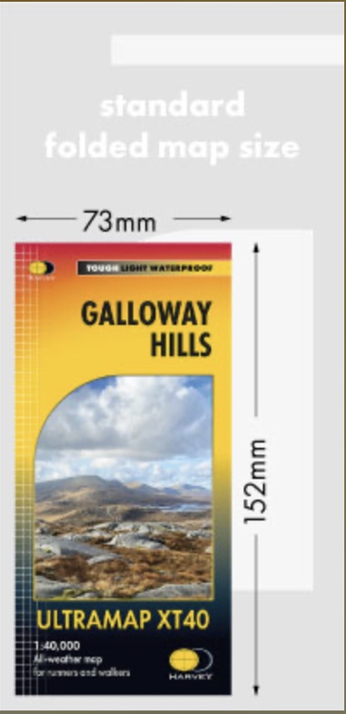
- Hoogte: 15.0 cm
- Breedte: 7.0 cm
- Gewicht: 26.0 g
- Bindwijze: -
- Uitvoering: Scheur- en watervast
- Schrijf als eerste een review
-
€ 20,95
Leverbaar in 3 - 5 werkdagen in huis in Nederland Levertijd Belgie
Gratis verzending in Nederland vanaf €35,-


Beschrijving
Van de uitgever
Reviews
Geen reviews gevonden voor dit product.
Schrijf een review
Graag horen wij wat u van dit artikel vindt. Vindt u het goed, leuk, mooi, slecht, lelijk, onbruikbaar of erg handig: schrijf gerust alles op! Het is niet alleen leuk om te doen maar u informeert andere klanten er ook nog mee!
Ook interessant voor europa/schotland/galloway-forest-park
-

Wandelkaart - Topografische kaart 07
€ 19,50Topografische kaarten Lowlands | Schotse Laaglanden en grenzen -

Wandelgids Galloway | Pocket Mountai
€ 10,95Wandelgidsen Lowlands | Schotse Laaglanden en grenzen -

Reisgids Slow Travel Dumfries and Ga
€ 24,95Reisgidsen Lowlands | Schotse Laaglanden en grenzen -

Wandelkaart - Topografische kaart 32
€ 19,50Topografische kaarten Lowlands | Schotse Laaglanden en grenzen -

Wegenkaart - landkaart Pocket Map Du
€ 7,95Wegenkaarten Lowlands | Schotse Laaglanden en grenzen