Wegenkaart - landkaart Rome & Italië Centraal | ITMB (9781771296731)
- ISBN / CODE: 9781771296731
- Editie: 01-06-2025
- Druk: 3
- Aantal blz.: 1
- Schaal: 1:9000
- Uitgever: ITMB
- Soort: Wegenkaart
- Taal: Engels
- Hoogte: 25.0 cm
- Breedte: 10.0 cm
- Gewicht: 108.0 g
- Uitvoering: Papier
- Bindwijze: -
- Schrijf als eerste een review
-
€ 12,95
Leverbaar in 3 - 5 werkdagen in huis in Nederland Levertijd Belgie
Gratis verzending in Nederland vanaf €35,-
Beschrijving
Van de uitgever
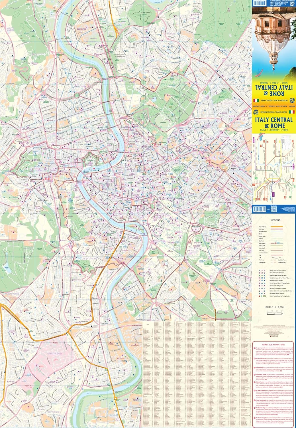
Stadsplan Rome - Wegenkaart Italië CentraalFirst, I'll describe Rome itself. We have increased the area of coverage significantly, using the Tevera River as a north-south axis. This places the Vatican and the 'new' city on the left side of the page, with the main shopping area, the Roman remains, the Colosseum, and the railway station on the right hand side. The map goes as far north as the ring road, so most former Olympic buildings are shown, and as far south as the Giancolense hospital complex, which is further than our competitors cover. Naturally, the map notes major touristic attractions, hotels, shopping areas, religious buildings, park and plazas, theatres, post offices metro lines and stations.
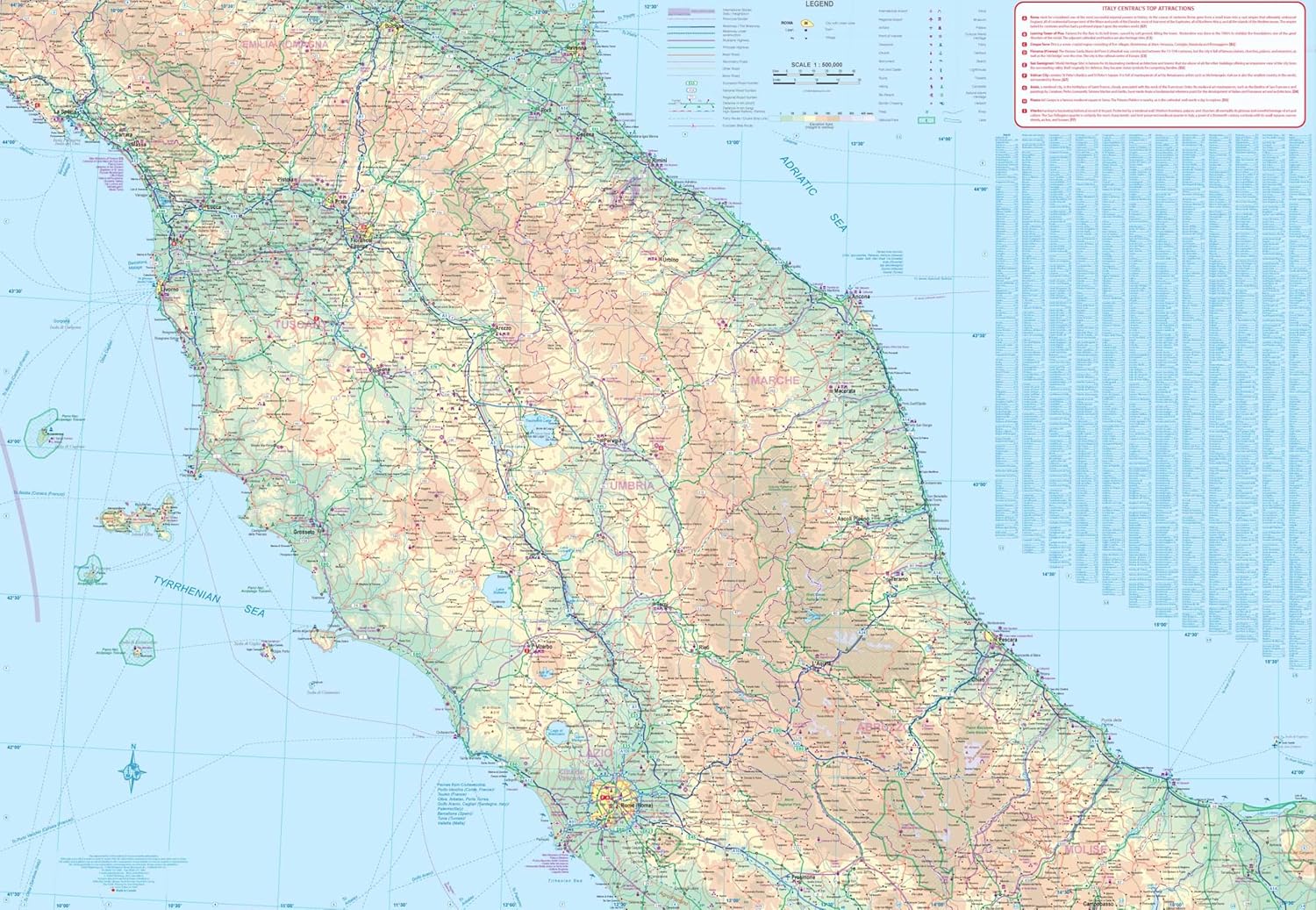
The second side of the map is equally fascinating. We believe that traditional city maps need to show more than just the city centre, as has been common practice for decades. Most travellers visit a city, even a major city like Rome for only a few days as part of a greater trip. For the past several years, we have been adding 'hinterland' surrounding area maps to our city maps so that end-use buyers don’t have to buy two maps to get around. Well, in the case of Rome, a map of all of southern Italy, including Sicily and Sardinia made sense to us, so we created a brand new and very detailed map covering Italy South. It is essentially a driving map, using symbols to note touristic attractions, whether those be castles, historic churches, interesting towns, beaches, or the remains of Greek and early Roman settlement.
Reviews
Geen reviews gevonden voor dit product.
Schrijf een review
Graag horen wij wat u van dit artikel vindt. Vindt u het goed, leuk, mooi, slecht, lelijk, onbruikbaar of erg handig: schrijf gerust alles op! Het is niet alleen leuk om te doen maar u informeert andere klanten er ook nog mee!
Ook interessant voor europa/italie/rome
-

Reisverhaal Het Colosseum voorbij |
€ 16,40Reisverhalen ■ Rome -

Reisgids National Geographic Rome |
€ 26,99Reisgidsen ■ Rome -

Wandelgids Rome On Foot City Guide |
€ 15,95Wandelgidsen ■ Rome -

Spel Taalkwartet Rome | Scala Leuker
€ 10,95Spellen ■ Rome -

Stadsplattegrond Rome 3 in 1 CityMap
€ 8,95Stadsplattegronden ■ Rome