Winkelwagen
Geen items in winkelwagen
Ga naar winkelwagen
Kaarten - Provence
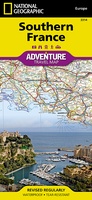 Wegenkaart - landkaart 3314 Adventure Map Southern France - Zuid Frankrijk | National Geographic
 Wandelkaart - Topografische kaart 3342ET Plateau de Valensole | IGN - Institut Géographique National
 Wandelkaart - Topografische kaart 3342OT Manosque - Forcalquier | IGN - Institut Géographique National
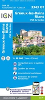 Wandelkaart - Topografische kaart 3343OT Gréoux-les-Bains - Rians | IGN - Institut Géographique National
 Wandelkaart - Topografische kaart 3344OT Saint-Maximin-la-Sainte-Baume | IGN - Institut Géographique National
 Wandelkaart - Topografische kaart 3345OT Signes – Tourves | IGN - Institut Géographique National
 Wandelkaart - Topografische kaart 3346OT Toulon | IGN - Institut Géographique National
 Wegenkaart - landkaart 340 Bouches du Rhone - Var | Michelin★★★★★
 Wegenkaart - landkaart 341 Alpes Maritimes | Michelin★★★★★
 Wandelkaart - Topografische kaart 3443OT Aups | IGN - Institut Géographique National
 Wandelkaart - Topografische kaart 3444OT Brignoles - le Luc | IGN - Institut Géographique National
 Wandelkaart - Topografische kaart 3445OT Cuers | IGN - Institut Géographique National
 Wandelkaart - Topografische kaart 3446ET Le Lavandou | IGN - Institut Géographique National
 Wandelkaart - Topografische kaart 3446OT Hyères | IGN - Institut Géographique National
 Wandelkaart - Topografische kaart 2943ET Arles | IGN - Institut Géographique National
 Wandelkaart - Topografische kaart 3042OT Saint-Rémy-de-Provence | IGN - Institut Géographique National★★★★★
 Topografische kaart - Wandelkaart 3043OT Saint-Martin-de-Crau | IGN - Institut Géographique National★★★★★
 Wandelkaart - Topografische kaart 3044OT Port-Saint-Louis-du-Rhône | IGN - Institut Géographique National
 Wandelkaart - Topografische kaart 3142OT Cavaillon | IGN - Institut Géographique National
 Wandelkaart - Topografische kaart 3143ET Aix-en-Provence | IGN - Institut Géographique National
Laatste reviews

Goede kaart, maar weinig meerwaarde boven de 1:200.000-kaart
Op zich een goede kaart, maar het is eigenlijk gewoon een uitvergroting van de bekende 1:200.000-kaarten, dus weinig tot geen extra informatie. Wel wat duidelijker …
★★★★★ door FGM Ballhaus 13 mei 2026 | Heeft dit artikel gekocht
Iets te grote schaal voor wandelen, maar verder een goede kaart voor wandelen en fietsen
Duidelijke kaart, goed voor fietsen, iets minder voor wandelen door de schaal, maar er is heel weinig kaartmateriaal voor dit gebied dus daarom toch dik …
★★★★★ door FGM Ballhaus 13 mei 2026 | Heeft dit artikel gekocht
Goede fietskaart voor nét over de grens
Fietskaart is een goede aanvulling op de Nederlandse fietskaarten, laat de Achterhoek zien maar ook een heel stuk Duitsland in (naar het oosten). Kwalitatief ook …
★★★★★ door FGM Ballhaus 13 mei 2026 | Heeft dit artikel gekocht
Leuk informatief boek, precieze route goed weergegeven.
Keurig verpakt, snel verzonden. Boek voldoet aan mijn verwachtingen!
★★★★★ door Beatrice 12 mei 2026 | Heeft dit artikel gekocht