Winkelwagen
Geen items in winkelwagen
Ga naar winkelwagen
Kaarten - Manche
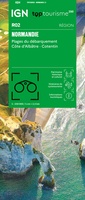 Wegenkaart - landkaart 02 TOP 250 Normandie | IGN - Institut Géographique National
 Wandelkaart 1310OT Cherbourg-en-Cotentin / Pointe de Barfleur | IGN - Institut Géographique National
 Wandelkaart - Topografische kaart 1311OT Valoges - Ste-Mère-Eglise Utah Beach | IGN - Institut Géographique National
 Wandelkaart - Topografische kaart 1312 SB - Serie Bleue Carentan - Periers | IGN - Institut Géographique National
 Wandelkaart - Topografische kaart 1313 SB - Serie Bleue St-Lô - Coutances | IGN - Institut Géographique National
 Wandelkaart - Topografische kaart 1314 SB - Serie Bleue Villedieu-les-Poêlles, Gavray | IGN - Institut Géographique National
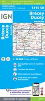 Wandelkaart - Topografische kaart 1315 SB - Serie Bleue Brécey - Ducey - Avranches | IGN - Institut Géographique National
 Wandelkaart - Topografische kaart 1316 SB - Serie Bleue St-Hilaire-du-Harcouët | IGN - Institut Géographique National
 Fietskaart 14 Velo La Manche a Velo | IGN - Institut Géographique National
 Wandelkaart - Topografische kaart 1412OT Pointe Du Hoc - Omaha Beach | IGN - Institut Géographique National★★★★★
 Wandelkaart - Topografische kaart 1415 SB - Serie Bleue Tinchebray - Bocage | IGN - Institut Géographique National
 Wandelkaart - Topografische kaart 1416 SB - Serie Bleue Le Teilleul | IGN - Institut Géographique National
 Wandelkaart - Topografische kaart 1210OT Cherbourg-en-Cotentin, Cap de la Hague | IGN - Institut Géographique National
 Wandelkaart - Topografische kaart 1211OT Les Pieux, Barneville, Carteret | IGN - Institut Géographique National
 Topografische kaart - Wandelkaart 1212ET La Haye-du-Puits / Lessay | IGN - Institut Géographique National
 Wandelkaart - Topografische kaart 1215ET Avranches, Granville, Le Mont Saint Michel | IGN - Institut Géographique National
 Wandelkaart - Topografische kaart 1215OT Le Mont St.-Michel, Dol-de-Bretagne | IGN - Institut Géographique National
 Wandelkaart - Topografische kaart 1216 SB - Serie Bleue Dol-de-Bretagne | IGN - Institut Géographique National
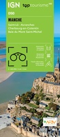 Fietskaart - Wegenkaart - landkaart D50 Top D100 Manche Saint-Lô | IGN - Institut Géographique National
Laatste reviews

Top gids met alle benodigde informatie.
Prachtige wandelgids voorzien van alle voor de wandelaars benodigde informatie (accommodaties, restaurants en cafés, vervoersmogelijkheden enz.). Ook is de gids beschreven in twee richtingen en …
★★★★★ door Mathie Hoenjet 27 juni 2026 | Heeft dit artikel gekocht
snel bezorgd
Zoals altijd duidelijke en overzichtelijke kaart van Michelin
★★★★★ door Charles Trippelvitz 26 juni 2026 | Heeft dit artikel gekocht
Het was heel leuk om de Vennbahn te fietsen aan de hand van deze handige gids!
Door deze gids konden we ons heel goed voorbereiden op onze fietstocht. En het gebruik onderweg was ook prima. Jammer dat de campings onderweg wat …
★★★★★ door Helma Feenstra 26 juni 2026 | Heeft dit artikel gekocht
Simpele keuze ondersteuning op website en hele snelle levering
Kort voor vakantie naar de Galapagos eilanden toch nog behoefte aan extra reisgids. Simpel kunnen bestellen en snelle levering. Zou niet weten wat er beter …
★★★★★ door Piet Grootenboer 25 juni 2026 | Heeft dit artikel gekocht