Winkelwagen
Geen items in winkelwagen
Ga naar winkelwagen
Bretagne
 Wandelkaart - Topografische kaart 1219 SB - Serie Bleue Bruz - Janzé | IGN - Institut Géographique National
 Wandelkaart - Topografische kaart 1517 SB - Serie Bleue Mayenne - Le Horps | IGN - Institut Géographique National★★★★★
 Wandelkaart - Topografische kaart 1518 SB - Serie Bleue Evron - Montsûrs | IGN - Institut Géographique National★★★★★
 Wandelkaart - Topografische kaart 1519 SB - Serie Bleue Meslay-du-Maine, Vaiges | IGN - Institut Géographique National
 Wandelkaart - Topografische kaart 1617 SB - Serie Bleue Villaines-la-Juhel, St-Pierre-des-Nids, Alpes Mancelles | IGN - Institut Géographique National
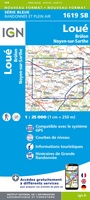 Wandelkaart - Topografische kaart 1619 SB - Serie Bleue Loué - Brûlon, Noyen-sur-Sarthe | IGN - Institut Géographique National
 Wandelkaart - Topografische kaart 1718 SB - Serie Bleue Beaumont-sur-Sarthe - Ballon | IGN - Institut Géographique National
 Wandelkaart - Topografische kaart 1719 SB - Serie Bleue Le Mans - La Suze-sur-Sarthe | IGN - Institut Géographique National
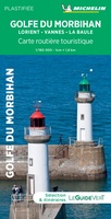 Wegenkaart - landkaart 17612 Golfe du Morbihan - Bretagne | Michelin
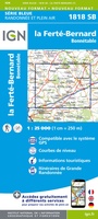 Wandelkaart - Topografische kaart 1818 SB - Serie Bleue La Ferté-Bernard | IGN - Institut Géographique National
 Wandelkaart - Topografische kaart 1116ET Saint-Malo – Dinard – Dinan – Rothéneuf – Cancale – Châteauneuf-d'ille-Vilaine | IGN - Institut Géographique National
 Topografische kaart - Wandelkaart 1119 Bréal-sous-Montfort, Guer | IGN - Institut Géographique National
 Wandelkaart - Topografische kaart 1120 SB - Serie Bleue Pipriac – La Gacilly | IGN - Institut Géographique National
 Wandelkaart - Topografische kaart 1121 SB - Serie Bleue Redon – St-Gildas-des-Bois | IGN - Institut Géographique National
 Topografische kaart - Wandelkaart 1122 SB - Serie Bleue Savenay | IGN - Institut Géographique National
 Wandelkaart - Topografische kaart 1123OT Saint-Nazaire - Pornic – Cote de Jade | IGN - Institut Géographique National
 Wegenkaart - landkaart 11621 Bretagne | Michelin★★★★★
 Campergids 10 Mit dem Wohnmobil in die Bretagne | WOMO verlag★★★★★
 Fietskaart 10 Velo Cotes-d'Armor a velo - by bike | IGN - Institut Géographique National★★★★★
 Wandelkaart - Topografische kaart 1016ET St.-Cast-le-Guildo - Cap Fréhel | IGN - Institut Géographique National
Laatste reviews

Simpele keuze ondersteuning op website en hele snelle levering
Kort voor vakantie naar de Galapagos eilanden toch nog behoefte aan extra reisgids. Simpel kunnen bestellen en snelle levering. Zou niet weten wat er beter …
★★★★★ door Piet Grootenboer 25 juni 2026 | Heeft dit artikel gekocht
Te gek
Enorm mooie wereldkaart met details en snelle fijne levering.
★★★★★ door Steven Goyvaerts 25 juni 2026 | Heeft dit artikel gekocht
Goede gids voor pelgrims
Deze Cicerone gids over de via Francigena is uitermate geschikt om je route en etappes te plannen als je de Via Francigena vanuit Zwitserland gaat …
★★★★★ door Vic 24 juni 2026 | Heeft dit artikel gekocht
Aantrekkelijk en boordevol nuttige info
Heerlijk om al te kunnen voorbereiden op een fantastische vakantie met dit uiterst fijne boek.
★★★★★ door Harry 24 juni 2026 | Heeft dit artikel gekocht