Winkelwagen
Geen items in winkelwagen
Ga naar winkelwagen
Bretagne
 Wandelkaart - Topografische kaart 1420 SB - Serie Bleue Craon | IGN - Institut Géographique National
 Wandelkaart - Topografische kaart 0317OT Île d'Ouessant, Le Conquet | IGN - Institut Géographique National
 Wandelgids 0345 Côte d'Emeraude Chemins du Mont-Saint-MichelGR34/37/39 +30j de rand. | FFRP★★★★★★★★★★
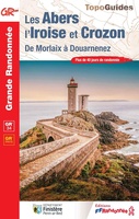 Wandelgids 0347 Les Abers et île de Crozon GR34 | FFRP★★★★★
 Wandelkaart - Topografische kaart 0416ET Plouguerneau, Les Abers, Plabennec, Ploudalmezeau | IGN - Institut Géographique National
 Wandelkaart - Topografische kaart 0417ET Brest, Pointe de St.Mathieu, St.-Renan, Le Conquet, Guipavas | IGN - Institut Géographique National
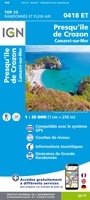 Wandelkaart - Topografische kaart 0418ET Camaret, Presqu'Île de Crozon, Morgat | IGN - Institut Géographique National★★★★★
 Wandelkaart - Topografische kaart 0419ET Audierne, Pointe du Raz, Pont-Croix,Plouhinec, Plozévet | IGN - Institut Géographique National
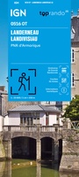 Wandelkaart 0516OT Landerneau / Landisvisiau / PNR d'Armorique | IGN - Institut Géographique National
 Wandelkaart - Topografische kaart 0517OT Plougastel, Daoulas, Le Faou, PNR D'Armorique | IGN - Institut Géographique National
 Wandelkaart - Topografische kaart 0518OT Chateaulin, Douarnenez, Locronan, Ménez Hom, Le Faou | IGN - Institut Géographique National
 Wandelkaart - Topografische kaart 0519ET Quimper, Concarneau, Fouesnant, Beg-Meil, iles de Glénan | IGN - Institut Géographique National
 Wandelkaart - Topografische kaart 0519OT Pont l Abbé, Pointe de Penmarc h, Plogastel-St.-Germain, Plonéour-Lanvern | IGN - Institut Géographique National★★★★★
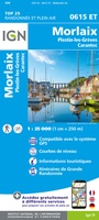 Wandelkaart - Topografische kaart 0615ET Morlaix, Lanmeur, Plougasnou, Taule, Plestin-les-Greves | IGN - Institut Géographique National★★★★★
 Wandelkaart 0617OT Huelgoat - Monts d'Arrée | IGN - Institut Géographique National
 Wandelkaart - Topografische kaart 0620ET Quimperlé, Pont-Aven, Tregunc, Bannalec, Clohars-Carnoët | IGN - Institut Géographique National★★★★★
 Wegenkaart - landkaart 117 Côte Normande | Michelin★★★★★★★★★★
 Wandelkaart - Topografische kaart 1215OT Le Mont St.-Michel, Dol-de-Bretagne | IGN - Institut Géographique National
 Wandelkaart - Topografische kaart 1216 SB - Serie Bleue Dol-de-Bretagne | IGN - Institut Géographique National
 Wandelkaart - Topografische kaart 1217 SB - Serie Bleue Combourg – St-Aubin-d'Aubigné | IGN - Institut Géographique National
Laatste reviews

Simpele keuze ondersteuning op website en hele snelle levering
Kort voor vakantie naar de Galapagos eilanden toch nog behoefte aan extra reisgids. Simpel kunnen bestellen en snelle levering. Zou niet weten wat er beter …
★★★★★ door Piet Grootenboer 25 juni 2026 | Heeft dit artikel gekocht
Te gek
Enorm mooie wereldkaart met details en snelle fijne levering.
★★★★★ door Steven Goyvaerts 25 juni 2026 | Heeft dit artikel gekocht
Goede gids voor pelgrims
Deze Cicerone gids over de via Francigena is uitermate geschikt om je route en etappes te plannen als je de Via Francigena vanuit Zwitserland gaat …
★★★★★ door Vic 24 juni 2026 | Heeft dit artikel gekocht
Aantrekkelijk en boordevol nuttige info
Heerlijk om al te kunnen voorbereiden op een fantastische vakantie met dit uiterst fijne boek.
★★★★★ door Harry 24 juni 2026 | Heeft dit artikel gekocht