Winkelwagen
Geen items in winkelwagen
Ga naar winkelwagen
Allier
 Wandelkaart - Topografische kaart 2627 SB - Serie Bleue Moulins | IGN - Institut Géographique National
 Wandelkaart - Topografische kaart 2628 SB - Serie Bleue St-Pourçain-sur-Sioule | IGN - Institut Géographique National
 Wandelkaart - Topografische kaart 2629 SB - Serie Bleue Vichy | IGN - Institut Géographique National
 Wandelkaart - Topografische kaart 2630 SB - Serie Bleue Maringues | IGN - Institut Géographique National
 Wandelkaart - Topografische kaart 2727 SB - Serie Bleue Dompierre-sur-Besbre | IGN - Institut Géographique National
 Wandelkaart - Topografische kaart 2728 SB - Serie Bleue Le Donjon | IGN - Institut Géographique National
 Wandelkaart - Topografische kaart 2729 SB - Serie Bleue Lapalisse | IGN - Institut Géographique National
 Wandelkaart 2730 SB - Serie Bleue Le Mayet-de-Montagne / St-just-en-Chevalet | IGN - Institut Géographique National
 Wandelkaart - Topografische kaart 2221 SB - Serie Bleue Lamotte-Beuvron | IGN - Institut Géographique National
 Wandelkaart - Topografische kaart 2327 SB - Serie Bleue Culan - Châteaumeillant | IGN - Institut Géographique National
 Wandelkaart - Topografische kaart 2328 SB - Serie Bleue Huriel - Boussac | IGN - Institut Géographique National
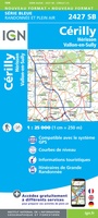 Topografische kaart - Wandelkaart 2427 SB - Serie Bleue Cérilly | IGN - Institut Géographique National
 Wandelkaart - Topografische kaart 2428 SB - Serie Bleue Montluçon | IGN - Institut Géographique National
 Wandelkaart 2527 SB - Serie Bleue Bourbon-l'Archambault | IGN - Institut Géographique National
 Wandelkaart - Topografische kaart 2528 SB - Serie Bleue Tronget - Montmarault | IGN - Institut Géographique National
 Wandelkaart - Topografische kaart 2529 SB - Serie Bleue Gannat | IGN - Institut Géographique National
 Wandelkaart 2530 SB - Serie Bleue Aigueperse / Châtel-Guyon / Manzat | IGN - Institut Géographique National
 Wegenkaart - landkaart 14 TOP 250 Auvergne - Rhône-Alpes - Massif Central | IGN - Institut Géographique National
 Wegenkaart - landkaart 15 TOP 250 Auvergne - Rhône-Alpes - Massif Alpin | IGN - Institut Géographique National
 Reliëfkaart 60176 Monts d'Auvergne rmet voelbaar 3D eliëf | 113 x 80 cm | IGN - Institut Géographique National
Laatste reviews

Compact gidsje
Ben nog niet het veld in geweest met de gids maar de eerste indruk is veel informatie om een meerdaagse tocht uit te stippelen.
★★★★★ door Henk 04 juli 2026 | Heeft dit artikel gekocht
Beschikbaarheid en snelheid
Prima in orde!
★★★★★ door Marko 04 juli 2026 | Heeft dit artikel gekocht
Lekker analoog
Fijn boekje met veel informatie, behalve knooppunten Utrecht af en toe incorrect. Wat heerlijk om offline te navigeren, lekker analoog. Zodra je het systeem begrijpt …
★★★★★ door Daan 03 juli 2026 | Heeft dit artikel gekocht
Aanrader
Als je van geschiedenis, Groningen en kaarteen houdt, is dit echt een aanrader!
★★★★★ door Reinout 03 juli 2026 | Heeft dit artikel gekocht