Winkelwagen
Geen items in winkelwagen
Ga naar winkelwagen
■ York
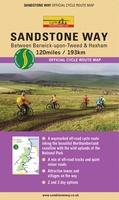 Fietskaart Sandstone Way - Northumberland Cycle Route Map | Northern Heritage Services
 Reisgids 111 places in Places in Yorkshire That You Shouldn't Miss | Emons
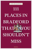 Reisgids 111 places in Places in Bradford That You Shouldn't Miss | Emons
 Fietsgids The Ultimate Trans Pennine Trail Guide | Excellent Books
 Wandelgids Cleveland Way | Rucksack Readers
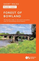 Wandelgids Forest of Bowland | Ordnance Survey
 Wandelgids York | Collins
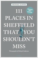 Reisgids 111 places in Places in Sheffield That You Shouldn't Miss | Emons
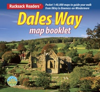 Wandelatlas Dales Way | Rucksack Readers
 Fietskaart Dales Noord | Harvey Maps
 Stadsplattegrond Pocket Street Map Sheffield | A-Z Map Company
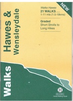 Wandelgids Hawes and Wensleydale | Hallewell Publications
 Wandelkaart Yorkshire Dales Noord-Oost | Harvey Maps
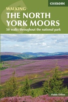 Wandelgids The North York Moors | Cicerone
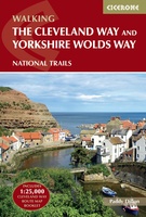 Wandelgids The Cleveland way and the Yorkshire Wolds way | Cicerone
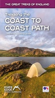 Wandelgids Trekking the Coast to Coast Path | Knife Edge Outdoor★★★★★
 Wandelgids Nidderdale Way | Rucksack Readers
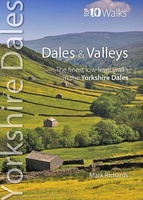 Wandelgids Dales & Valleys | Northern Eye Books
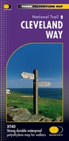 Wandelkaart Cleveland Way | Harvey Maps★★★★★
 Reisgids Trotter Noord-Engeland en Wales | Lannoo★★★★★
Laatste reviews

Compact gidsje
Ben nog niet het veld in geweest met de gids maar de eerste indruk is veel informatie om een meerdaagse tocht uit te stippelen.
★★★★★ door Henk 04 juli 2026 | Heeft dit artikel gekocht
Beschikbaarheid en snelheid
Prima in orde!
★★★★★ door Marko 04 juli 2026 | Heeft dit artikel gekocht
Lekker analoog
Fijn boekje met veel informatie, behalve knooppunten Utrecht af en toe incorrect. Wat heerlijk om offline te navigeren, lekker analoog. Zodra je het systeem begrijpt …
★★★★★ door Daan 03 juli 2026 | Heeft dit artikel gekocht
Aanrader
Als je van geschiedenis, Groningen en kaarteen houdt, is dit echt een aanrader!
★★★★★ door Reinout 03 juli 2026 | Heeft dit artikel gekocht