South East England
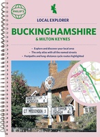 Wegenatlas Local Explorer Street Atlas Buckinghamshire and Milton Keynes | Philip's Maps
Philip's created this new series for walkers, cyclists and local explorers at a scale that provides greener options to uncover all the nature and hidden gems in your local area. …
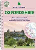 Wegenatlas Local Explorer Street Atlas Oxfordshire | Philip's Maps
Who hasn't explored and enjoyed their surrounding area in recent years and come to appreciate what is on our respective doorsteps? Philip's have created this new series for walkers, cyclists …
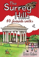 Wandelgids Weekend Walks The Surrey Hills | Pocket Mountains
Although Surrey is not far from metropolitan London, it famously has more mature woodland than any other county in England and has long been renowned for its rolling hills and …
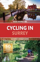 Fietsgids Cycling in Surrey | Bradt Travel Guides
Bradt's new cycling guide to Surrey - part of a growing series designed for the saddle bag - offers 21 routes, each including comprehensive directions plus contextual exploration of history, …
 Wandelatlas Ridgeway Map Booklet | Cicerone
Heel handig bedacht van uitgever Cicerone: een boekje dat dienst doet als atlas met alle topografische kaarten die je nodig hebt voor het lopen van de Ridgeway. Past goed in …
 Reisgids Brighton, Sussex & the South Downs | Rough Guides
Een kleinere versie in zakformaat van de grotere versies van de Rough Guides. Als altijd weer vol met goede informatie over cultuur en praktische zaken. Voorin een kaart van de …
 Reisgids Slow Travel Isle of Wight | Bradt Travel Guides
Een bijzondere serie van Bradt guides, waarin een gedeelte van Engeland uitgebreid beschreven wordt. Met veelv aandacht voor kleine details die je niet ao gauw elders zult vinden. Naast de …
★★★★★ Wandelgids 72 Pathfinder Guides The Home Counties from London by Train | Ordnance Survey
The all-revised edition contains 27 carefully selected walks, all chosen to be easily accessible from London's main railway stations. The routes lie across Essex, Bedfordshire, Oxfordshire, Surrey, West Sussex, East …
 Wandelgids Park Rangers Favourite Walks South Downs | Collins
Compacte wandelgids met 20 wandelingen geselecteerd door park rangers en met duidelijke beschrijvingen en routekaartjes. Walking guide to the South Downs National Park, with 20 best routes chosen by …
 Wandelgids Walking the North Downs Way Map Booklet | Cicerone
All the mapping you need to walk the 130 mile (208km) North Downs Way National Trail between Farnham and Dover. One of the easier National Trails, it can be comfortably …
 Wandelgids Thames Path | Trailblazer Guides
This book follows the Thames Path National Trail from the river's source in Gloucestershire to the Thames Barrier in London. Officially 184 miles (294km) in length (although the actual distance …
 Reisgids England | Reise Know-How Verlag
Der Reiseführer für den Süden Englands von Reise Know-How - umfassend, engagiert und aktuell: Folgen Sie den Autoren nach Südengland und erleben Sie wunderschöne Gärten und historische Herrschaftshäuser. Entdecken Sie …
 Reisgids The England Coast Path | gritstone Publishing
The England Coast Path is a new long distance path around the whole coast of England. At 2,88 miles, it is the longest coastal path in the world and provides …
 Stadsplattegrond Popout Map Brighton and Hove | Compass Maps
Let PopOut Map Brighton and Hove guide you around this wonderful city. Experience Brighton and Hove with the help of this genuinely pocket-sized, pop-up map. Small in size yet big …
 Reisgids Capitool Reisgidsen Zuid-Engeland | Unieboek
De Capitool Reisgids Zuid-Engeland helpt je bij het samenstellen van de perfecte reis. Deze reisgids verdeelt Zuid-Engeland in zes gebieden: Londen, Kent en Sussex, Hampshire en Wiltshire, Dorset en Somerset, …
★★★★★ Reisgids Zuid Engeland | Lannoo
Maak op een onovertroffen wijze kennis met de regio's Kent, East & West Sussex, Surrey, Hampshire en het eiland Wight, en de bestemmingen die je daar absoluut niet mag missen. …
 Wandelgids 66 Pathfinder Guides West Sussex and the South Downs National Park | Ordnance Survey
Wandelgids van een deel van Engeland. Deze gids bevat 28 dagwandelingen, variërend van korte tochten tot pittige dagtochten. De bijbehorende kaarten zijn uitstekend: men heeft de topografische kaarten van Ordnance …
 Fietsgids 20 Classic Sportives - South East England | Cicerone
This guidebook offers 20 sportive cycling routes in the best cycling areas of south east England. The training rides range between 60 and 117km (37 to 73 miles) in length, …
 Reisgids Eyewitness Travel England's South Coast - Zuid Engeland | Dorling Kindersley
Prachtig geillustreerde reisgids met o.a. 3D tekeningen, fraaie kaarten en geweldige foto’s. Daarnaast uitgebreide achtergrondbeschrijvingen. Echt om in de stemming te komen! Groot formaat gids. Engelstalig Taking you from Kent …
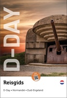 Reisgids D-Day Slag om Normandie | War travel
Deze reisgids is voor jou als je het meeste uit je reis naar Normandië wilt halen. Per landingsstrand en landinwaarts leidt deze reisgids jou langs de musea, monumenten, batterijen en …
Laatste reviews

het is heel goed
★★★★★ door Marc 11 mei 2024 | Heeft dit artikel gekocht
Hallo, metrokaart van Delft gekocht. Die bestaat natuurlijk niet, maar wel heel leuk bedacht met de gekste steenkolen Engelse termen als haltes. Hilarisch. Ik hen …
★★★★★ door Nellie 10 mei 2024 | Heeft dit artikel gekocht
We hebben het boekje alleen gebruikt om wandelingen uit te halen. I.v.m. kleine kinderen hebben we vooral de 'short walks for motorists' gelopen, die echter …
★★★★★ door Jochem 10 mei 2024 | Heeft dit artikel gekocht
Prima. Wel erg gefocust op jonge mensen die geïnteresseerd zouden zijn in hippe winkeltjes en cafeetjes.
★★★★★ door Miquel 10 mei 2024 | Heeft dit artikel gekocht