Wandelgidsen - North West England
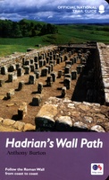 Wandelgids Hadrian's Wall Path | Aurum Press
Beschrijving van Hadrian's Wall Path. Historische en culturele aspecten komen vrij uitgebreid aan bod, praktische informatie is wel summier. Kaartmateriaal van Ordnance Survey is zonder meer uitstekend! Since it opened …
 Wandelgids Walking in Cumbria's Eden Valley - Lake district | Cicerone
Uitstekende Engelstalige wandelgids van dit prachtige gebied op de grens van Engeland en Schotland. Guidebook to 30 of the best walks in Cumbria's enchanting Eden Valley. The graded routes, which …
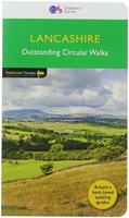 Wandelgids 53 Pathfinder Guides Lancashire | Ordnance Survey
Wandelgids van een deel van Engeland, Schotland of Wales. Deze gids bevat 28 dagwandelingen, variërend van korte tochten tot pittige dagtochten. De bijbehorende kaarten zijn uitstekend: men heeft de topografische …
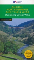 Wandelgids 39 Pathfinder Guides Durham, north Pennines and Tyne and Wear | Ordnance Survey
Wandelgids van een deel van Engeland, Schotland of Wales. Deze gids bevat 28 dagwandelingen, variërend van korte tochten tot pittige dagtochten. De bijbehorende kaarten zijn uitstekend: men heeft de topografische …
★★★★★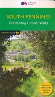 Wandelgids 64 Pathfinder Guides South Pennines | Ordnance Survey
Pathfinder are Britain's best-loved walking guides. Enjoy 28 circular walks around the beautiful South Pennines, with Pathfinder, enjoy the stunning scenery with: Easy to follow directions Route highlights from the …
 Wandelgids The Isle of Man | Cicerone
Wandelgids met 40 wandelingen op het eiland Man dat tussen Engeland en Ierland in ligt. De wandelingen variëren van zo'n 2 tot 22 km. Kaartmateriaal voldoende. Engelstalig. A guidebook to …
★★★★★ Wandelgids Walks in Silverdale and Arnside - rand van Lake District | Cicerone
Second edition of a popular walking guide to Silverdale and Arnside Area of Outstanding Natural Beauty (AONB), at the top of Morecambe Bay in Cumbria and Lancashire, north west England, …
 Wandelgids Coast to Coast Path: St Bees to Robin Hood's Bay | Trailblazer Guides
Goede wandelgids van de hele route van kust naar kust. Met veel details zijn alle etappes beschreven. Tevens informatie over overnachtingen en openbaar vervoer. All the information you need to …
★★★★★ Wandelgids Coast to Coast Walk - van Ierse Zee tot Noordzee | Aurum Press
Goede gids over dit inmiddels beroemde pad. Kaartmateriaal is perfect, alsmede achtergrondinformatie. Praktische info wat minder, maar die is op de ramblerssite op internet te vinden! The Coast to Coast …
 Wandelgids Hadrian's Wall path | Rucksack Readers
Uitgevoerd in de vorm van een klapper, met ringband geeft deze gids een goede beschrijving van de lange afstands route. De kaarten zijn schetsmatig maar wel duidelijk. Hadrian's Wall …
★★★★★ Wandelgids Pennine Way | Aurum Press
Goede beschrijving van de aantrekkelijke route. Kaartmateriaal van Ordnance Survey - de Engelse topografische dienst op een schaal van 1:25.000. Praktische info voor overnachten ed. niet altijd uitgebreid, maar die …
 Wandelgids Cheshire | Pocket Mountains
Handige compacte wandelgids met 40 dagwandelingen. Deze gids bevat kleine kaartjes en leuke uitgebreide informatie over wat er langs de route te zien is. Goede wandelkaarten zijn echter we noodzakelijk …
 Wandelgids Cumbria Coast | Pocket Mountains
Handige compacte wandelgids met 40 dagwandelingen. Deze gids bevat kleine kaartjes en leuke uitgebreide informatie over wat er langs de route te zien is. Much quieter than the nearby Lake …
 Wandelgids 42 Pathfinder Guides Cheshire | Ordnance Survey
175 miles of delightfully pastoral country walking from Thurstaston Common on the Wirral to Tegg's Nose on the north-western fringes of the Peak District National Park . . . …
 Wandelgids Cheshire & Wirral Pub Walks | Northern Eye Books
These attractive and cleverly structured guides will give walkers ten of the best themed short circular walks to Cheshire's finest pubs. With clear information, an overview and introduction for each …
 Wandelgids Easy Walks from the Sandstone Trail | Northern Eye Books
One in the popular Top 10 Walks series of pocket-sized, full colour walking guides written by the author of the Official Guide to the Sandstone Trail. This attractive and cleverly …
 Wandelgids Day Walks in the South Pennines | Vertebrate Publishing
Day Walks in the South Pennines features 20 circular walks between 5 and 18 miles (8km and 29 km) in length, spread across West Yorkshire, Lancashire and Greater Manchester. Researched …
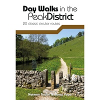 Wandelgids Day Walks in the Peak District | Vertebrate Publishing
Day Walks in the Peak District - 20 classic circular routes features 20 circular walks, between 8.25 and 12 miles (13 and 19.5 kilometres) in length, suitable for hillwalkers of …
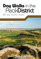 Wandelgids Day Walks in the Peak District | Vertebrate Publishing
Day Walks in the Peak District: 20 new circular routes features 20 circular walks, between 8 and 13 miles (14km and 21km) in length, suitable for hillwalkers of all abilities. …
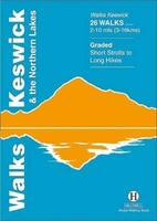 Wandelgids Keswick and the Northern Lakes | Hallewell Publications
Rewalked and updated in 2021 - Walks Keswick & the Northern Lakes features walks in The Lake District - the famous area of spectacular peaks and lakes in the north-west …
Laatste reviews

We hebben een landkaart van Albanië besteld. Deze hebben we in goede staat ontvangen
★★★★★ door Ida van der Heiden 26 april 2024 | Heeft dit artikel gekocht
Zoals gewend van de Alpverein weer een mooie en duidelijke kaart voor dit mooie wandelgebied incl. hutten.
★★★★★ door B van R 26 april 2024 | Heeft dit artikel gekocht
Duidelijke en mooie kaart van het gebied. Oogt stevig/dik waardoor niet snel kapot tijdens wandelingen. Sommige tekens zijn wel wat aan de kleine kant waardoor …
★★★★★ door B van R 26 april 2024 | Heeft dit artikel gekocht
Voor een reis Ivoorkust is er weiniginformatie te vinden. Dit boek brengt het meeste. Duidelijk en overzichtelijk.
★★★★★ door Annemiek van Riezen 26 april 2024 | Heeft dit artikel gekocht