Winkelwagen
Geen items in winkelwagen
Ga naar winkelwagen
Topografische kaarten - Europa
 Wandelkaart - Topografische kaart 1914 SB - Serie Bleue Breteuil – La Neuve-Lyre | IGN - Institut Géographique National
 Wandelkaart - Topografische kaart 1915 SB - Serie Bleue Verneuil-sur-Avre, Bourth | IGN - Institut Géographique National
 Wandelkaart - Topografische kaart 1916 SB - Serie Bleue La Loupe - Rémalard | IGN - Institut Géographique National
 Wandelkaart - Topografische kaart 1917 SB - Serie Bleue Nogent-le-Rotrou, Thiron-Gardais | IGN - Institut Géographique National
 Wandelkaart - Topografische kaart 1918 SB - Serie Bleue Authon-du-Perche, La Bazoche-Gouet | IGN - Institut Géographique National
 Wandelkaart - Topografische kaart 1919 SB - Serie Bleue St-Calais - Droué | IGN - Institut Géographique National
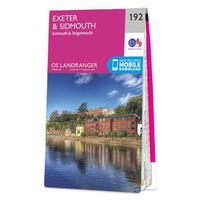 Wandelkaart - Topografische kaart 192 Landranger Exeter & Sidmouth, Exmouth & Teignmouth | Ordnance Survey
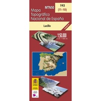 Topografische kaart 192 MT50 Lucillo | CNIG - Instituto Geográfico Nacional
 Wandelkaart - Topografische kaart 192 OS Explorer Map Buckingham, Milton Keynes | Ordnance Survey
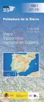 Topografische kaart 192-I Pobladura De La Sierra | CNIG - Instituto Geográfico Nacional
 Topografische kaart 192-II Santa Colomba De Somoza | CNIG - Instituto Geográfico Nacional
 Wandelkaart - Topografische kaart 1920 SB - Serie Bleue Vendome, Montoire-sur-le-Loir | IGN - Institut Géographique National
 Wandelkaart - Topografische kaart 1921 SB - Serie Bleue Château-Renault, St-Amand-Longpré | IGN - Institut Géographique National
 Wandelkaart - Topografische kaart 1922 SB - Serie Bleue Amboise, Montlouis-sur-Loire | IGN - Institut Géographique National
 Wandelkaart - Topografische kaart 1923 SB - Serie Bleue Bléré - Chenonceaux - Veigné | IGN - Institut Géographique National
 Wandelkaart - Topografische kaart 1924 SB - Serie Bleue Loches - Ligueil | IGN - Institut Géographique National
 Wandelkaart - Topografische kaart 1925 SB - Serie Bleue Preuilly-sur-Claise, le Grand-Pressigny | IGN - Institut Géographique National
 Wandelkaart - Topografische kaart 1926 SB - Serie Bleue Le Blanc, Pleumartin, La Roche-Posay | IGN - Institut Géographique National
 Wandelkaart - Topografische kaart 1927 SB - Serie Bleue La Trimouille | IGN - Institut Géographique National
 Wandelkaart - Topografische kaart 1928 SB - Serie Bleue Montmorillon, Lathus-St-Rémy | IGN - Institut Géographique National
Laatste reviews

Prima kaart voor tochtplanning en backup
Duuraam resistent papier. Voor navigatie zou een meer gedetailleerde schaal beter zijn, maar de eigenlijke wandelroutes zijn ook in het veld vindbaar door markering. In …
★★★★★ door Jan Willem Genuit 14 mei 2026 | Heeft dit artikel gekocht
Duidelijke kaart
Prima kaart met veel informatie.
★★★★★ door Hans 13 mei 2026 | Heeft dit artikel gekocht
Goede kaart, maar weinig meerwaarde boven de 1:200.000-kaart
Op zich een goede kaart, maar het is eigenlijk gewoon een uitvergroting van de bekende 1:200.000-kaarten, dus weinig tot geen extra informatie. Wel wat duidelijker …
★★★★★ door FGM Ballhaus 13 mei 2026 | Heeft dit artikel gekocht
Iets te grote schaal voor wandelen, maar verder een goede kaart voor wandelen en fietsen
Duidelijke kaart, goed voor fietsen, iets minder voor wandelen door de schaal, maar er is heel weinig kaartmateriaal voor dit gebied dus daarom toch dik …
★★★★★ door FGM Ballhaus 13 mei 2026 | Heeft dit artikel gekocht