Winkelwagen
Geen items in winkelwagen
Ga naar winkelwagen
Topografische kaarten - Europa
 Wandelkaart - Topografische kaart 2631 SB - Serie Bleue Thiers | IGN - Institut Géographique National
 Wandelkaart - Topografische kaart 2632 SB - Serie Bleue Issoire | IGN - Institut Géographique National
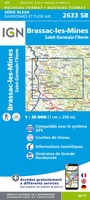 Wandelkaart - Topografische kaart 2633 SB - Serie Bleue St-Germain-l'Herm, Brassac-les-Mines | IGN - Institut Géographique National
 Wandelkaart - Topografische kaart 2634 SB - Serie Bleue Paulhaguet - Brioude | IGN - Institut Géographique National
 Wandelkaart - Topografische kaart 2635 SB - Serie Bleue Langeac - Lavoûte-Chilhac | IGN - Institut Géographique National
 Wandelkaart - Topografische kaart 2636 SB - Serie Bleue Saugues | IGN - Institut Géographique National
 Wandelkaart - Topografische kaart 2637 SB - Serie Bleue Saint-Chély-d'Apcher | IGN - Institut Géographique National
 Wandelkaart - Topografische kaart 2638 SB - Serie Bleue Mende | IGN - Institut Géographique National
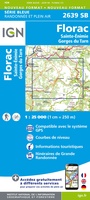 Wandelkaart - Topografische kaart 2639 SB - Serie Bleue Florac | IGN - Institut Géographique National
 Wandelkaart - Topografische kaart 264 Jungfrau | Swisstopo★★★★★
 Wandelkaart - Topografische kaart 264 OS Explorer Map Vale of Clwyd, Dyffryn Clwyd | Ordnance Survey
 Topografische kaart 264 MT50 Xinzo de Limia | CNIG - Instituto Geográfico Nacional1
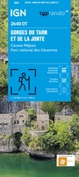 Topografische kaart - Wandelkaart 2640OT Gorges du Tarn et de la Jonte / Causse Méjan PNR | IGN - Institut Géographique National★★★★★
 Wandelkaart - Topografische kaart 2641ET Mont Aigoual | IGN - Institut Géographique National
 Wandelkaart - Topografische kaart 2642ET St.-Guilhem-le-Desert | IGN - Institut Géographique National
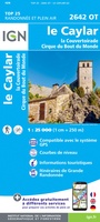 Wandelkaart - Topografische kaart 2642OT Le Caylar - La Couvertoirade | IGN - Institut Géographique National★★★★★
 Wandelkaart - Topografische kaart 2643OT Lodeve | IGN - Institut Géographique National
 Wandelkaart - Topografische kaart 2644OT Pézenas - Murviel-lès-Béziers | IGN - Institut Géographique National
 Wandelkaart - Topografische kaart 2645ET Cap d'Agde - Sète - Etang de Thau | IGN - Institut Géographique National
 Wandelkaart - Topografische kaart 265 OS Explorer Map Clwydian Range | Ordnance Survey
Laatste reviews

Cadeau voor mijn vriendin
Review van mijn vriendin. Heel mooi boek met gedetailleerde informatie over waar je op welk moment de foto's kan maken die je zou willen. Zelfs …
★★★★★ door Tony Everaert 17 januari 2026 | Heeft dit artikel gekocht
Goed
Precies wat ik zocht
★★★★★ door Hans Linneman 16 januari 2026 | Heeft dit artikel gekocht
Gedetailleerde landkaart
Het is een zeer gedetailleerde landkaart, zoals ook door de Zwerver duidelijk omschreven. Zal voor mijn vakantie met een huurauto zeer nuttig zijn. De levering …
★★★★★ door Jeroen 16 januari 2026 | Heeft dit artikel gekocht
Informatief boekje voor kleine wandelingen
Mooi uitgevoerd en fijn. Bij elke wandeling niet alleen een kaartje en routebeschrijving, maar ook achtergrondinformatie en informatie over de natuur. Bevat dus echt korte …
★★★★★ door Arjan de Jong 15 januari 2026 | Heeft dit artikel gekocht