Winkelwagen
Geen items in winkelwagen
Ga naar winkelwagen
Topografische kaarten - Europa
 Wandelkaart - Topografische kaart 2911 SB - Serie Bleue Attigny | IGN - Institut Géographique National
 Wandelkaart - Topografische kaart 2912 SB - Serie Bleue Mourmelon-le-Grand | IGN - Institut Géographique National
 Wandelkaart - Topografische kaart 2913 SB - Serie Bleue Châlons-en-Champagne | IGN - Institut Géographique National
 Wandelkaart - Topografische kaart 2914 SB - Serie Bleue Marson, Châlons-en-Champagne | IGN - Institut Géographique National
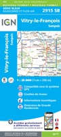 Wandelkaart - Topografische kaart 2915 SB - Serie Bleue Vitry-le-François, Sompuis | IGN - Institut Géographique National
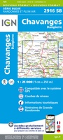 Wandelkaart - Topografische kaart 2916 SB - Serie Bleue Chavanges, Dampierre | IGN - Institut Géographique National
 Wandelkaart - Topografische kaart 2917 SB - Serie Bleue Brienne-le-Chateau, Piney, Lacs de la Foret d'Orient | IGN - Institut Géographique National
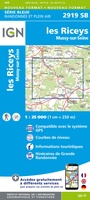 Topografische kaart - Wandelkaart 2919 SB - Serie Bleue les Riceys | IGN - Institut Géographique National
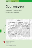 Wandelkaart - Topografische kaart 292 Courmayeur | Swisstopo
 Wandelkaart - Topografische kaart 292 OS Explorer Map Withernsea & Spurn Head | Ordnance Survey
 Topografische kaart 292 MT50 Sant Llorenç de Morunys | CNIG - Instituto Geográfico Nacional1
 Topografische kaart - Wandelkaart 2920 SB - Serie Bleue Châtillon-sur-Seine | IGN - Institut Géographique National
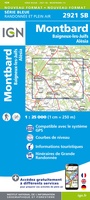 Topografische kaart - Wandelkaart 2921 Baigneux-les-Juifs, Alésia, Montbard | IGN - Institut Géographique National
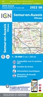 Wandelkaart - Topografische kaart 2922 SB - Serie Bleue Semur-en-Auxois – Vitteaux | IGN - Institut Géographique National★★★★★
 Wandelkaart - Topografische kaart 2923 SB - Serie Bleue Pouilly-en-Auxois – Thoisy-la-Berchère | IGN - Institut Géographique National
 Wandelkaart - Topografische kaart 2924 SB - Serie Bleue Arnay-le-Duc – Epignac | IGN - Institut Géographique National★★★★★
 Wandelkaart - Topografische kaart 2925 SB - Serie Bleue Autun - Le Creusot | IGN - Institut Géographique National
 Wandelkaart - Topografische kaart 2926 SB - Serie Bleue Montceau-les-Mines, Ecuisses | IGN - Institut Géographique National
 Wandelkaart - Topografische kaart 2927 SB - Serie Bleue St-Bonnet-de-Joux – Saint-Gengoux-le-National | IGN - Institut Géographique National
 Wandelkaart - Topografische kaart 2928 SB - Serie Bleue Cluny Matour | IGN - Institut Géographique National
Laatste reviews

Goede kaart, maar weinig meerwaarde boven de 1:200.000-kaart
Op zich een goede kaart, maar het is eigenlijk gewoon een uitvergroting van de bekende 1:200.000-kaarten, dus weinig tot geen extra informatie. Wel wat duidelijker …
★★★★★ door FGM Ballhaus 13 mei 2026 | Heeft dit artikel gekocht
Iets te grote schaal voor wandelen, maar verder een goede kaart voor wandelen en fietsen
Duidelijke kaart, goed voor fietsen, iets minder voor wandelen door de schaal, maar er is heel weinig kaartmateriaal voor dit gebied dus daarom toch dik …
★★★★★ door FGM Ballhaus 13 mei 2026 | Heeft dit artikel gekocht
Goede fietskaart voor nét over de grens
Fietskaart is een goede aanvulling op de Nederlandse fietskaarten, laat de Achterhoek zien maar ook een heel stuk Duitsland in (naar het oosten). Kwalitatief ook …
★★★★★ door FGM Ballhaus 13 mei 2026 | Heeft dit artikel gekocht
Leuk informatief boek, precieze route goed weergegeven.
Keurig verpakt, snel verzonden. Boek voldoet aan mijn verwachtingen!
★★★★★ door Beatrice 12 mei 2026 | Heeft dit artikel gekocht