Winkelwagen
Geen items in winkelwagen
Ga naar winkelwagen
IGN - Institut Géographique National
IGN is de officiële instantie voor geografische informatie in Frankrijk ofwel Institut Géographique National. Ze staan bekend om de zeer goede wandelkaarten op schaal 1:25.000 (Serie Bleue en Top 25) van Frankrijk. De wandelkaarten zijn dan ook zeer uitgebreid. De wandelaar vindt hier alle wandelpaden, campings en langeafstandswandelpaden, ook wel GR-paden (Grande Randonnée) genoemd. Kleine weggetjes en paden, maar ook de verschillende types landschappen en bebouwingen, populaire gebieden en onontdekte parels: de wandelaar in Frankrijk vindt alles terug op deze betrouwbare kaarten van IGN.
Naast wandelkaarten geeft het IGN ook goede fiets- c.q. wegenkaarten op schaal 1:100.000 (serie Top 100) en fietskaarten op schaal 1:75.000 (serie Top 75) uit.
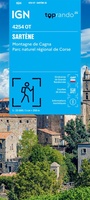 Wegenkaart - landkaart 4254OT Sartène | IGN - Institut Géographique National
 Wandelkaart - Topografische kaart 4255OT Bonifacio | IGN - Institut Géographique National
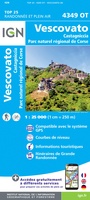 Wandelkaart - Topografische kaart 4349OT Vescovato | IGN - Institut Géographique National
 Wandelkaart - Topografische kaart 4401RT Saint-Paul-Le-Port, Reunion | IGN - Institut Géographique National
 Wandelkaart - Topografische kaart 4402RT St-Denis, La Reunion | IGN - Institut Géographique National
 Wandelkaart - Topografische kaart 4403RT St-Benoit, St-André, la Reunion | IGN - Institut Géographique National
 Wandelkaart - Topografische kaart 4404RT Saint-Leu, l'Étang Salé, La Reunion | IGN - Institut Géographique National
 Wandelkaart - Topografische kaart 4405RT Saint-Pierre, La Reunion | IGN - Institut Géographique National
 Wandelkaart - Topografische kaart 4405RTR Saint-Pierre - Cirque de Cilaos -PN Réunion | IGN - Institut Géographique National
 Wandelkaart - Topografische kaart 4406RT Piton de la Fournaise, La Reunion | IGN - Institut Géographique National
 Wandelkaart 4410MT Mamoudzou / Petite-Terre / Mayotte | IGN - Institut Géographique National
 Wandelkaart 4411MT Sada / Mlima Bénara / Mlima Choungui / Mayotte | IGN - Institut Géographique National
 Wandelkaart - Topografische kaart 4501MT Fort-de-France - Montagne Pelée - PNR Martinique | IGN - Institut Géographique National
 Wandelkaart - Topografische kaart 4502MT Le Lamentin - Presqu''île Caravelle - PNR Martinique | IGN - Institut Géographique National
 Wandelkaart - Topografische kaart 4503MT Le Marin - Presqu'île Trois Ilets - PNR Martinique | IGN - Institut Géographique National
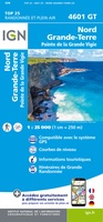 Wandelkaart 4601GT Nord Grande-Terre (Guadeloupe) | IGN - Institut Géographique National
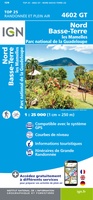 Wandelkaart 4602GT Nord Basse-Terre (Guadeloupe) | IGN - Institut Géographique National
 Wandelkaart 4603GT Pointe-à-Pitre / Ste-Anne (Guadeloupe) | IGN - Institut Géographique National
 Wandelkaart 4604GT St-François / Marie-Galante / La Désirade (Guadeloupe) | IGN - Institut Géographique National
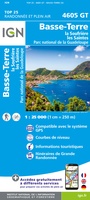 Wandelkaart 4605GT Basse-Terre / La Soufrière / Les Saintes (Guadeloupe) | IGN - Institut Géographique National
Laatste reviews

Compact gidsje
Ben nog niet het veld in geweest met de gids maar de eerste indruk is veel informatie om een meerdaagse tocht uit te stippelen.
★★★★★ door Henk 04 juli 2026 | Heeft dit artikel gekocht
Beschikbaarheid en snelheid
Prima in orde!
★★★★★ door Marko 04 juli 2026 | Heeft dit artikel gekocht
Lekker analoog
Fijn boekje met veel informatie, behalve knooppunten Utrecht af en toe incorrect. Wat heerlijk om offline te navigeren, lekker analoog. Zodra je het systeem begrijpt …
★★★★★ door Daan 03 juli 2026 | Heeft dit artikel gekocht
Aanrader
Als je van geschiedenis, Groningen en kaarteen houdt, is dit echt een aanrader!
★★★★★ door Reinout 03 juli 2026 | Heeft dit artikel gekocht