Winkelwagen
Geen items in winkelwagen
Ga naar winkelwagen
IGN - Institut Géographique National
IGN is de officiële instantie voor geografische informatie in Frankrijk ofwel Institut Géographique National. Ze staan bekend om de zeer goede wandelkaarten op schaal 1:25.000 (Serie Bleue en Top 25) van Frankrijk. De wandelkaarten zijn dan ook zeer uitgebreid. De wandelaar vindt hier alle wandelpaden, campings en langeafstandswandelpaden, ook wel GR-paden (Grande Randonnée) genoemd. Kleine weggetjes en paden, maar ook de verschillende types landschappen en bebouwingen, populaire gebieden en onontdekte parels: de wandelaar in Frankrijk vindt alles terug op deze betrouwbare kaarten van IGN.
Naast wandelkaarten geeft het IGN ook goede fiets- c.q. wegenkaarten op schaal 1:100.000 (serie Top 100) en fietskaarten op schaal 1:75.000 (serie Top 75) uit.
 Wandelkaart - Topografische kaart 3719OT Colmar & Le Hohneck | IGN - Institut Géographique National★★★★★★★★★★
 Wandelkaart - Topografische kaart 3719OTR Colmar, Le Hohneck | IGN - Institut Géographique National
 Wandelkaart - Topografische kaart 3720ET Mulhouse | IGN - Institut Géographique National
 Wandelkaart - Topografische kaart 3721ET Altkirch - Bâle - Sundgau | IGN - Institut Géographique National
 Wandelkaart - Topografische kaart 3741ET Vallée de la Bévera | IGN - Institut Géographique National★★★★★
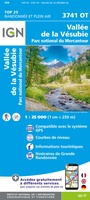 Wandelkaart - Topografische kaart 3741OT Vallée de la Vesubie | IGN - Institut Géographique National★★★★★
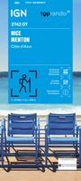 Wandelkaart 3742OT Nice / Menton / Côte d'Azur | IGN - Institut Géographique National★★★★★★★★★★
 Wandelkaart - Topografische kaart 3814ET Hagenau - Lembach - PNR des Vosges du Nord | IGN - Institut Géographique National★★★★★
 Wandelkaart - Topografische kaart 3815 SB - Serie Bleue Bischwiller - Brumath | IGN - Institut Géographique National
 Wandelkaart - Topografische kaart 3816OT Strasbourg | IGN - Institut Géographique National★★★★★
 Wandelkaart - Topografische kaart 3817 SB - Serie Bleue Sélestat - Marckolsheim | IGN - Institut Géographique National
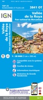 Wandelkaart - Topografische kaart 3841OT Vallée de la Roya | IGN - Institut Géographique National★★★★★
 Wandelkaart - Topografische kaart 3914OT Wissembourg | IGN - Institut Géographique National
 Fietskaart 4 Velo L' Alsace à vélo - by bike, Elzas- Vogezen | IGN - Institut Géographique National
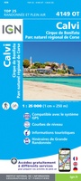 Wandelkaart - Topografische kaart 4149OT Calvi - Cirque de Bonifatu | IGN - Institut Géographique National
 Wandelkaart 4150OT Porto / Calanche de Piana / PNR de Corse | IGN - Institut Géographique National★★★★★
 Wandelkaart 4250OT Corte / Monte Cinto / PNR de Corse | IGN - Institut Géographique National★★★★★★★★★★
 Wandelkaart 4251OT Monte d'Oro / Monte Rotondo / PNR de Corse | IGN - Institut Géographique National★★★★★
 Wandelkaart 4253ET Aiguilles de Bavella / Solenzara / PNR de Corse | IGN - Institut Géographique National
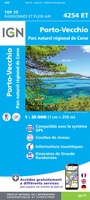 Wandelkaart - Topografische kaart 4254ET Porto-Vecchio | IGN - Institut Géographique National
Laatste reviews

Compact gidsje
Ben nog niet het veld in geweest met de gids maar de eerste indruk is veel informatie om een meerdaagse tocht uit te stippelen.
★★★★★ door Henk 04 juli 2026 | Heeft dit artikel gekocht
Beschikbaarheid en snelheid
Prima in orde!
★★★★★ door Marko 04 juli 2026 | Heeft dit artikel gekocht
Lekker analoog
Fijn boekje met veel informatie, behalve knooppunten Utrecht af en toe incorrect. Wat heerlijk om offline te navigeren, lekker analoog. Zodra je het systeem begrijpt …
★★★★★ door Daan 03 juli 2026 | Heeft dit artikel gekocht
Aanrader
Als je van geschiedenis, Groningen en kaarteen houdt, is dit echt een aanrader!
★★★★★ door Reinout 03 juli 2026 | Heeft dit artikel gekocht