Winkelwagen
Geen items in winkelwagen
Ga naar winkelwagen
IGN - Institut Géographique National
IGN is de officiële instantie voor geografische informatie in Frankrijk ofwel Institut Géographique National. Ze staan bekend om de zeer goede wandelkaarten op schaal 1:25.000 (Serie Bleue en Top 25) van Frankrijk. De wandelkaarten zijn dan ook zeer uitgebreid. De wandelaar vindt hier alle wandelpaden, campings en langeafstandswandelpaden, ook wel GR-paden (Grande Randonnée) genoemd. Kleine weggetjes en paden, maar ook de verschillende types landschappen en bebouwingen, populaire gebieden en onontdekte parels: de wandelaar in Frankrijk vindt alles terug op deze betrouwbare kaarten van IGN.
Naast wandelkaarten geeft het IGN ook goede fiets- c.q. wegenkaarten op schaal 1:100.000 (serie Top 100) en fietskaarten op schaal 1:75.000 (serie Top 75) uit.
 Wandelkaart - Topografische kaart 2934ET Bourg-Argental - Col de la République - PNR du Pilat Ardéche | IGN - Institut Géographique National
 Wandelkaart 2935OT Le Chambon-sur-Lignon / St-Agrève | IGN - Institut Géographique National
 Topografische kaart - Wandelkaart 2936 SB - Serie Bleue le Cheylard | IGN - Institut Géographique National★★★★★
 Wandelkaart - Topografische kaart 2937OT Privas – Vals-les-Bains | IGN - Institut Géographique National
 Wandelkaart - Topografische kaart 2938 SB - Serie Bleue Largentière, Aubenas, Villeneuve-de-Berg | IGN - Institut Géographique National★★★★★
 Wandelkaart 2941OT Uzès / Remoulins / Pont du Gard | IGN - Institut Géographique National
 Wandelkaart - Topografische kaart 2942OT Nîmes | IGN - Institut Géographique National
 Wandelkaart - Topografische kaart 2943ET Arles | IGN - Institut Géographique National
 Wandelkaart 2943OT Saint-Gilles / Vauvert / le Petite Camargue | IGN - Institut Géographique National
 Wandelkaart - Topografische kaart 2944OT Saintes-Maries-de-la-Mer | IGN - Institut Géographique National
 Fietskaart 3 Velo Le Vaucluse a Velo | IGN - Institut Géographique National
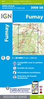 Topografische kaart - Wandelkaart 3008 SB - Serie Bleue Fumay | IGN - Institut Géographique National★★★★★
 Wandelkaart 3009 SB - Serie Bleue Charleville - Mézières / Sedan | IGN - Institut Géographique National★★★★★
 Wandelkaart - Topografische kaart 3010 SB - Serie Bleue le Chesne | IGN - Institut Géographique National
 Wandelkaart - Topografische kaart 3011 SB - Serie Bleue Vouziers | IGN - Institut Géographique National
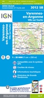 Topografische kaart - Wandelkaart 3012 SB - Serie Bleue Varennes-en-Argonne | IGN - Institut Géographique National
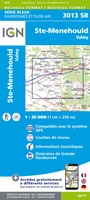 Wandelkaart - Topografische kaart 3013 SB - Serie Bleue Ste-Menehould | IGN - Institut Géographique National
 Wandelkaart - Topografische kaart 3014 SB - Serie Bleue Revigny-sur-Ornain | IGN - Institut Géographique National
 Wandelkaart - Topografische kaart 3015 SB - Serie Bleue Saint-Dizier, Pargny-sur-Saulx | IGN - Institut Géographique National
 Wandelkaart - Topografische kaart 3016 SB - Serie Bleue Wassy, Montier-en-Der, Lac du Der-Chantecoq | IGN - Institut Géographique National
Laatste reviews

Compact gidsje
Ben nog niet het veld in geweest met de gids maar de eerste indruk is veel informatie om een meerdaagse tocht uit te stippelen.
★★★★★ door Henk 04 juli 2026 | Heeft dit artikel gekocht
Beschikbaarheid en snelheid
Prima in orde!
★★★★★ door Marko 04 juli 2026 | Heeft dit artikel gekocht
Lekker analoog
Fijn boekje met veel informatie, behalve knooppunten Utrecht af en toe incorrect. Wat heerlijk om offline te navigeren, lekker analoog. Zodra je het systeem begrijpt …
★★★★★ door Daan 03 juli 2026 | Heeft dit artikel gekocht
Aanrader
Als je van geschiedenis, Groningen en kaarteen houdt, is dit echt een aanrader!
★★★★★ door Reinout 03 juli 2026 | Heeft dit artikel gekocht