Winkelwagen
Geen items in winkelwagen
Ga naar winkelwagen
IGN - Institut Géographique National
IGN is de officiële instantie voor geografische informatie in Frankrijk ofwel Institut Géographique National. Ze staan bekend om de zeer goede wandelkaarten op schaal 1:25.000 (Serie Bleue en Top 25) van Frankrijk. De wandelkaarten zijn dan ook zeer uitgebreid. De wandelaar vindt hier alle wandelpaden, campings en langeafstandswandelpaden, ook wel GR-paden (Grande Randonnée) genoemd. Kleine weggetjes en paden, maar ook de verschillende types landschappen en bebouwingen, populaire gebieden en onontdekte parels: de wandelaar in Frankrijk vindt alles terug op deze betrouwbare kaarten van IGN.
Naast wandelkaarten geeft het IGN ook goede fiets- c.q. wegenkaarten op schaal 1:100.000 (serie Top 100) en fietskaarten op schaal 1:75.000 (serie Top 75) uit.
 Wandelkaart - Topografische kaart 1812 SB - Serie Bleue Brionne – Cormeilles | IGN - Institut Géographique National
 Wandelkaart - Topografische kaart 1813 SB - Serie Bleue Bernay - Orbec | IGN - Institut Géographique National
 Wandelkaart - Topografische kaart 1814 SB - Serie Bleue Rugles – La Ferté-Frênel | IGN - Institut Géographique National
 Wandelkaart - Topografische kaart 1815 SB - Serie Bleue L'Aigle - Ste-Gauburge - Ste Colombe | IGN - Institut Géographique National
 Wandelkaart - Topografische kaart 1816 SB - Serie Bleue Mortagne-au-Perche - Mêle-sur-Sarthe | IGN - Institut Géographique National
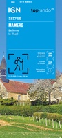 Wandelkaart 1817 SB - Serie Bleue Mamers / Bellême / Le Theil | IGN - Institut Géographique National
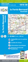 Wandelkaart - Topografische kaart 1818 SB - Serie Bleue La Ferté-Bernard | IGN - Institut Géographique National
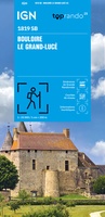 Wandelkaart 1819 SB - Serie Bleue Bouloire / Le Grand-Lucé | IGN - Institut Géographique National
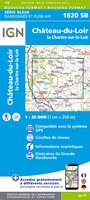 Wandelkaart - Topografische kaart 1820 SB - Serie Bleue Château-du-Loir- La Chartre-sur-Loir | IGN - Institut Géographique National★★★★★
 Wandelkaart - Topografische kaart 1821 SB - Serie Bleue Château-du-Loir, Neuillé-Pont-Pierre | IGN - Institut Géographique National
 Topografische kaart - Wandelkaart 1823 SB - Serie Bleue Chambray-les-Tours | IGN - Institut Géographique National
 Wandelkaart - Topografische kaart 1824 SB - Serie Bleue Sainte-Maure-de-Touraine, L'Ile Bouchard | IGN - Institut Géographique National
 Wandelkaart - Topografische kaart 1825 SB - Serie Bleue Chatellerault - Descartes | IGN - Institut Géographique National
 Wandelkaart - Topografische kaart 1826 SB - Serie Bleue Vouneuil-sur-Vienne, Archigny, Jaunay-Clan | IGN - Institut Géographique National
 Wandelkaart - Topografische kaart 1827 SB - Serie Bleue Poitiers - Chauvigny | IGN - Institut Géographique National
 Wandelkaart - Topografische kaart 1828 SB - Serie Bleue Gençay - Persac | IGN - Institut Géographique National
 Wandelkaart - Topografische kaart 1829 SB - Serie Bleue L'Isle-Jourdain - Charroux | IGN - Institut Géographique National
 Wandelkaart - Topografische kaart 1830 SB - Serie Bleue Confolens | IGN - Institut Géographique National
 Wandelkaart - Topografische kaart 1831 SB - Serie Bleue Rochefoucauld - Exideuil | IGN - Institut Géographique National
 Wandelkaart - Topografische kaart 1832 SB - Serie Bleue Montbron, Piégut-Pluviers | IGN - Institut Géographique National★★★★★
Laatste reviews

Cadeau voor mijn vriendin
Review van mijn vriendin. Heel mooi boek met gedetailleerde informatie over waar je op welk moment de foto's kan maken die je zou willen. Zelfs …
★★★★★ door Tony Everaert 17 januari 2026 | Heeft dit artikel gekocht
Goed
Precies wat ik zocht
★★★★★ door Hans Linneman 16 januari 2026 | Heeft dit artikel gekocht
Gedetailleerde landkaart
Het is een zeer gedetailleerde landkaart, zoals ook door de Zwerver duidelijk omschreven. Zal voor mijn vakantie met een huurauto zeer nuttig zijn. De levering …
★★★★★ door Jeroen 16 januari 2026 | Heeft dit artikel gekocht
Informatief boekje voor kleine wandelingen
Mooi uitgevoerd en fijn. Bij elke wandeling niet alleen een kaartje en routebeschrijving, maar ook achtergrondinformatie en informatie over de natuur. Bevat dus echt korte …
★★★★★ door Arjan de Jong 15 januari 2026 | Heeft dit artikel gekocht