Winkelwagen
Geen items in winkelwagen
Ga naar winkelwagen
IGN - Institut Géographique National
IGN is de officiële instantie voor geografische informatie in Frankrijk ofwel Institut Géographique National. Ze staan bekend om de zeer goede wandelkaarten op schaal 1:25.000 (Serie Bleue en Top 25) van Frankrijk. De wandelkaarten zijn dan ook zeer uitgebreid. De wandelaar vindt hier alle wandelpaden, campings en langeafstandswandelpaden, ook wel GR-paden (Grande Randonnée) genoemd. Kleine weggetjes en paden, maar ook de verschillende types landschappen en bebouwingen, populaire gebieden en onontdekte parels: de wandelaar in Frankrijk vindt alles terug op deze betrouwbare kaarten van IGN.
Naast wandelkaarten geeft het IGN ook goede fiets- c.q. wegenkaarten op schaal 1:100.000 (serie Top 100) en fietskaarten op schaal 1:75.000 (serie Top 75) uit.
 Wandelkaart - Topografische kaart 1748ET Neouvielle | IGN - Institut Géographique National★★★★★
 Wandelkaart - Topografische kaart 1748ETR Néouvielle | IGN - Institut Géographique National★★★★★
 Wandelkaart - Topografische kaart 1748OT Gavarnie | IGN - Institut Géographique National★★★★★★★★★★
 Wandelkaart - Topografische kaart 1748OTR Gavarnie | IGN - Institut Géographique National★★★★★
 Wandelkaart - Topografische kaart 1809OT Fecamp, St-Valery-en-Caux, Cote d'Albatre | IGN - Institut Géographique National
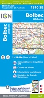 Wandelkaart - Topografische kaart 1810 SB - Serie Bleue Bolbec | IGN - Institut Géographique National
 Wandelkaart - Topografische kaart 1811OT Pont Audemer Tancarville | IGN - Institut Géographique National★★★★★
 Wandelkaart - Topografische kaart 1812 SB - Serie Bleue Brionne – Cormeilles | IGN - Institut Géographique National
 Wandelkaart - Topografische kaart 1813 SB - Serie Bleue Bernay - Orbec | IGN - Institut Géographique National
 Wandelkaart - Topografische kaart 1814 SB - Serie Bleue Rugles – La Ferté-Frênel | IGN - Institut Géographique National
 Wandelkaart - Topografische kaart 1815 SB - Serie Bleue L'Aigle - Ste-Gauburge - Ste Colombe | IGN - Institut Géographique National
 Wandelkaart - Topografische kaart 1816 SB - Serie Bleue Mortagne-au-Perche - Mêle-sur-Sarthe | IGN - Institut Géographique National
 Wandelkaart 1817 SB - Serie Bleue Mamers / Bellême / Le Theil | IGN - Institut Géographique National
 Wandelkaart - Topografische kaart 1818 SB - Serie Bleue La Ferté-Bernard | IGN - Institut Géographique National
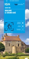 Wandelkaart 1819 SB - Serie Bleue Bouloire / Le Grand-Lucé | IGN - Institut Géographique National
 Wandelkaart - Topografische kaart 1820 SB - Serie Bleue Château-du-Loir- La Chartre-sur-Loir | IGN - Institut Géographique National★★★★★
 Wandelkaart - Topografische kaart 1821 SB - Serie Bleue Château-du-Loir, Neuillé-Pont-Pierre | IGN - Institut Géographique National
 Wandelkaart - Topografische kaart 1822 SB - Serie Bleue Tours - Langeais | IGN - Institut Géographique National
 Topografische kaart - Wandelkaart 1823 SB - Serie Bleue Chambray-les-Tours | IGN - Institut Géographique National
 Wandelkaart - Topografische kaart 1824 SB - Serie Bleue Sainte-Maure-de-Touraine, L'Ile Bouchard | IGN - Institut Géographique National
Laatste reviews

Mooi overzichtelijk boekje
Gemakkelijk opzoeken en mooie kaarten
★★★★★ door Til Palm 09 januari 2026 | Heeft dit artikel gekocht
Een prachtig boek om vanuit je stoel op reis te gaan door een relatief ongekend gebied
Namaqualand en West Coast zijn de delen van Zuid-Afrika om in het voorjaar te bezoeken om te genieten van de uitbundige bloemenpracht die uitbarst na …
★★★★★ door Jan de Graaf 09 januari 2026 | Heeft dit artikel gekocht
Helemaal blij!
Echt prachtig boek, uniek mag ik wel zeggen. Als cadeau gegeven aan onze vriend. Een super gaaf ‘tafelboek’ . We hebben er ook en standaard …
★★★★★ door Visser 08 januari 2026 | Heeft dit artikel gekocht
Geweldig!
Wegens winter kunnen we het nog niet in de praktijk proberen, maar al enorm veel voorpret bij het lezen van deze prachtige wandelgids van de …
★★★★★ door Charlotte 08 januari 2026 | Heeft dit artikel gekocht