Winkelwagen
Geen items in winkelwagen
Ga naar winkelwagen
Footprint maps
 Wandelkaart The West Highland Way | Footprint maps
 Wandelkaart Discover Cairngorms National Park | Footprint maps★★★★★
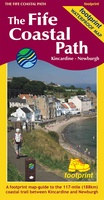 Wandelkaart The Fife Coastal Path | Footprint maps
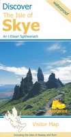 Wegenkaart - landkaart the isle of Skye | Footprint maps★★★★★
 Wandelkaart The Fife Pilgrim Way | Footprint maps
 Wandelkaart The Great Glen Way | Footprint maps
 Wandelkaart The Speyside Way | Footprint maps★★★★★
 Wandelkaart The Dales Way | Footprint maps
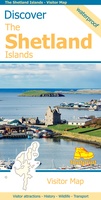 Wegenkaart - landkaart Discover the Shetlands Islands | Footprint maps★★★★★★★★★★
 Wandelkaart Fort William | Footprint maps
 Wegenkaart - landkaart Discover the Orkney Islands | Footprint maps★★★★★
 Fietskaart The C2C Cycle Route - Coast to Coast | Footprint maps
Laatste reviews

Uitstekend
Zeer vlotte levering. Prima ingepakt. Kaart voldoet aan de verwachtingen.
★★★★★ door John Gielen 20 maart 2026 | Heeft dit artikel gekocht
Prima artikel en snel afgeleverd
Prima artikel en snel afgeleverd!
★★★★★ door Cees veltman 20 maart 2026 | Heeft dit artikel gekocht
Perfect e kaart
Een mooie bruikbare kaart, goede kwaliteit papier.
★★★★★ door Ferry 20 maart 2026 | Heeft dit artikel gekocht
Prima wandelkaart
Zoals verwacht weer een prima wandelkaart en snelle levering
★★★★★ door Frank 19 maart 2026 | Heeft dit artikel gekocht