Winkelwagen
Geen items in winkelwagen
Ga naar winkelwagen
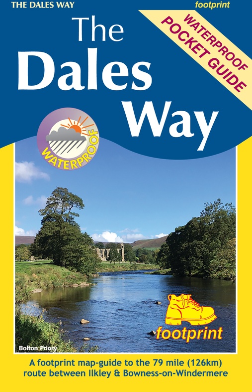
Wandelkaart The Dales Way | Footprint maps (9781916002937)
Ilkkley to Bowness-on-Windermere
- ISBN / CODE: 9781916002937
- Editie: 2022
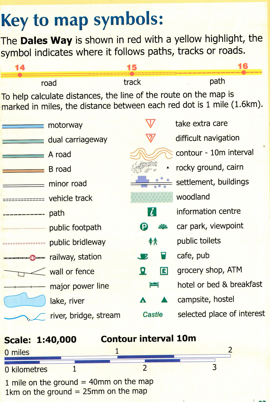
- Schaal: 1:40000
- Uitgever: Footprint maps
- Soort: Wandelkaart
- Taal: Engels
- Bindwijze: -
- Uitvoering: Scheur- en watervast
- Schrijf als eerste een review
-
€ 14,95
Dit artikel is (tijdelijk) niet leverbaar
Beschrijving
Handzame wandelkaart voor de Dales Way in Noord Engeland.
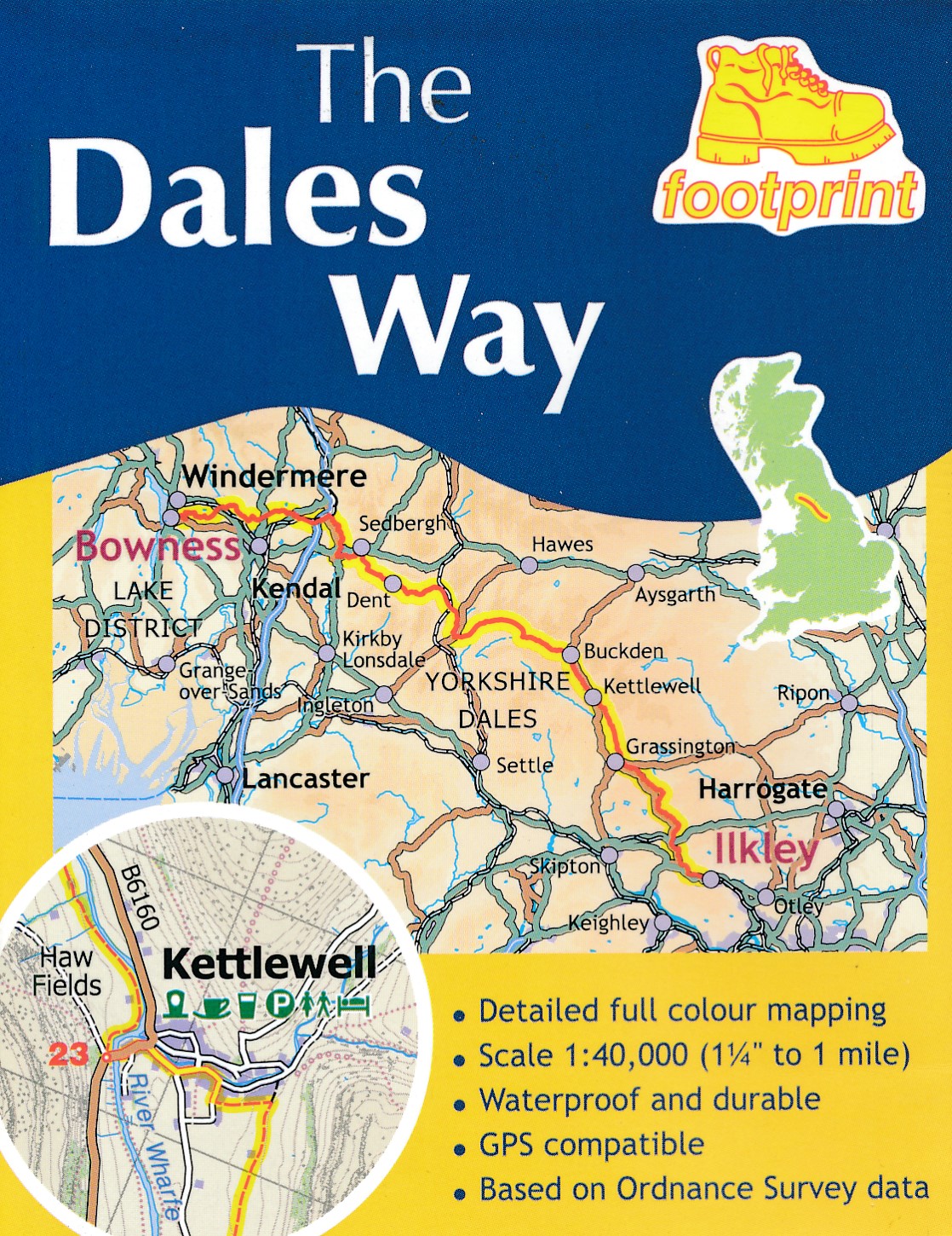
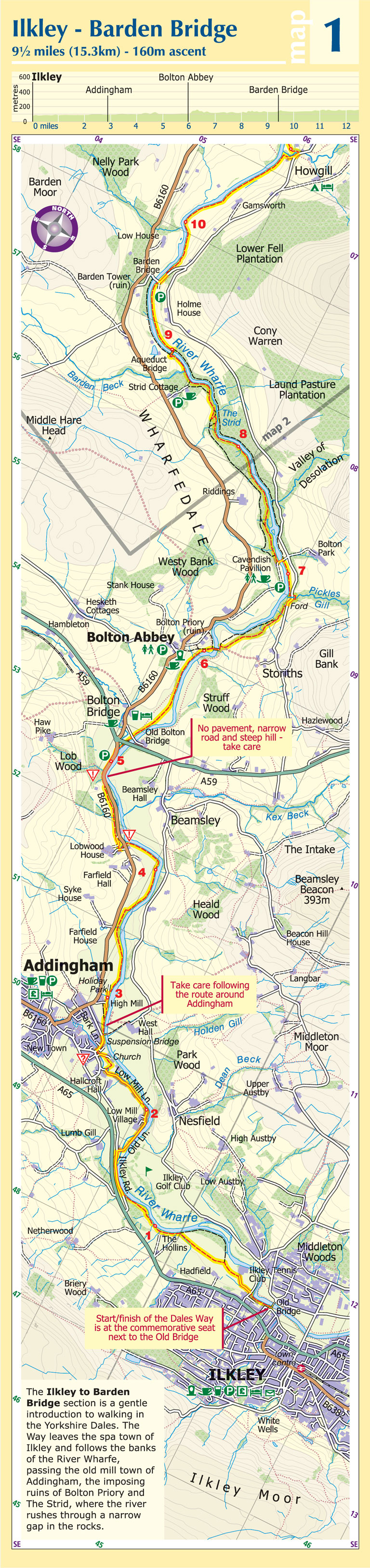
The Dales Way is a 79 mile (127km) long distance trail in the north of England, running between Ilkley, in North Yorkshire and Bowness-on-Windermere, in Cumbria. Much of the route passes through the Yorkshire Dales and Lake District National Parks. Starting out in Ilkley, the route runs along Wharfedale, passing the impressive ruins of Bolton Priory and the attractive market town of Grassington. It continues along the River Wharfe through dramatic limestone scenery before it crosses The Pennines to reach Dentdale and Sedbergh. It then skirts the Howgill Fells and crosses the M6 motorway to finish overlooking Lake Windermere.
This map-guide is laid out for walkers travelling from Ilkley to Bowness, although walkers travelling in the opposite direction should find it equally useful. Each panel includes a detailed route map, route profile and helpful notes on navigation.
There are link routes from Bradford, Leeds and Harrogate to the start of the route at Ilkley.
Reviews
Geen reviews gevonden voor dit product.
Schrijf een review
Graag horen wij wat u van dit artikel vindt. Vindt u het goed, leuk, mooi, slecht, lelijk, onbruikbaar of erg handig: schrijf gerust alles op! Het is niet alleen leuk om te doen maar u informeert andere klanten er ook nog mee!
Alle gerelateerde rubrieken >
Ook interessant voor europa/engeland/yorkshire-and-the-humber
-

Fietskaart 3 Tour Map Lake District
€ 11,95Fietskaarten North West England -

Wandelkaart - Topografische kaart 30
€ 26,95Topografische kaarten North West England -

Wegenkaart - landkaart 3 OS Road Map
€ 12,95Wegenkaarten North East England -

Wegenkaart - landkaart 3 Nicolson Ro
€ 12,95Wegenkaarten ♦ Northumberland National Park -

Wandelkaart - Topografische kaart 31
€ 20,95Topografische kaarten North West England