Footprint maps
 Wandelkaart The West Highland Way | Footprint maps
Handige wandelkaart van de bekende West Higland Way. Inclusief redelijk wat praktische informatie. The West Highland Way waterproof map from Footprint is a map-guide to the 95 mile (153km) route …
 Wandelkaart Discover Cairngorms National Park | Footprint maps
Since it was created in 2003 the Cairngorms National Park has provided the ultimate destination for visitors in the UK wanting to experience a unique mixture of wilderness and cultural …
★★★★★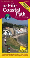 Wandelkaart The Fife Coastal Path | Footprint maps
A handy, waterproof map breaking down the Fife Pilgrim Way into seven sections. The Fife Pilgrim Way runs between North Queensferry or Culross and St Andrews. It is designed as …
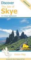 Wegenkaart - landkaart the isle of Skye | Footprint maps
Goede heldere overzichtskaart van het eiland Skye. Als wegenkaart prima te gebruiken, wandelroutes vind je er niet op terug. De wegen staan er duidelijk op ingetekend met wegnmmers en in …
★★★★★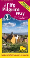 Wandelkaart The Fife Pilgrim Way | Footprint maps
A handy, waterproof map breaking down the Fife Pilgrim Way into seven sections. The Fife Pilgrim Way runs between North Queensferry or Culross and St Andrews. It is designed as …
 Wandelkaart The Great Glen Way | Footprint maps
The complete map/guide of both routes between Fort William and Inverness. Also contains compact and concise practical information for walkers. For every copy of this map sold, a …
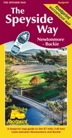 Wandelkaart The Speyside Way | Footprint maps
The Speyside Way is one of 'Scotland's Great Trails'. It runs between Newtonmore, in the heart of Strathspey, 87 miles to Buckie, on the Moray Firth. The route passes through …
★★★★★ Wandelkaart The Dales Way | Footprint maps
Handzame wandelkaart voor de Dales Way in Noord Engeland. The Dales Way is a 79 mile (127km) long distance trail in the north of England, running between Ilkley, in North …
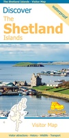 Wegenkaart - landkaart Discover the Shetlands Islands | Footprint maps
This map is the perfect companion to take for exploring the Shetland Islands. It is packed with lots of information on where to find the best that this group of …
★★★★★★★★★★ Wegenkaart - landkaart Discover the Orkney Islands | Footprint maps
A group of islands close to the north coast of Scotland, Orkney has a visible history spanning more than 5500 years. From the world’s best preserved Neolithic settlement at Skara …
★★★★★ Fietskaart The C2C Cycle Route - Coast to Coast | Footprint maps
- Britains most popular loing distance route. - New clear mapping, based on OS data,ata a scale of 1:90 000 - Waterproof paper and compact size - Excellent value for …
Laatste reviews

Op zich een goede kaart, maar het is eigenlijk gewoon een uitvergroting van de bekende 1:200.000-kaarten, dus weinig tot geen extra informatie. Wel wat duidelijker …
★★★★★ door FGM Ballhaus 13 mei 2026 | Heeft dit artikel gekocht
Duidelijke kaart, goed voor fietsen, iets minder voor wandelen door de schaal, maar er is heel weinig kaartmateriaal voor dit gebied dus daarom toch dik …
★★★★★ door FGM Ballhaus 13 mei 2026 | Heeft dit artikel gekocht
Fietskaart is een goede aanvulling op de Nederlandse fietskaarten, laat de Achterhoek zien maar ook een heel stuk Duitsland in (naar het oosten). Kwalitatief ook …
★★★★★ door FGM Ballhaus 13 mei 2026 | Heeft dit artikel gekocht
Keurig verpakt, snel verzonden. Boek voldoet aan mijn verwachtingen!
★★★★★ door Beatrice 12 mei 2026 | Heeft dit artikel gekocht