Winkelwagen
Geen items in winkelwagen
Ga naar winkelwagen
Top 25
De kaarten van IGN (kort voor Institute Geographique National), wandelkaarten voor Frankrijk, zijn van een ongekend hoog niveau. Met name de wandelkaarten 1:25.000 vinden wij geweldig: werkelijk alles staat erop, de kaarten bevatten zeer veel details en het kleurgebruik is fantastisch, waardoor alles ook nog eens heel goed leesbaar. Je hoort het: wij zijn fan van deze kaarten!
 Wandelkaart - Topografische kaart 3618OT Le Hohneck - Gérardmer | IGN - Institut Géographique National★★★★★★★★★★
 Wandelkaart - Topografische kaart 3618OTR Le Hohneck - Gérardmer | IGN - Institut Géographique National★★★★★
 Wandelkaart - Topografische kaart 3619OT Bussang - La Bresse | IGN - Institut Géographique National★★★★★★★★★★
 Wandelkaart - Topografische kaart 3619OTR Bussang - La Bresse | IGN - Institut Géographique National
 Wandelkaart - Topografische kaart 3620ET Grand Ballon | IGN - Institut Géographique National★★★★★
 Wandelkaart - Topografische kaart 3621ET Dannemarie - Delle - Sundgau | IGN - Institut Géographique National
 Wandelkaart - Topografische kaart 3621OT Belfort - Montbeliard | IGN - Institut Géographique National
 Wandelkaart - Topografische kaart 3622OT Montbéliard | IGN - Institut Géographique National
 Wandelkaart - Topografische kaart 3623OT Maîche | IGN - Institut Géographique National
 Wandelkaart - Topografische kaart 3630OT Chamonix-Mont-Blanc | IGN - Institut Géographique National★★★★★★★★★★
 Wandelkaart 3630OTR Chamonix-Mont-Blanc | IGN - Institut Géographique National★★★★★
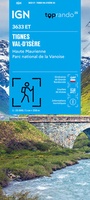 Wandelkaart 3633ET Tignes - Val d'Isère | IGN - Institut Géographique National★★★★★
 Wandelkaart 3634OT Val Cenis | IGN - Institut Géographique National★★★★★★★★★★
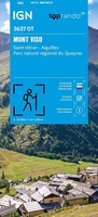 Wandelkaart 3637OT Mont Viso | IGN - Institut Géographique National★★★★★
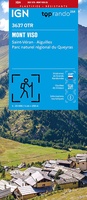 Wandelkaart 3637OTR Mont Viso / St-Véran / Aiguilles / PNR du Queyras | IGN - Institut Géographique National★★★★★
 Wandelkaart - Topografische kaart 3639OT Haute Tinée 1 | IGN - Institut Géographique National
 Wandelkaart - Topografische kaart 3640ET Haute Tinée 2 | IGN - Institut Géographique National
 Wandelkaart - Topografische kaart 3640OT Haut Cians | IGN - Institut Géographique National
 Wandelkaart - Topografische kaart 3641ET Moyenne Tinée | IGN - Institut Géographique National
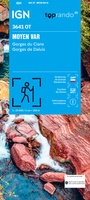 Wandelkaart 3641OT Moyen Var | IGN - Institut Géographique National
Laatste reviews

Duidelijk, overzichtelijk en geplastificeerde wandelkaart
Uitstekend
★★★★★ door Nelly van Ginkel 24 juli 2026 | Heeft dit artikel gekocht
Handige kaart
Fijne kaart waterafstootend.
★★★★★ door Nicole 21 juli 2026 | Heeft dit artikel gekocht
Mooie kaart.
Mooie helder kaart, netjes bezorgd
★★★★★ door Michael Rijke 21 juli 2026 | Heeft dit artikel gekocht
Mooie wandelkaart, lekker stevig ook!
Fijne wandelkaart, gedetailleerd en met veel extra info. Super fijn om m voor onze vakantie al te kunnen kopen, zo kon de voorpret al beginnen …
★★★★★ door Wille Groenewolt 21 juli 2026 | Heeft dit artikel gekocht