Wandelkaart - Topografische kaart 250 Cape Cod | National Geographic (9781566953559)

- ISBN / CODE: 9781566953559
- Editie: 01-11-2023
- Aantal blz.: 1
- Schaal: 1:63360
- Uitgever: National Geographic
- Soort: Topografische kaart, Wandelkaart
- Taal: Engels
- Hoogte: 19.0 cm
- Breedte: 10.0 cm
- Gewicht: 94.0 g
- Uitvoering: Scheur- en watervast
- Schrijf als eerste een review
-
€ 17,95
Leverbaar in 3 - 5 werkdagen in huis in Nederland Levertijd Belgie
Gratis verzending in Nederland vanaf €50,-
Beschrijving
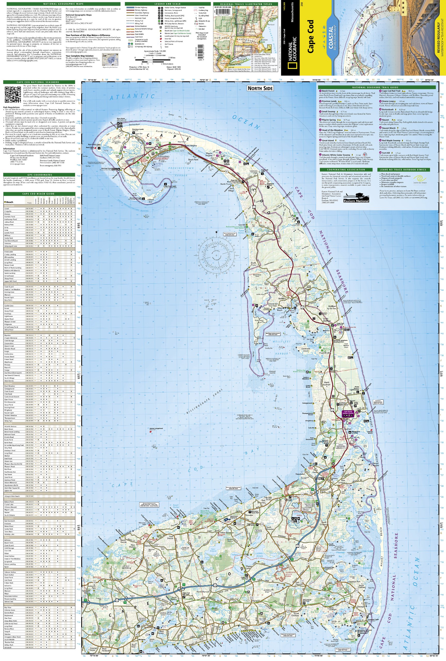
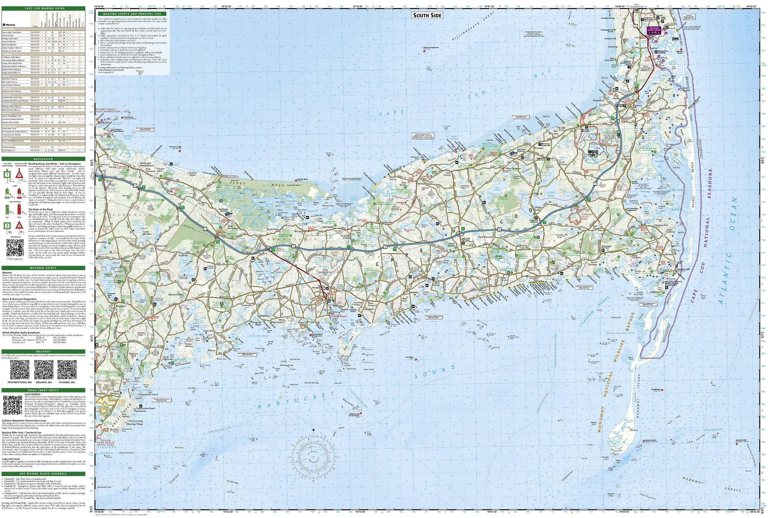
Prachtige geplastificeerde topografische wandel- en vaarkaart van het Cape Cod kustgebied. Met alle recreatieve voorzieningen als campsites, stranden, en watersport maar ook met topografische details en wandelroutes ed. Door uitgekiend kleurgebruik zeer prettig in gebruik. Scheur en watervast!
Reviews
Geen reviews gevonden voor dit product.
Schrijf een review
Graag horen wij wat u van dit artikel vindt. Vindt u het goed, leuk, mooi, slecht, lelijk, onbruikbaar of erg handig: schrijf gerust alles op! Het is niet alleen leuk om te doen maar u informeert andere klanten er ook nog mee!
Ook interessant voor noord-amerika/verenigde-staten-van-amerika/north-east
-

Stadsplattegrond Popout Map Philadel
€ 7,95Stadsplattegronden Overige Steden -

Wandelgids 1510 Topographic Map Guid
€ 17,95Wandelgidsen Noordoost USA -

Wandelkaart - Topografische kaart 21
€ 17,95Topografische kaarten Nationale Parken Verenigde Staten van Amerika -

Reisgids 111 places in Places in Phi
€ 20,95Reisgidsen Noordoost USA -

Wegenkaart - landkaart 4 New England
€ 14,95Wegenkaarten Noordoost USA