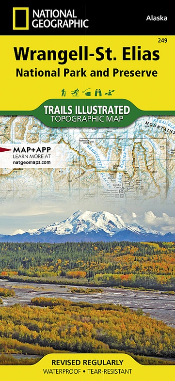
Wandelkaart 249 Wrangell and St.Elias National Park | National Geographic (9781566953825)
- ISBN / CODE: 9781566953825
- Editie: 01-12-2023
- Aantal blz.: 1
- Schaal: 1:400000
- Uitgever: National Geographic
- Soort: Wandelkaart
- Serie: Trails Illustrated Topographic Maps
- Taal: Engels
- Hoogte: 24.0 cm
- Breedte: 11.0 cm
- Gewicht: 91.0 g
- Bindwijze: -
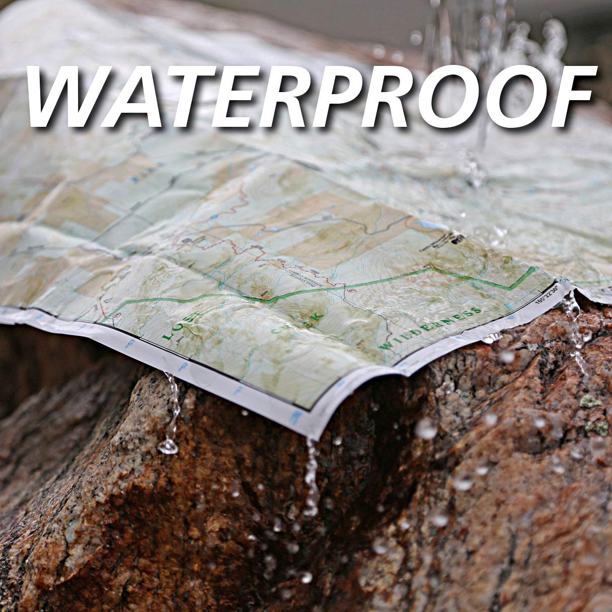
- Uitvoering: Scheur- en watervast
- Schrijf als eerste een review
-
€ 17,95
Leverbaar in 3 - 5 werkdagen in huis in Nederland Levertijd Belgie
Gratis verzending in Nederland vanaf €50,-

.jpg)


-
Overzicht Wandelkaarten Alaska Trails Illustrated National Geographic

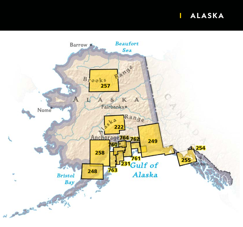
Producten op deze overzichtskaart:
Klik op een product om naar de pagina van dat product te gaan.
- Wandelkaart - Topografische kaart 222 Trails Illustrated Denali National Park | National Geographic
- Wandelkaart 231 Kenai Fjords National Park | National Geographic
- Wandelkaart - Topografische kaart 248 Katmai National Park & Preserve | National Geographic
- Wandelkaart 249 Wrangell and St.Elias National Park | National Geographic
- Wandelkaart - Topografische kaart 254 Chilkoot Trail | National Geographic
- Wandelkaart - Topografische kaart 255 Glacier Bay National Park & Preserve | National Geographic
- Wandelkaart - Topografische kaart 257 Trails Illustrated Gates of the Arctic National Park & Preserve | National Geographic
- Wandelkaart 760 Kenai Nat. Wildlife Refuge / Chugach Nat.Forest | National Geographic
- Wandelkaart - Topografische kaart 761 Prince William Sound West | National Geographic
- Wandelkaart 763 Kachemak Bay State Park | National Geographic
- Wandelkaart 764 Chugach State Park, Anchorage | National Geographic
Overzichtskaarten
Beschrijving
Prachtige geplastificeerde kaart van het bekende nationaal park. Met alle recreatieve voorzieningen als campsites, maar ook met topografische details en wandelroutes ed. Door uitgekiend kleurgebruik zeer prettig in gebruik. Scheur en watervast!
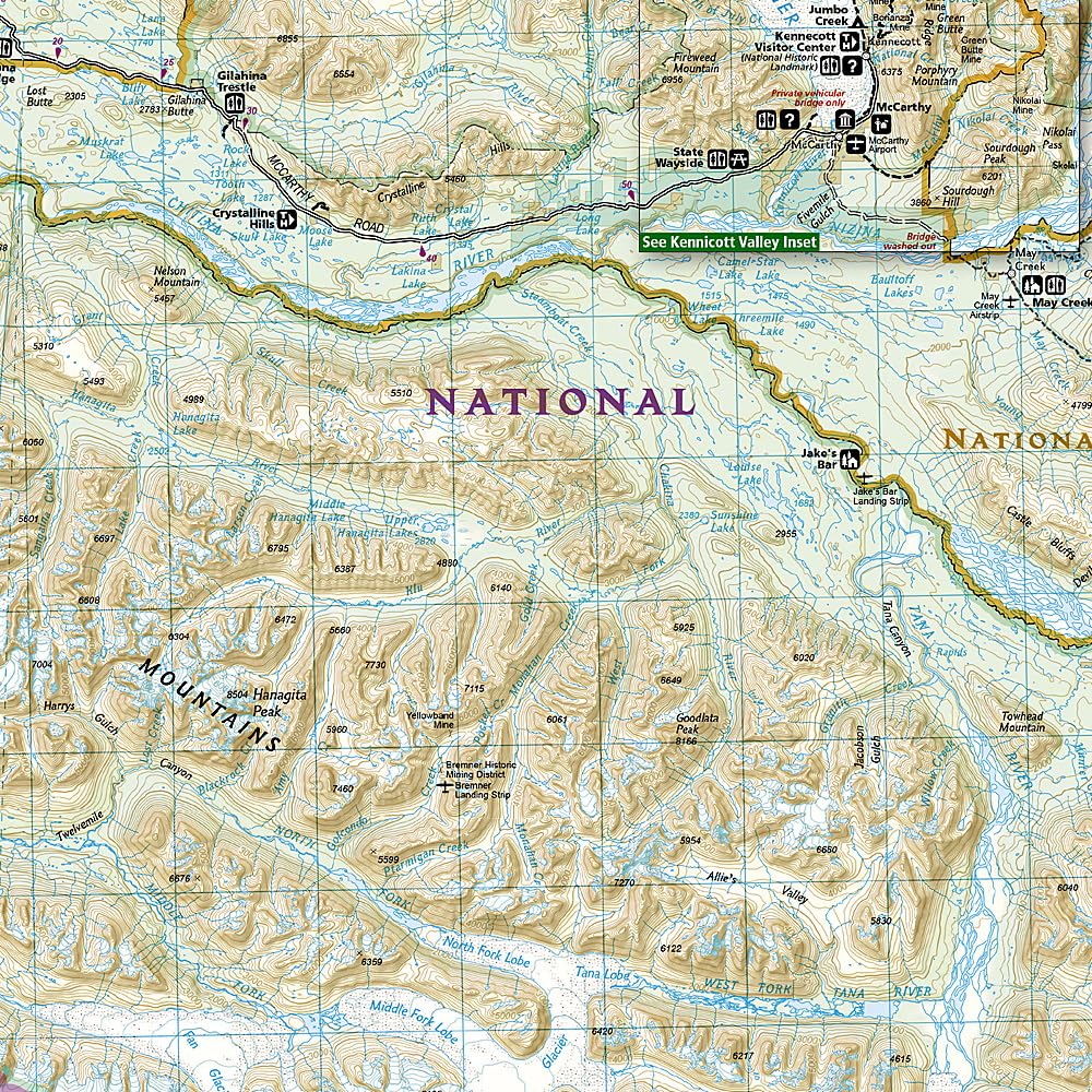
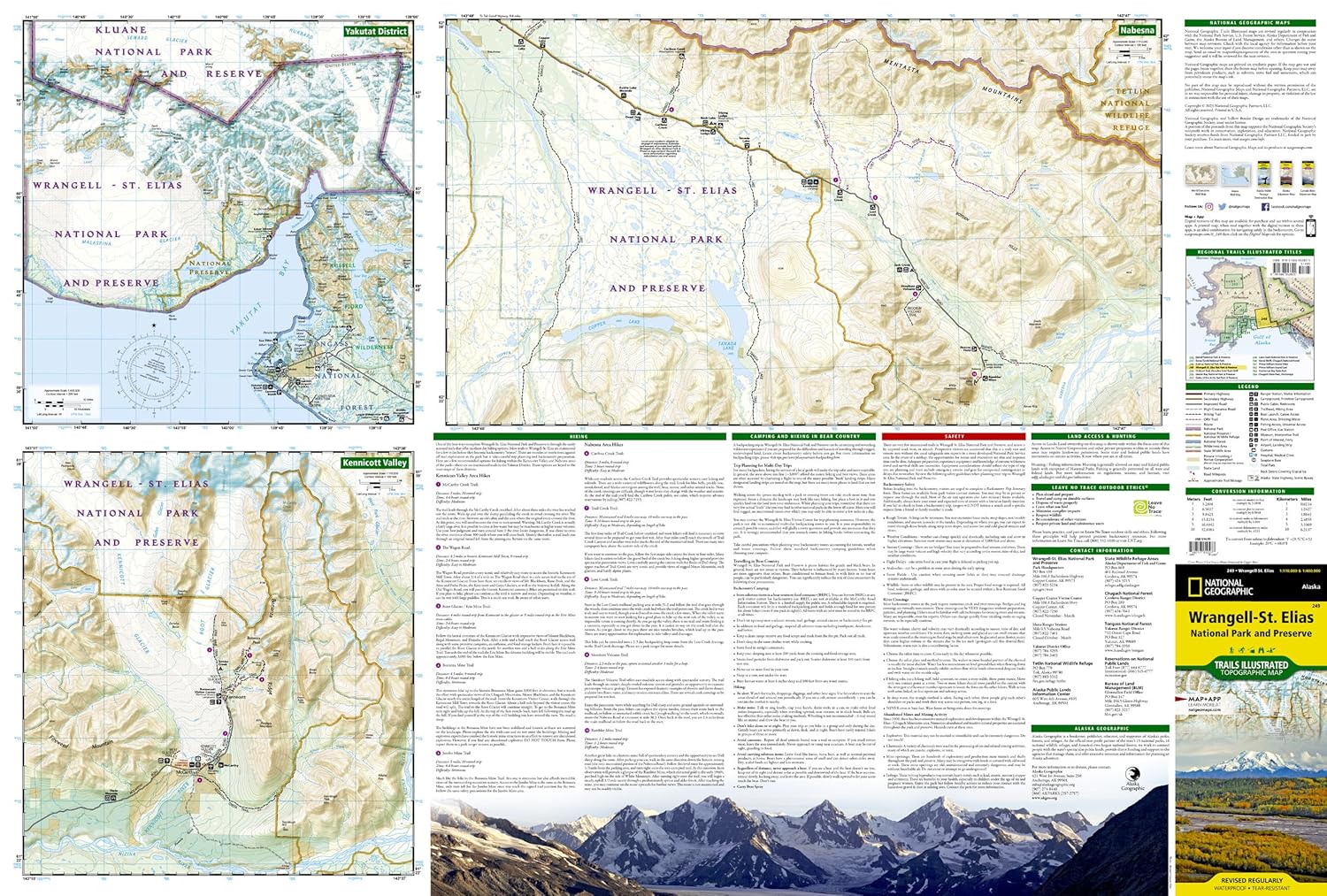
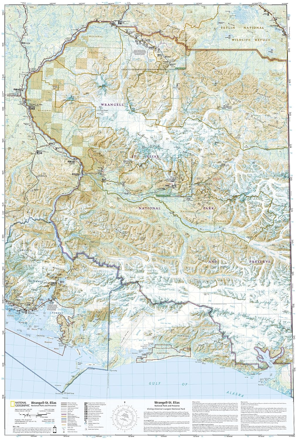
This two-sided map (325.000) covers Wrangell - St. Elias National Park in its entirety, along with Tetlin National Wildlife Refuge, portions of Chugach National Forest, the Bering Glacier, Robinson Mountains, Chugach Mountains, Wrangell Mountains, and Kayak Island State Marine Park. Towns include Katalla, Mt. Hazelet, Cape Yakataga, Kennicott, McCarthy, Slana, and Glennallen. The map features two detailed insets (85.000). The first includes Yakutat Bay, Disenchantment Bay, Russel Fjord, Nunatak Fjord, the Malaspina Glacier. The second detailed inset shows the Kennicott and McCarthy areas, along with the Bonanza Ridge, Fireweed Mountain, and the Nizina River.
Reviews
Geen reviews gevonden voor dit product.
Schrijf een review
Graag horen wij wat u van dit artikel vindt. Vindt u het goed, leuk, mooi, slecht, lelijk, onbruikbaar of erg handig: schrijf gerust alles op! Het is niet alleen leuk om te doen maar u informeert andere klanten er ook nog mee!
Ook interessant voor noord-amerika/verenigde-staten-van-amerika/nationale-parken
-

Wandkaart 20587 Alaska | 103 x 78 cm
€ 44,95Wandkaarten van landen ■ Anchorage -

Wandelkaart 244 Crater Lake National
€ 17,95Wandelkaarten Nationale Parken Verenigde Staten van Amerika -

Wandelkaart - Topografische kaart 25
€ 17,95Topografische kaarten Nationale Parken Verenigde Staten van Amerika -

Wandelkaart - Topografische kaart 30
€ 14,95Topografische kaarten Nationale Parken Verenigde Staten van Amerika -

Wegenkaart - landkaart 3117 Adventur
€ 18,50Wegenkaarten Alaska