Wandelkaarten - Noord-Amerika
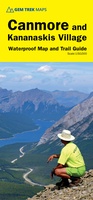 Wandelkaart 06 Canmore & Kananaskis Village | Gem Trek Maps
This map covers some of the most popular terrain for hikers and mountain bikers in Kananaskis Country - Bow Valley Provincial Park, the Canmore area, the Smith-Dorrien/Spray Lakes area south …
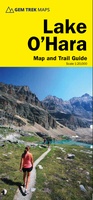 Wandelkaart 14 Lake O'Hara | Gem Trek Maps
Mooie, gedetailleerde kaart uit de serie van Gem Trek Hiking map-guides, van het gebied Lake O'Hara. This is a detailed map of the Lake O'Hara area. On the front …
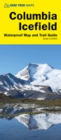 Wandelkaart 02 Columbia Icefield | Gem Trek Maps
Waterproof and tear-resistant hiking and recreation map for the Columbia Icefield region of the Canadian Rockies. Updated with the latest satellite imagery of the icefield extent, Gem Trek's Columbia …
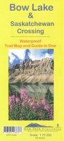 Wandelkaart 03 Bow Lake and Saskatchewan Crossing | Gem Trek Maps
This map covers the trails departing from the southern section of the Icefields Parkway from Rampart Creek south to Hector Lake. A 1:100 000-scale inset map on the back of …
 Wegenkaart - landkaart - Topografische kaart - Wandelkaart Algonquin Park (Canada) | ITMB
Algonquin National Park kaart, zeer gedetailleerd (schaal 1:50,000) plus op de anderekant van de kaart staat een overzicht van de park, schaal 1:250,000. Natuurkundige overzichtskaart met veel plaatsen en wegen, spoorlijnen en …
 Wandelkaart 267 Capitol Reef National Park | National Geographic
Prachtige geplastificeerde kaart van het bekende nationaal park. Met alle recreatieve voorzieningen als campsites, maar ook met topografische details en wandelroutes ed. Door uitgekiend kleurgebruik zeer prettig in gebruik. Scheur …
 Wandelkaart 900 Banff South National Park | National Geographic
Prachtige geplastificeerde kaart van het bekende nationaal park. Met alle recreatieve voorzieningen als campsites, maar ook met topografische details en wandelroutes ed. Door uitgekiend kleurgebruik zeer prettig in gebruik. Scheur …
 Fietskaart - Wandelkaart North & West Vancouver Biking Hiking | ITMB
Dubbelzijge wandel- en fietskaart van Vanvouver en omgeving. Schaal Vancouver 1:20.000 Omgeving 1:55.000
 Wandelkaart 731 Santa Fe, Truchas Peak | National Geographic
Prachtige geplastificeerde kaart van het bekende nationaal park. Met alle recreatieve voorzieningen als campsites, maar ook met topografische details en wandelroutes ed. Door uitgekiend kleurgebruik zeer prettig in gebruik. Scheur …
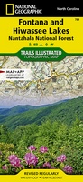 Wandelkaart 784 Fontana and Hiwassee Lakes | National Geographic
Prachtige geplastificeerde kaart van het bekende nationaal park. Met alle recreatieve voorzieningen als campsites, maar ook met topografische details en wandelroutes ed. Door uitgekiend kleurgebruik zeer prettig in gebruik. Scheur …
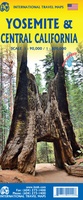 Wandelkaart Yosemite & Central California | ITMB
The USA is blessed with many wonderful parks, forests, and natural monuments that have been preserved for all to enjoy. The second most-visited national park (after Yellowstone) is Yosemite (pronounced …
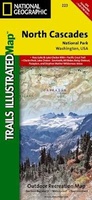 Wandelkaart 223 North Cascades National Park | National Geographic
Prachtige geplastificeerde kaart van het bekende nationaal park. Met alle recreatieve voorzieningen als campsites, maar ook met topografische details en wandelroutes ed. Door uitgekiend kleurgebruik zeer prettig in gebruik. Scheur …
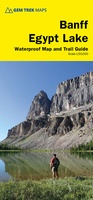 Wandelkaart Banff - Egypt Lake | Gem Trek Maps
Mooie, gedetailleerde kaart uit de serie van Gem Trek Hiking map-guides. Helder kleurgebruik en met de beste / mooiste wandelroutes, hikes en interessante plaatsen erop aangegeven. Gem Trek’s 1:50,000-scale BANFF–EGYPT …
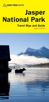 Wegenkaart - landkaart - Wandelkaart Jasper National Park (Alberta) | Gem Trek Maps
Waterproof and tear-resistant map for Jasper National Park in the Canadian Rockies. Whether you are a first-time visitor or a long-time local, you’ll find Gem Trek’s Jasper National Park …
 Wandelkaart Touring Maps Route 66 | Collins
Full color, informative map of the famous US Route 66. With detailed mapping, key tourist information and a suggested itinerary, this is a perfect guide for anyone traveling along America’s …
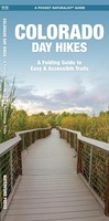 Wandelkaart Colorado Day Hikes | Waterford Press
Central Colorado is known as the gateway to the nearby Rocky Mountains, but there are many attractions and beautiful hikes within driving distance of some of the major urban areas …
Laatste reviews

Duidelijke kaart, ook met kleinere wegen. Snelle levering
★★★★★ door Ger Sulkers 02 mei 2024 | Heeft dit artikel gekocht
Ja wij zijn tevreden, alleen is mijn vriendin het boekje al kwijtgeraakt bij onze eerste wandeling.🙁
★★★★★ door Mark 02 mei 2024 | Heeft dit artikel gekocht
Ja ik ben dik tevreden over de wegenkaart van Kazachstan. Stond alles op wat ik wou dus heel erg tevreden daarover.
★★★★★ door Sjoerd Westra 02 mei 2024 | Heeft dit artikel gekocht
Zoals altijd mooie verzorgde kaarten die tijdens de reis van pas komen en achteraf mooie herinneringen oproepen.
★★★★★ door Klaas Wijnberg 02 mei 2024 | Heeft dit artikel gekocht