Winkelwagen
Geen items in winkelwagen
Ga naar winkelwagen
Pyreneeën
 Wandelkaart - Topografische kaart 2043ET Toulouse | IGN - Institut Géographique National
 Wandelkaart - Topografische kaart 2044 SB - Serie Bleue Muret, Saint Lys | IGN - Institut Géographique National
 Wandelkaart - Topografische kaart 2045 SB - Serie Bleue Lézat-sur-Lèze, Cazeres | IGN - Institut Géographique National
 Wandelkaart - Topografische kaart 2047ET Massat - Pic des Trois Seigneurs - PNR Pyr. Ariégeoises | IGN - Institut Géographique National
 Wandelkaart - Topografische kaart 2048OT Aulus-les-Bains, Mont Valier | IGN - Institut Géographique National
 Wandelkaart - Topografische kaart 2447OT Tuchan | IGN - Institut Géographique National
 Wandelkaart - Topografische kaart 2448OT Thuir, Ille-sur-Tet, Latour-de-France, Estagel, Millas | IGN - Institut Géographique National
 Wandelkaart - Topografische kaart 2449OT Céret, Amélie-les-Bains-Palalda, Vallée du Tech | IGN - Institut Géographique National
 Wandelgids - Pelgrimsroute 253 Französischer Jakobsweg GR65 | Rother Bergverlag
 Wandelkaart - Topografische kaart 2139 SB - Serie Bleue Cahors | IGN - Institut Géographique National
 Wandelkaart - Topografische kaart 2140 SB - Serie Bleue Caussade | IGN - Institut Géographique National
 Wandelkaart - Topografische kaart 2141 SB - Serie Bleue Nègrepelisse | IGN - Institut Géographique National★★★★★
 Wandelkaart - Topografische kaart 2142 SB - Serie Bleue Villemur-sur-Tarn | IGN - Institut Géographique National
 Wandelkaart - Topografische kaart 2143 SB - Serie Bleue Montastruc-la-Conseillère, Lavaur | IGN - Institut Géographique National
 Wandelkaart - Topografische kaart 2144 SB - Serie Bleue Ramonville-Saint-Agne | IGN - Institut Géographique National
 Wandelkaart - Topografische kaart 2145 SB - Serie Bleue Auterive - Mazères - Saverdun | IGN - Institut Géographique National
 Wandelkaart 2148ET Ax-les-Thermes, Ussat, Les Cabannes, Ax-Bonascre | IGN - Institut Géographique National
 Wandelgids 216 Frankreich: Pyrenäenweg GR 10 | Conrad Stein Verlag★★★★★
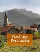 Reisgids PassePartout Prachtige Pyreneeën | Edicola
 Wegenkaart - landkaart 00 Pyreneeën | Rando Editions
Laatste reviews

Simpele keuze ondersteuning op website en hele snelle levering
Kort voor vakantie naar de Galapagos eilanden toch nog behoefte aan extra reisgids. Simpel kunnen bestellen en snelle levering. Zou niet weten wat er beter …
★★★★★ door Piet Grootenboer 25 juni 2026 | Heeft dit artikel gekocht
Te gek
Enorm mooie wereldkaart met details en snelle fijne levering.
★★★★★ door Steven Goyvaerts 25 juni 2026 | Heeft dit artikel gekocht
Goede gids voor pelgrims
Deze Cicerone gids over de via Francigena is uitermate geschikt om je route en etappes te plannen als je de Via Francigena vanuit Zwitserland gaat …
★★★★★ door Vic 24 juni 2026 | Heeft dit artikel gekocht
Aantrekkelijk en boordevol nuttige info
Heerlijk om al te kunnen voorbereiden op een fantastische vakantie met dit uiterst fijne boek.
★★★★★ door Harry 24 juni 2026 | Heeft dit artikel gekocht