
Winkelwagen
Geen items in winkelwagen
Ga naar winkelwagen
Pyreneeën
 Wandelkaart - Topografische kaart 1444 SB - Serie Bleue Orthez | IGN - Institut Géographique National
 Wandelkaart - Topografische kaart 1445 SB - Serie Bleue Mauléon-Licharre – St-Palais | IGN - Institut Géographique National
 Wandelkaart - Topografische kaart 1446ET Tardets-Sorholus, Arette | IGN - Institut Géographique National★★★★★
 Wandelkaart - Wegenkaart - landkaart 1541 SB - Serie Bleue Ygos-St-Saturnin / Labrit / Brocas | IGN - Institut Géographique National
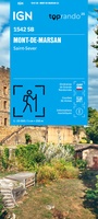 Wandelkaart 1542 SB - Serie Bleue Mont-de-Marsan / Saint-Sever | IGN - Institut Géographique National
 Wandelkaart 1543 SB - Serie Bleue Hagetmau / Geaune | IGN - Institut Géographique National
 Wandelkaart - Topografische kaart 1544 SB - Serie Bleue Arthez-de-Béarn | IGN - Institut Géographique National
 Wandelkaart - Topografische kaart 1545 SB - Serie Bleue Oloron – Sainte-Marie | IGN - Institut Géographique National
 Wandelkaart - Topografische kaart 1545ET Pau | IGN - Institut Géographique National
 Wandelkaart - Topografische kaart 1546ET Laruns, Gourette | IGN - Institut Géographique National★★★★★
 Wandelkaart - Topografische kaart 1546OT Oloron-Sainte.Marie, Vallee d'Aspe | IGN - Institut Géographique National★★★★★
 Wandelkaart - Topografische kaart 1547OT Ossau - Vallée D'Aspe | IGN - Institut Géographique National
 Wandelkaart - Topografische kaart 2239 SB - Serie Bleue Villefranche-de-Rouergue, Martiel | IGN - Institut Géographique National
 Wandelkaart - Topografische kaart 2244 SB - Serie Bleue Revel, St-Félix-Lauragais, Sorèze | IGN - Institut Géographique National
 Wandelkaart - Topografische kaart 2245 SB - Serie Bleue Bram - Castelnaudary | IGN - Institut Géographique National
 Wandelkaart - Topografische kaart 2246 SB - Serie Bleue Mirepoix | IGN - Institut Géographique National
 Wandelkaart - Topografische kaart 2247OT Lavelanet, Chalabre, Montségur, Laroque-d'Olmes | IGN - Institut Géographique National
 Wandelkaart - Topografische kaart 2248ET Axat, Querigut | IGN - Institut Géographique National★★★★★
 Wandelkaart - Topografische kaart 2249ET Font Romeu, Capcir, Olette | IGN - Institut Géographique National★★★★★
 Wandelkaart - Topografische kaart 2249OT Bourg-Madame, Pic Carlit, Col de Puymorens, Port d'Envalira | IGN - Institut Géographique National★★★★★
Laatste reviews

Goed contact met de leverancier
Snelle levering, duidelijke kaart!
★★★★★ door Christa 06 november 2026 | Heeft dit artikel gekocht
Prima levering
Snel geleverd, mooie overzichtelijke kaart 👍
★★★★★ door Christa 06 november 2026 | Heeft dit artikel gekocht
Dun papier, te veel hoogte lijnen
De zwerver leverde een prima kaart maar over de kaart zelf zijn we minder tevreden. Het papier is niet gecoat en scheurt snel. Ook de …
★★★★★ door Nathalie Schoonman 05 november 2026 | Heeft dit artikel gekocht
Wel erg veel tekst
Op zich handige gids voor onderweg, maar veel tekst. Aangezien de stempelposten belangrijk zijn voor pelgrims, zou een duidelijker opsomming vd vindplaatsen hiervan handig zijn. …
★★★★★ door Ingrid 03 november 2026 | Heeft dit artikel gekocht