Winkelwagen
Geen items in winkelwagen
Ga naar winkelwagen
Kaarten - Vendee
 Wegenkaart - landkaart 07 TOP 250 Pays de la Loire | IGN - Institut Géographique National
 Wandelkaart - Topografische kaart 1324 SB - Serie Bleue Clisson | IGN - Institut Géographique National
 Wandelkaart - Topografische kaart 1325 SB - Serie Bleue Montaigu | IGN - Institut Géographique National
 Wandelkaart - Topografische kaart 1326 SB - Serie Bleue La Roche-sur-Yon | IGN - Institut Géographique National
 Wandelkaart 1327 SB - Serie Bleue Luçon / St-Michel-en-l'Herm | IGN - Institut Géographique National
 Wandelkaart 1328OT La Tranche-s-Mer / l'Aiguillon-s-Mer PNR Marais Poitevin | IGN - Institut Géographique National
 Wandelkaart - Topografische kaart 1329ET La Rochelle - Anse de l'Aiguillon | IGN - Institut Géographique National
 Wandelkaart - Topografische kaart 1424 SB - Serie Bleue Cholet | IGN - Institut Géographique National
 Wandelkaart - Topografische kaart 1425 SB - Serie Bleue Les Herbiers | IGN - Institut Géographique National
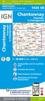 Wandelkaart - Topografische kaart 1426 SB - Serie Bleue Chantonnay | IGN - Institut Géographique National
 Wandelkaart - Topografische kaart 1225 SB - Serie Bleue Legé | IGN - Institut Géographique National
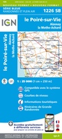 Wandelkaart - Topografische kaart 1226 SB - Serie Bleue Le Poiré-sur-Vie, Aizenay, La Mothe-Achard | IGN - Institut Géographique National
 Wandelkaart - Topografische kaart 1227 SB - Serie Bleue Aubigny-les-Clouzeaux | IGN - Institut Géographique National
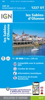 Wandelkaart 1227OT Les Sables-d'Olonne | IGN - Institut Géographique National
 Wandelkaart - Topografische kaart 1528 SB - Serie Bleue Niort | IGN - Institut Géographique National
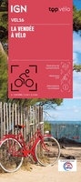 Fietskaart 16 Velo Vendée à vélo | IGN - Institut Géographique National
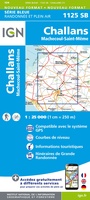 Wandelkaart - Topografische kaart 1125 SB - Serie Bleue Challans, Machecoul-Saint-Même | IGN - Institut Géographique National
 Wandelkaart - Topografische kaart 1125OT Ile de Noirmoutier, Beauvoir-sur-Mer & Bourgneuf-en-Ret | IGN - Institut Géographique National
 Wandelkaart - Topografische kaart 1126OT Ile d'Yeu, Saint-Gilles-Croix-de-Vie & Saint-Jean-de-Mont | IGN - Institut Géographique National
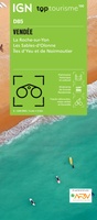 Fietskaart - Wegenkaart - landkaart D85 Top D100 Vendée | IGN - Institut Géographique National★★★★★
Laatste reviews

Kwalitatieve topkaart
Heldere gedetailleerde kaart, onmisbaar voor tochtplanning, waterafstotend
★★★★★ door Walter 24 april 2026 | Heeft dit artikel gekocht
Ideaal voor gebruik family adventure
We gebruiken ze voor een evenement met ouders en kinderen. Perfect om de kaarten en kaarthoekmeter in op te slaan. Flappie voelt wel een beetje …
★★★★★ door Wolfpack performance gym 24 april 2026 | Heeft dit artikel gekocht
Onmisbaar voor een pelgrimstocht PLUS
Heel fijn om het fysieke boek te hebben zodat je niet ieder moment naar je mobiel hoeft te grijpen voor je pelgrimstocht. Dit geeft een …
★★★★★ door Gerard Smit 24 april 2026 | Heeft dit artikel gekocht
Snel en efficiënt geregeld
Prima
★★★★★ door Carla Simons 24 april 2026 | Heeft dit artikel gekocht