Winkelwagen
Geen items in winkelwagen
Ga naar winkelwagen
Kaarten - Vendee
 Wegenkaart - landkaart 07 TOP 250 Pays de la Loire | IGN - Institut Géographique National
 Wandelkaart - Topografische kaart 1324 SB - Serie Bleue Clisson | IGN - Institut Géographique National
 Wandelkaart - Topografische kaart 1325 SB - Serie Bleue Montaigu | IGN - Institut Géographique National
 Wandelkaart - Topografische kaart 1326 SB - Serie Bleue La Roche-sur-Yon | IGN - Institut Géographique National
 Wandelkaart 1327 SB - Serie Bleue Luçon / St-Michel-en-l'Herm | IGN - Institut Géographique National
 Wandelkaart - Topografische kaart 1329ET La Rochelle - Anse de l'Aiguillon | IGN - Institut Géographique National
 Wandelkaart - Topografische kaart 1424 SB - Serie Bleue Cholet | IGN - Institut Géographique National
 Wandelkaart - Topografische kaart 1425 SB - Serie Bleue Les Herbiers | IGN - Institut Géographique National
 Wandelkaart - Topografische kaart 1426 SB - Serie Bleue Chantonnay | IGN - Institut Géographique National
 Wandelkaart - Topografische kaart 1528 SB - Serie Bleue Niort | IGN - Institut Géographique National
 Fietskaart 16 Velo Vendée à vélo | IGN - Institut Géographique National
 Wandelkaart - Topografische kaart 1225 SB - Serie Bleue Legé | IGN - Institut Géographique National
 Wandelkaart - Topografische kaart 1226 SB - Serie Bleue Le Poiré-sur-Vie, Aizenay, La Mothe-Achard | IGN - Institut Géographique National
 Wandelkaart - Topografische kaart 1227 SB - Serie Bleue Aubigny-les-Clouzeaux | IGN - Institut Géographique National
 Wandelkaart 1227OT Les Sables-d'Olonne | IGN - Institut Géographique National
 Wandelkaart - Topografische kaart 1125 SB - Serie Bleue Challans, Machecoul-Saint-Même | IGN - Institut Géographique National
 Wandelkaart - Topografische kaart 1125OT Ile de Noirmoutier, Beauvoir-sur-Mer & Bourgneuf-en-Ret | IGN - Institut Géographique National
 Wandelkaart - Topografische kaart 1126OT Ile d'Yeu, Saint-Gilles-Croix-de-Vie & Saint-Jean-de-Mont | IGN - Institut Géographique National
 Fietskaart - Wegenkaart - landkaart D85 Top D100 Vendée | IGN - Institut Géographique National★★★★★
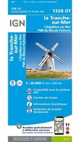 Wandelkaart 1328OT La Tranche-s-Mer / l'Aiguillon-s-Mer PNR Marais Poitevin | IGN - Institut Géographique National
Laatste reviews

Prima kaart, snel geleverd
Zoals altijd snel geleverd, prima kaart voor de 3 à 4 daagse randonnee dents du midi.
★★★★★ door Kees wim Van den Herik 28 maart 2026 | Heeft dit artikel gekocht
Gedetailleede kaart
Prima kaart, alleen eeg gedetailleerd en niet voorzien van gemarkeerde wandelroutes en hutten. Zoals de beschrijving al aangeeft is deze niet zo geschikt als wandelkaart …
★★★★★ door Kees wim Van den Herik 28 maart 2026 | Heeft dit artikel gekocht
Mooi
Heel erg dankbaar
★★★★★ door Marc 27 maart 2026 | Heeft dit artikel gekocht
Prima fietskaart
Ik denk dat ik met deze fietskaart prima uit de voeten kan. Maar dat weet ik pas na de zomer.
★★★★★ door Prins 27 maart 2026 | Heeft dit artikel gekocht