Winkelwagen
Geen items in winkelwagen
Ga naar winkelwagen
Calvados
 Wegenkaart - landkaart 303 Calvados - Manche | Michelin★★★★★
 Wegenkaart - landkaart 02 TOP 250 Normandie | IGN - Institut Géographique National
 Wandelkaart - Topografische kaart 1314 SB - Serie Bleue Villedieu-les-Poêlles, Gavray | IGN - Institut Géographique National
 Fietskaart 14 Velo La Manche a Velo | IGN - Institut Géographique National
 Wandelkaart - Topografische kaart 1413 SB - Serie Bleue Condé-sur-Vire, Caumont- sur-Aure | IGN - Institut Géographique National
 Wandelkaart - Topografische kaart 1414 SB - Serie Bleue Vire Normandie, Souleuvre en Bocage | IGN - Institut Géographique National
 Wandelkaart - Topografische kaart 1512OT Bayeux Arromanches Les Bains Plages - Normandië | IGN - Institut Géographique National★★★★★
 Wandelkaart - Topografische kaart 1513 SB - Serie Bleue Aunay-sur-Odon | IGN - Institut Géographique National
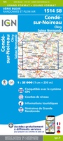 Topografische kaart - Wandelkaart 1514 SB - Serie Bleue Condé-sur-Noireau | IGN - Institut Géographique National★★★★★
 Wandelkaart - Topografische kaart 1612OT Caen - Ouistreham , Normandië | IGN - Institut Géographique National
 Topografische kaart - Wandelkaart 1613 SB - Serie Bleue Saint-Pierre-sur-Dives | IGN - Institut Géographique National
 Wandelkaart - Topografische kaart 1614 SB - Serie Bleue Falaise | IGN - Institut Géographique National★★★★★
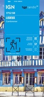 Wandelkaart 1712 SB - Serie Bleue Lisieux / Cambremer | IGN - Institut Géographique National★★★★★
 Wandelkaart - Topografische kaart 1713 SB - Serie Bleue Livarot - Beuvillers | IGN - Institut Géographique National★★★★★
 Wandelkaart - Topografische kaart 1811OT Pont Audemer Tancarville | IGN - Institut Géographique National★★★★★
 Fietsgids Bikeline Seine-Radweg | Esterbauer
 Fietsgids La cote Normande a Velo | Chamina★★★★★
 Reisgids Normandie | Chamina
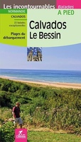 Wandelgids Calvados - Le Bessin à pied | Chamina
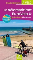 Fietsgids La Vélomaritime Eurovelo 4 | Chamina
Laatste reviews

Duidelijk, overzichtelijk en geplastificeerde wandelkaart
Uitstekend
★★★★★ door Nelly van Ginkel 24 juli 2026 | Heeft dit artikel gekocht
Handige kaart
Fijne kaart waterafstootend.
★★★★★ door Nicole 21 juli 2026 | Heeft dit artikel gekocht
Mooie kaart.
Mooie helder kaart, netjes bezorgd
★★★★★ door Michael Rijke 21 juli 2026 | Heeft dit artikel gekocht
Mooie wandelkaart, lekker stevig ook!
Fijne wandelkaart, gedetailleerd en met veel extra info. Super fijn om m voor onze vakantie al te kunnen kopen, zo kon de voorpret al beginnen …
★★★★★ door Wille Groenewolt 21 juli 2026 | Heeft dit artikel gekocht