Winkelwagen
Geen items in winkelwagen
Ga naar winkelwagen
Kaarten - Normandië
 Wandelkaart - Topografische kaart 1913 SB - Serie Bleue Evreux - Conches-en-Ouche | IGN - Institut Géographique National
 Wandelkaart - Topografische kaart 1914 SB - Serie Bleue Breteuil – La Neuve-Lyre | IGN - Institut Géographique National
 Wegenkaart - landkaart 11615 Normandie | Michelin
 Wegenkaart - landkaart 513 Normandie 2026 | Michelin★★★★★★★★★★
 Wegenkaart - landkaart Frankreich Nord - Frankrijk Noord | Kümmerly & Frey
 Wegenkaart - landkaart - Fietskaart D53 Top D100 Mayenne | IGN - Institut Géographique National
 Wegenkaart - landkaart - Fietskaart D72 Top D100 Sarthe | IGN - Institut Géographique National
 Wegenkaart - landkaart - Fietskaart D35 Top D100 Ille et Villaine | IGN - Institut Géographique National
 Fietskaart - Wandelkaart 75036 Baie De Somme - Cote d'Albatre - Fecamp - Etretat - Normandië | IGN - Institut Géographique National★★★★★★★★★★
 Fietskaart 8 Dieppe | Alta Via
 Wegenkaart - landkaart 87044 Normandie D Day, june 6, 1944 | IGN - Institut Géographique National★★★★★★★★★★
 Wegenkaart - landkaart Normandië | ExpressMap
 Historische Kaart Major & Mrs Holt's Battle Map of The Normandy D-Day Landing Beaches | Pen and Sword publications
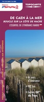 Wandelkaart De Caen à la mer | FFRP
 Wandelkaart - Topografische kaart 1710ET Le Havre, Etretat, PNR des Boucles Seine Normandie | IGN - Institut Géographique National★★★★★
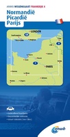 Wegenkaart - landkaart 4 Normandië - Picardië - Parijs | ANWB Media
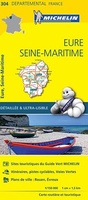 Wegenkaart - landkaart 304 Eure - Seine Martime | Michelin★★★★★
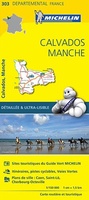 Wegenkaart - landkaart 303 Calvados - Manche | Michelin★★★★★
 Wegenkaart - landkaart 309 Cotes d'Armor - Ille et Vilaine (Bretagne, Normandie) | Michelin★★★★★
 Wegenkaart - landkaart 17617 Plages du Débarquement | Invasiestranden D-Day | Michelin
Laatste reviews

Top gids met alle benodigde informatie.
Prachtige wandelgids voorzien van alle voor de wandelaars benodigde informatie (accommodaties, restaurants en cafés, vervoersmogelijkheden enz.). Ook is de gids beschreven in twee richtingen en …
★★★★★ door Mathie Hoenjet 27 juni 2026 | Heeft dit artikel gekocht
snel bezorgd
Zoals altijd duidelijke en overzichtelijke kaart van Michelin
★★★★★ door Charles Trippelvitz 26 juni 2026 | Heeft dit artikel gekocht
Het was heel leuk om de Vennbahn te fietsen aan de hand van deze handige gids!
Door deze gids konden we ons heel goed voorbereiden op onze fietstocht. En het gebruik onderweg was ook prima. Jammer dat de campings onderweg wat …
★★★★★ door Helma Feenstra 26 juni 2026 | Heeft dit artikel gekocht
Simpele keuze ondersteuning op website en hele snelle levering
Kort voor vakantie naar de Galapagos eilanden toch nog behoefte aan extra reisgids. Simpel kunnen bestellen en snelle levering. Zou niet weten wat er beter …
★★★★★ door Piet Grootenboer 25 juni 2026 | Heeft dit artikel gekocht