Winkelwagen
Geen items in winkelwagen
Ga naar winkelwagen
Kaarten - Haute-Garonne
 Wandelkaart - Topografische kaart 2244 SB - Serie Bleue Revel, St-Félix-Lauragais, Sorèze | IGN - Institut Géographique National
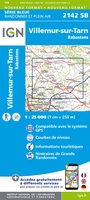 Wandelkaart - Topografische kaart 2142 SB - Serie Bleue Villemur-sur-Tarn | IGN - Institut Géographique National
 Wandelkaart - Topografische kaart 2143 SB - Serie Bleue Montastruc-la-Conseillère, Lavaur | IGN - Institut Géographique National
 Wandelkaart - Topografische kaart 2144 SB - Serie Bleue Ramonville-Saint-Agne | IGN - Institut Géographique National
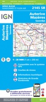 Wandelkaart - Topografische kaart 2145 SB - Serie Bleue Auterive - Mazères - Saverdun | IGN - Institut Géographique National
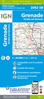 Wandelkaart 2042 SB - Serie Bleue Grenade - Verdun-sur-Garonne | IGN - Institut Géographique National
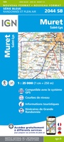 Wandelkaart - Topografische kaart 2044 SB - Serie Bleue Muret, Saint Lys | IGN - Institut Géographique National
 Wandelkaart - Topografische kaart 2045 SB - Serie Bleue Lézat-sur-Lèze, Cazeres | IGN - Institut Géographique National
 Wandelkaart 2046 SB - Serie Bleue Le Mas-d'Azil | IGN - Institut Géographique National
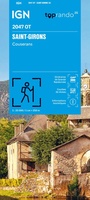 Wandelkaart 2047OT St-Girons / Couserans | IGN - Institut Géographique National
 Wegenkaart - landkaart 13 TOP 250 Occitanie - Cévennes - Languedoc - Roussillon | IGN - Institut Géographique National
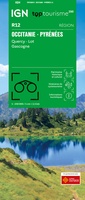 Wegenkaart - landkaart 12 TOP 250 Occitanie - Pyrénées - Quercy | IGN - Institut Géographique National
 Wandelkaart - Topografische kaart 1845 SB - Serie Bleue Boulogne-sur-Gesse | IGN - Institut Géographique National
 Wandelkaart - Topografische kaart 1847OT Saint Bertrand de Comminges, Arreau | IGN - Institut Géographique National
 Wandelkaart - Topografische kaart 1848OT Bagnères de Luchon, | IGN - Institut Géographique National★★★★★
 Wandelkaart - Topografische kaart 1945 SB - Serie Bleue Le Fousseret - Aurignac | IGN - Institut Géographique National
 Wandelkaart - Topografische kaart 1946 SB - Serie Bleue St-Gaudens, Salies-du-Salat | IGN - Institut Géographique National
 Wandelkaart - Topografische kaart 1947OT Aspet, Pic de Mauberme | IGN - Institut Géographique National★★★★★
 Wegenkaart - landkaart 343 Ariege - Haute Garonne | Michelin★★★★★
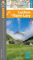 Wandelkaart Luchon Saint-Lary | Editorial Alpina
Laatste reviews

Top gids met alle benodigde informatie.
Prachtige wandelgids voorzien van alle voor de wandelaars benodigde informatie (accommodaties, restaurants en cafés, vervoersmogelijkheden enz.). Ook is de gids beschreven in twee richtingen en …
★★★★★ door Mathie Hoenjet 27 juni 2026 | Heeft dit artikel gekocht
snel bezorgd
Zoals altijd duidelijke en overzichtelijke kaart van Michelin
★★★★★ door Charles Trippelvitz 26 juni 2026 | Heeft dit artikel gekocht
Het was heel leuk om de Vennbahn te fietsen aan de hand van deze handige gids!
Door deze gids konden we ons heel goed voorbereiden op onze fietstocht. En het gebruik onderweg was ook prima. Jammer dat de campings onderweg wat …
★★★★★ door Helma Feenstra 26 juni 2026 | Heeft dit artikel gekocht
Simpele keuze ondersteuning op website en hele snelle levering
Kort voor vakantie naar de Galapagos eilanden toch nog behoefte aan extra reisgids. Simpel kunnen bestellen en snelle levering. Zou niet weten wat er beter …
★★★★★ door Piet Grootenboer 25 juni 2026 | Heeft dit artikel gekocht