Winkelwagen
Geen items in winkelwagen
Ga naar winkelwagen
Haute-Garonne
 Wandelkaart - Topografische kaart 2244 SB - Serie Bleue Revel, St-Félix-Lauragais, Sorèze | IGN - Institut Géographique National
 Wandelkaart 2042 SB - Serie Bleue Grenade - Verdun-sur-Garonne | IGN - Institut Géographique National
 Wandelkaart - Topografische kaart 2044 SB - Serie Bleue Muret, Saint Lys | IGN - Institut Géographique National
 Wandelkaart - Topografische kaart 2045 SB - Serie Bleue Lézat-sur-Lèze, Cazeres | IGN - Institut Géographique National
 Wandelkaart 2046 SB - Serie Bleue Le Mas-d'Azil | IGN - Institut Géographique National
 Wandelkaart 2047OT St-Girons / Couserans | IGN - Institut Géographique National
 Wandelkaart - Topografische kaart 2142 SB - Serie Bleue Villemur-sur-Tarn | IGN - Institut Géographique National
 Wandelkaart - Topografische kaart 2143 SB - Serie Bleue Montastruc-la-Conseillère, Lavaur | IGN - Institut Géographique National
 Wandelkaart - Topografische kaart 2144 SB - Serie Bleue Ramonville-Saint-Agne | IGN - Institut Géographique National
 Wandelkaart - Topografische kaart 2145 SB - Serie Bleue Auterive - Mazères - Saverdun | IGN - Institut Géographique National
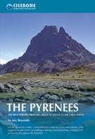 Wandelgids - Klimgids - Klettersteiggids The Pyrenees | Cicerone
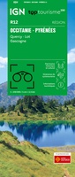 Wegenkaart - landkaart 12 TOP 250 Occitanie - Pyrénées - Quercy | IGN - Institut Géographique National
 Wegenkaart - landkaart 13 TOP 250 Occitanie - Cévennes - Languedoc - Roussillon | IGN - Institut Géographique National
 Wandelkaart - Topografische kaart 1845 SB - Serie Bleue Boulogne-sur-Gesse | IGN - Institut Géographique National
 Wandelkaart - Topografische kaart 1847OT Saint Bertrand de Comminges, Arreau | IGN - Institut Géographique National
 Wandelkaart - Topografische kaart 1848OT Bagnères de Luchon, | IGN - Institut Géographique National★★★★★
 Wandelkaart - Topografische kaart 1945 SB - Serie Bleue Le Fousseret - Aurignac | IGN - Institut Géographique National
 Wandelkaart - Topografische kaart 1946 SB - Serie Bleue St-Gaudens, Salies-du-Salat | IGN - Institut Géographique National
 Wandelkaart - Topografische kaart 1947OT Aspet, Pic de Mauberme | IGN - Institut Géographique National★★★★★
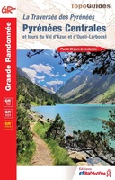 Wandelgids 1091 La traversée des Pyrénées Centrales GR10 & 101 | FFRP★★★★★
Laatste reviews

Onmisbaar
Deze kaart is onmisbaar bij het wandelen in de Eifel, we lopen jaarlijks de Hermannsweg met een vergelijkbare kaart en we kunnen echt niet zonder, …
★★★★★ door R. van den Driesche 01 juli 2026 | Heeft dit artikel gekocht
Prima kaart doe vlot is geleverd.
Ideale kaart om als toerist door Jutland te trekken. Prettige schaal.
★★★★★ door Irma van Hof 01 juli 2026 | Heeft dit artikel gekocht
Prima wandelgidsen
Kompassboekjes zijn prima gidsen. Dat wordt een leuke vakantie.
★★★★★ door Anna 01 juli 2026 | Heeft dit artikel gekocht
Handig formaat en gedetailleerd
Perfecte wegenatlas en door het A4 formaat handiger dan een uitvouwbare kaart. Fijne combinatie van de wegenatlas en het navigatiesysteem van google maps
★★★★★ door Hay van Emden 30 juni 2026 | Heeft dit artikel gekocht