Winkelwagen
Geen items in winkelwagen
Ga naar winkelwagen
Kaarten - Centre - Val de Loire
 Wandelkaart - Topografische kaart 2126 SB - Serie Bleue Le Poinçonnet, Velles, Luant | IGN - Institut Géographique National
 Wandelkaart - Topografische kaart 2214ET Versailles, Forêts de Marly et de St-Germain | IGN - Institut Géographique National
 Wandelkaart - Topografische kaart 2216ET Etampes, Dourdan | IGN - Institut Géographique National
 Wandelkaart - Topografische kaart 2217 SB - Serie Bleue Méréville - Sainville | IGN - Institut Géographique National
 Wandelkaart - Topografische kaart 2218 SB - Serie Bleue Pithiviers, Neuville-aux-Bois, Artenay | IGN - Institut Géographique National
 Wandelkaart - Topografische kaart 2219 SB - Serie Bleue Orléans - Fay aux Loges | IGN - Institut Géographique National
 Topografische kaart - Wandelkaart 1322 SB - Serie Bleue Ancenis | IGN - Institut Géographique National
 Topografische kaart - Wandelkaart 1323 SB - Serie Bleue Vallet | IGN - Institut Géographique National
 Wandelkaart - Topografische kaart 1324 SB - Serie Bleue Clisson | IGN - Institut Géographique National
 Wandelkaart - Topografische kaart 1325 SB - Serie Bleue Montaigu | IGN - Institut Géographique National
 Wandelkaart - Topografische kaart 1326 SB - Serie Bleue La Roche-sur-Yon | IGN - Institut Géographique National
 Wandelkaart - Topografische kaart 1421 SB - Serie Bleue Segré | IGN - Institut Géographique National
 Wandelkaart - Topografische kaart 1422 SB - Serie Bleue Chalonnes-sur-Loire | IGN - Institut Géographique National
 Wandelkaart - Topografische kaart 1423 SB - Serie Bleue Chemillé-Melay | IGN - Institut Géographique National
 Wandelkaart - Topografische kaart 1424 SB - Serie Bleue Cholet | IGN - Institut Géographique National
 Wandelkaart - Topografische kaart 1425 SB - Serie Bleue Les Herbiers | IGN - Institut Géographique National
 Wandelkaart - Topografische kaart 1426 SB - Serie Bleue Chantonnay | IGN - Institut Géographique National
 Wandelkaart - Topografische kaart 1221 SB - Serie Bleue Guémené – Penfao – Nozay | IGN - Institut Géographique National
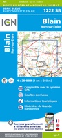 Wandelkaart - Topografische kaart 1222 SB - Serie Bleue Blain - Nort-sur-Erdre | IGN - Institut Géographique National
 Topografische kaart - Wandelkaart 1223 SB - Serie Bleue Nantes - St Herblain | IGN - Institut Géographique National
Laatste reviews

Goede kaart, maar weinig meerwaarde boven de 1:200.000-kaart
Op zich een goede kaart, maar het is eigenlijk gewoon een uitvergroting van de bekende 1:200.000-kaarten, dus weinig tot geen extra informatie. Wel wat duidelijker …
★★★★★ door FGM Ballhaus 13 mei 2026 | Heeft dit artikel gekocht
Iets te grote schaal voor wandelen, maar verder een goede kaart voor wandelen en fietsen
Duidelijke kaart, goed voor fietsen, iets minder voor wandelen door de schaal, maar er is heel weinig kaartmateriaal voor dit gebied dus daarom toch dik …
★★★★★ door FGM Ballhaus 13 mei 2026 | Heeft dit artikel gekocht
Goede fietskaart voor nét over de grens
Fietskaart is een goede aanvulling op de Nederlandse fietskaarten, laat de Achterhoek zien maar ook een heel stuk Duitsland in (naar het oosten). Kwalitatief ook …
★★★★★ door FGM Ballhaus 13 mei 2026 | Heeft dit artikel gekocht
Leuk informatief boek, precieze route goed weergegeven.
Keurig verpakt, snel verzonden. Boek voldoet aan mijn verwachtingen!
★★★★★ door Beatrice 12 mei 2026 | Heeft dit artikel gekocht