Winkelwagen
Geen items in winkelwagen
Ga naar winkelwagen
Kaarten - Centre - Val de Loire
 Wandelkaart - Topografische kaart 2320 SB - Serie Bleue Châteauneuf-sur-Loire, Sully-sur-Loire | IGN - Institut Géographique National
 Topografische kaart - Wandelkaart 2321 SB - Serie Bleue Argent-sur-Sauldre | IGN - Institut Géographique National
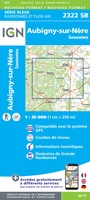 Topografische kaart - Wandelkaart 2322 SB - Serie Bleue Aubigny-sur-Nère | IGN - Institut Géographique National
 Wandelkaart - Topografische kaart 2323 SB - Serie Bleue St-Martin-d'Auxigny, Foëcy | IGN - Institut Géographique National
 Wandelkaart - Topografische kaart 2324 SB - Serie Bleue Bourges, Mehun-sur-Yèvre | IGN - Institut Géographique National
 Wandelkaart - Topografische kaart 2413OT Dammartin-en-Goële, Centre | IGN - Institut Géographique National
 Wandelkaart - Topografische kaart 2414ET Marne-la-Vallée - Forêts: Crécy - Armainvilliers - Ferrières, Centre | IGN - Institut Géographique National
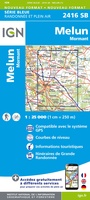 Wandelkaart - Topografische kaart 2416 SB - Serie Bleue Melun, Mormant | IGN - Institut Géographique National
 Wandelkaart - Topografische kaart 2417OT Forêt de Fontainebleau | IGN - Institut Géographique National★★★★★
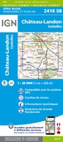 Wandelkaart - Topografische kaart 2418 SB - Serie Bleue Château-Landon, Corbeilles | IGN - Institut Géographique National
 Wandelkaart - Topografische kaart 2513OT Meaux - Vallée de l'Ourcq, Centre | IGN - Institut Géographique National
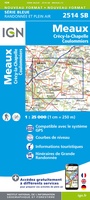 Wandelkaart - Topografische kaart 2514 SB - Serie Bleue Meaux | IGN - Institut Géographique National
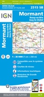 Wandelkaart - Topografische kaart 2515 SB - Serie Bleue Mormant, Rozay-en-Brie, Jouy-le-Châtel | IGN - Institut Géographique National
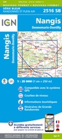 Wandelkaart - Topografische kaart 2516 SB - Serie Bleue Donnemarie-Dontilly, Nangis | IGN - Institut Géographique National
 Wandelkaart - Topografische kaart 2517 SB - Serie Bleue Montereau-Fault-Yonne, Moret-Loing-et-Orvanne | IGN - Institut Géographique National
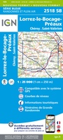 Wandelkaart - Topografische kaart 2518 SB - Serie Bleue Lorrez-le-Bocage-Préaux, Chéroy, St-Valérien | IGN - Institut Géographique National
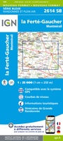 Wandelkaart - Topografische kaart 2614 SB - Serie Bleue La Ferté-Gaucher, Montmirail | IGN - Institut Géographique National
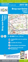 Wandelkaart - Topografische kaart 2617 SB - Serie Bleue Bray-sur-Seine | IGN - Institut Géographique National
 Fietskaart 2 Velo Ile-de-France a velo - by bike | IGN - Institut Géographique National
 Wandelkaart - Topografische kaart 2015 SB - Serie Bleue Dreux - Nonancourt | IGN - Institut Géographique National
Laatste reviews

Goede kaart, maar weinig meerwaarde boven de 1:200.000-kaart
Op zich een goede kaart, maar het is eigenlijk gewoon een uitvergroting van de bekende 1:200.000-kaarten, dus weinig tot geen extra informatie. Wel wat duidelijker …
★★★★★ door FGM Ballhaus 13 mei 2026 | Heeft dit artikel gekocht
Iets te grote schaal voor wandelen, maar verder een goede kaart voor wandelen en fietsen
Duidelijke kaart, goed voor fietsen, iets minder voor wandelen door de schaal, maar er is heel weinig kaartmateriaal voor dit gebied dus daarom toch dik …
★★★★★ door FGM Ballhaus 13 mei 2026 | Heeft dit artikel gekocht
Goede fietskaart voor nét over de grens
Fietskaart is een goede aanvulling op de Nederlandse fietskaarten, laat de Achterhoek zien maar ook een heel stuk Duitsland in (naar het oosten). Kwalitatief ook …
★★★★★ door FGM Ballhaus 13 mei 2026 | Heeft dit artikel gekocht
Leuk informatief boek, precieze route goed weergegeven.
Keurig verpakt, snel verzonden. Boek voldoet aan mijn verwachtingen!
★★★★★ door Beatrice 12 mei 2026 | Heeft dit artikel gekocht