🥾 GR-10 Trektocht
 Wandelkaart - Topografische kaart 2549OT Banyuls-sur-Mer | IGN - Institut Géographique National
 Wandelkaart - Topografische kaart 2449OT Céret, Amélie-les-Bains-Palalda, Vallée du Tech | IGN - Institut Géographique National
 Wandelkaart - Topografische kaart 2349ET Massif du Canigou, La Preste, Prats-de-Mollo, Vernet-les-Bains | IGN - Institut Géographique National★★★★★
 Wandelkaart - Topografische kaart 2250ET Bourg-Madame - Mont-Louis | IGN - Institut Géographique National★★★★★
 Wandelkaart - Topografische kaart 2249OT Bourg-Madame, Pic Carlit, Col de Puymorens, Port d'Envalira | IGN - Institut Géographique National★★★★★
 Wandelkaart - Topografische kaart 2148OT Vicdessos, Pic d'Estats et de Montcalm, Pyrenees-Ariegeoises | IGN - Institut Géographique National★★★★★
 Wandelkaart - Topografische kaart 2047ET Massat - Pic des Trois Seigneurs - PNR Pyr. Ariégeoises | IGN - Institut Géographique National
 Wandelkaart - Topografische kaart 2048OT Aulus-les-Bains, Mont Valier | IGN - Institut Géographique National
 Wandelkaart - Topografische kaart 1947OT Aspet, Pic de Mauberme | IGN - Institut Géographique National
 Wandelkaart - Topografische kaart 1848OT Bagnères de Luchon, | IGN - Institut Géographique National★★★★★
 Wandelkaart - Topografische kaart 1748OT Gavarnie | IGN - Institut Géographique National★★★★★★★★★★
 Wandelkaart - Topografische kaart 1647OT Vignemale, Ossau, Cauterets, Gourette | IGN - Institut Géographique National★★★★★
 Wandelkaart - Topografische kaart 1546ET Laruns, Gourette | IGN - Institut Géographique National★★★★★
 Wandelkaart - Topografische kaart 1547OT Ossau - Vallée D'Aspe | IGN - Institut Géographique National
 Wandelkaart - Topografische kaart 1446ET Tardets-Sorholus, Arette | IGN - Institut Géographique National★★★★★
 Topografische kaart - Wandelkaart 1346ET Forêt d'Iraty - Pic d'Orly | IGN - Institut Géographique National
 Topografische kaart - Wandelkaart 1346OT St.-Jean-Pied-de-Port | IGN - Institut Géographique National
 Wandelkaart - Topografische kaart 1345OT Cambo-les-Bains – Hasparren | IGN - Institut Géographique National
 Wandelkaart - Topografische kaart 1245OT Hendaye - St.Jean de Luz - Cote d'Argent | IGN - Institut Géographique National
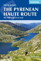
 Wandelgids Pyrenean Haute Route - a high level trail, Pyreneeën HRP | Cicerone★★★★★
Laatste reviews

Duidelijke en overzichtelijke wegenkaart. Handig dat de highlights er beknopt op staan en dat je alvast een beetje je weg kunt vinden voordat je op …
★★★★★ door Marianne van der Panne 23 april 2024 | Heeft dit artikel gekocht
Prachtige kaart - gigantische lap papier, beter niet in de wind naar de achterkant wisselen. Maar wel overzichtelijk en gedetailleerd. En actueel 2023
★★★★★ door Wolf Joehlinger 23 april 2024 | Heeft dit artikel gekocht
Overzichtelijk en toch gedetailleerd. En redelijk actueel
★★★★★ door Wolf Joehlinger 23 april 2024 | Heeft dit artikel gekocht
Nergens te krijgen. Een gids van Austin Texas. Maar hier dus mooi wel! Snel geleverd en nou ja niet echt te duur.
★★★★★ door Joop 23 april 2024 | Heeft dit artikel gekocht

