Winkelwagen
Geen items in winkelwagen
Ga naar winkelwagen
Kaarten - Bretagne
 Wandelkaart - Topografische kaart 0620ET Quimperlé, Pont-Aven, Tregunc, Bannalec, Clohars-Carnoët | IGN - Institut Géographique National★★★★★
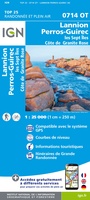 Wandelkaart - Topografische kaart 0714OT Perros-Guirec, Lannion, Trégastel-Plage, Trébeurden, Côte de Granit Rose | IGN - Institut Géographique National★★★★★
 Wandelkaart - Topografische kaart 0720ET Lorient - Ile de Groix | IGN - Institut Géographique National
 Topografische kaart - Wandelkaart 0814OT Paimpol | IGN - Institut Géographique National★★★★★★★★★★
 Wandelkaart - Topografische kaart 0820 SB - Serie Bleue Baud - Languidic | IGN - Institut Géographique National
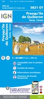 Wandelkaart - Topografische kaart 0821OT Presqu'Ile de Quiberon - Auray - Carnac Bretagne | IGN - Institut Géographique National
 Wandelkaart - Topografische kaart 0822OT Belle-Ile - Ile d'Houat et d'Hoëdic Bretagne | IGN - Institut Géographique National★★★★★
 Wandelkaart - Topografische kaart 0916ET Erquy - le Val-André | IGN - Institut Géographique National
 Wandelkaart - Topografische kaart 0916OT Saint-Brieuc | IGN - Institut Géographique National★★★★★
 Wandelkaart - Topografische kaart 0921OT Vannes | IGN - Institut Géographique National★★★★★
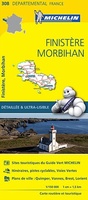 Wegenkaart - landkaart 308 Finistere - Morbihan (Bretagne) | Michelin★★★★★
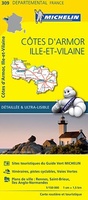 Wegenkaart - landkaart 309 Cotes d'Armor - Ille et Vilaine (Bretagne, Normandie) | Michelin★★★★★
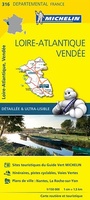 Wegenkaart - landkaart 316 Loire Atlantique - Vendee | Michelin★★★★★
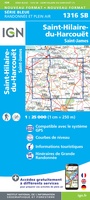 Wandelkaart - Topografische kaart 1316 SB - Serie Bleue St-Hilaire-du-Harcouët | IGN - Institut Géographique National
 Wandelkaart 1317 SB - Serie Bleue Fougères – St-Brice-en-Coglès | IGN - Institut Géographique National
 Wandelkaart - Topografische kaart 1318 SB - Serie Bleue Vitré - Châteaubourg | IGN - Institut Géographique National
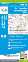 Wandelkaart - Topografische kaart 1319 SB - Serie Bleue La Guerche-de-Bretagne – Retiers | IGN - Institut Géographique National
 Wandelkaart - Topografische kaart 1320 SB - Serie Bleue Châteaubriant - Pouancé | IGN - Institut Géographique National
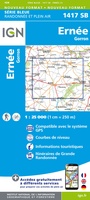 Wandelkaart - Topografische kaart 1417 SB - Serie Bleue Ernée - Gorron | IGN - Institut Géographique National
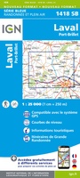 Wandelkaart - Topografische kaart 1418 SB - Serie Bleue Laval - Port-Brillet | IGN - Institut Géographique National★★★★★
- 1
- 2
- 3
- Volgende >>
- 6
Laatste reviews

Prima kaart, snel geleverd
Zoals altijd snel geleverd, prima kaart voor de 3 à 4 daagse randonnee dents du midi.
★★★★★ door Kees wim Van den Herik 28 maart 2026 | Heeft dit artikel gekocht
Gedetailleede kaart
Prima kaart, alleen eeg gedetailleerd en niet voorzien van gemarkeerde wandelroutes en hutten. Zoals de beschrijving al aangeeft is deze niet zo geschikt als wandelkaart …
★★★★★ door Kees wim Van den Herik 28 maart 2026 | Heeft dit artikel gekocht
Mooi
Heel erg dankbaar
★★★★★ door Marc 27 maart 2026 | Heeft dit artikel gekocht
Prima fietskaart
Ik denk dat ik met deze fietskaart prima uit de voeten kan. Maar dat weet ik pas na de zomer.
★★★★★ door Prins 27 maart 2026 | Heeft dit artikel gekocht