Winkelwagen
Geen items in winkelwagen
Ga naar winkelwagen
Kaarten - Bourgondië
 Wegenkaart - landkaart 327 Loire - Rhone | Michelin★★★★★
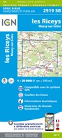 Topografische kaart - Wandelkaart 2919 SB - Serie Bleue les Riceys | IGN - Institut Géographique National
 Topografische kaart - Wandelkaart 2920 SB - Serie Bleue Châtillon-sur-Seine | IGN - Institut Géographique National
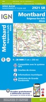 Topografische kaart - Wandelkaart 2921 Baigneux-les-Juifs, Alésia, Montbard | IGN - Institut Géographique National
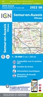 Wandelkaart - Topografische kaart 2922 SB - Serie Bleue Semur-en-Auxois – Vitteaux | IGN - Institut Géographique National★★★★★
 Wandelkaart - Topografische kaart 2923 SB - Serie Bleue Pouilly-en-Auxois – Thoisy-la-Berchère | IGN - Institut Géographique National
 Wandelkaart - Topografische kaart 2924 SB - Serie Bleue Arnay-le-Duc – Epignac | IGN - Institut Géographique National★★★★★
 Wandelkaart - Topografische kaart 2925 SB - Serie Bleue Autun - Le Creusot | IGN - Institut Géographique National
 Wandelkaart - Topografische kaart 2926 SB - Serie Bleue Montceau-les-Mines, Ecuisses | IGN - Institut Géographique National
 Wandelkaart - Topografische kaart 2927 SB - Serie Bleue St-Bonnet-de-Joux – Saint-Gengoux-le-National | IGN - Institut Géographique National
 Wandelkaart - Topografische kaart 2928 SB - Serie Bleue Cluny Matour | IGN - Institut Géographique National
 Wandelkaart - Topografische kaart 2929ET Beaujeu - Belleville - Haut Beaujolais – Rhônevallei – Bourgondië | IGN - Institut Géographique National
 Topografische kaart - Wandelkaart 3019 SB - Serie Bleue Châteauvillain | IGN - Institut Géographique National
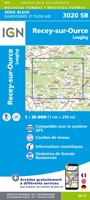 Topografische kaart - Wandelkaart 3020 SB - Serie Bleue Recey-sur-Ource | IGN - Institut Géographique National
 Wandelkaart - Topografische kaart 3021 Grancey-le-Château-Neuvelle – Aignay-le-Duc | IGN - Institut Géographique National
 Wandelkaart - Topografische kaart 3022ET Val-Suzon - St-Seine-l'Abbaye - Dijon Ouest | IGN - Institut Géographique National★★★★★
 Wandelkaart - Topografische kaart 3023OT Nuits-St-Georges | IGN - Institut Géographique National
 Wandelkaart - Topografische kaart 3024OT Beaune Chagny | IGN - Institut Géographique National
 Wandelkaart - Topografische kaart 3026 SB - Serie Bleue Chalon-sur-Saône, St-Gernain-du-Plain | IGN - Institut Géographique National
 Wandelkaart - Topografische kaart 3027 SB - Serie Bleue Tournus - Lugny | IGN - Institut Géographique National
- 1
- 2
- 3
- Volgende >>
- 5
Laatste reviews

Top gids met alle benodigde informatie.
Prachtige wandelgids voorzien van alle voor de wandelaars benodigde informatie (accommodaties, restaurants en cafés, vervoersmogelijkheden enz.). Ook is de gids beschreven in twee richtingen en …
★★★★★ door Mathie Hoenjet 27 juni 2026 | Heeft dit artikel gekocht
snel bezorgd
Zoals altijd duidelijke en overzichtelijke kaart van Michelin
★★★★★ door Charles Trippelvitz 26 juni 2026 | Heeft dit artikel gekocht
Het was heel leuk om de Vennbahn te fietsen aan de hand van deze handige gids!
Door deze gids konden we ons heel goed voorbereiden op onze fietstocht. En het gebruik onderweg was ook prima. Jammer dat de campings onderweg wat …
★★★★★ door Helma Feenstra 26 juni 2026 | Heeft dit artikel gekocht
Simpele keuze ondersteuning op website en hele snelle levering
Kort voor vakantie naar de Galapagos eilanden toch nog behoefte aan extra reisgids. Simpel kunnen bestellen en snelle levering. Zou niet weten wat er beter …
★★★★★ door Piet Grootenboer 25 juni 2026 | Heeft dit artikel gekocht