Winkelwagen
Geen items in winkelwagen
Ga naar winkelwagen
Kaarten - Franse Atlantische Kust - Nouvelle-Aquitaine
 Wandelkaart - Topografische kaart 1629 Melle | IGN - Institut Géographique National
 Wandelkaart - Topografische kaart 1630 SB - Serie Bleue Aulnay | IGN - Institut Géographique National
 Wandelkaart - Topografische kaart 1631 SB - Serie Bleue Matha | IGN - Institut Géographique National
 Wandelkaart - Topografische kaart 1632 SB - Serie Bleue Cognac | IGN - Institut Géographique National
 Wandelkaart - Topografische kaart 1633 SB - Serie Bleue Barbezieux-Saint-Hilaire | IGN - Institut Géographique National
 Wandelkaart - Topografische kaart 1634 SB - Serie Bleue Brossac - Montguyon | IGN - Institut Géographique National
 Wandelkaart - Topografische kaart 1635 SB - Serie Bleue Guîtres - Coutras | IGN - Institut Géographique National
 Wandelkaart - Topografische kaart 1636 SB - Serie Bleue Libourne, Saint-Emilion | IGN - Institut Géographique National★★★★★
 Wandelkaart - Topografische kaart 1637 SB - Serie Bleue Podensac | IGN - Institut Géographique National
 Topografische kaart - Wandelkaart 1638 La Réole - Langon | IGN - Institut Géographique National
 Wandelkaart - Topografische kaart 1639 SB - Serie Bleue Grignols - Bazas | IGN - Institut Géographique National
 Wandelkaart - Topografische kaart 1640 SB - Serie Bleue Losse | IGN - Institut Géographique National
 Wandelkaart - Topografische kaart 1728 SB - Serie Bleue Vivonne - Lusignan | IGN - Institut Géographique National
 Wandelkaart - Topografische kaart 1729 SB - Serie Bleue Civray - Sauze - Vaussais | IGN - Institut Géographique National
 Wandelkaart - Topografische kaart 1730 SB - Serie Bleue Ruffec - Villefagnan | IGN - Institut Géographique National
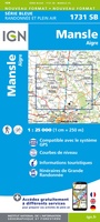 Wandelkaart - Topografische kaart 1731 SB - Serie Bleue Mansle | IGN - Institut Géographique National
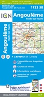 Wandelkaart - Topografische kaart 1732 SB - Serie Bleue Angoulême, Ruelle-sur-Touvre | IGN - Institut Géographique National
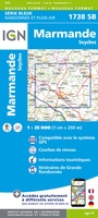 Wandelkaart - Topografische kaart 1738 SB - Serie Bleue Marmande - Seyches | IGN - Institut Géographique National
 Wandelkaart - Topografische kaart 1827 SB - Serie Bleue Poitiers - Chauvigny | IGN - Institut Géographique National
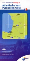 Wegenkaart - landkaart 10 Atlantische Kust - Pyreneeën West | ANWB Media
Laatste reviews

Cadeau voor mijn vriendin
Review van mijn vriendin. Heel mooi boek met gedetailleerde informatie over waar je op welk moment de foto's kan maken die je zou willen. Zelfs …
★★★★★ door Tony Everaert 17 januari 2026 | Heeft dit artikel gekocht
Goed
Precies wat ik zocht
★★★★★ door Hans Linneman 16 januari 2026 | Heeft dit artikel gekocht
Gedetailleerde landkaart
Het is een zeer gedetailleerde landkaart, zoals ook door de Zwerver duidelijk omschreven. Zal voor mijn vakantie met een huurauto zeer nuttig zijn. De levering …
★★★★★ door Jeroen 16 januari 2026 | Heeft dit artikel gekocht
Informatief boekje voor kleine wandelingen
Mooi uitgevoerd en fijn. Bij elke wandeling niet alleen een kaartje en routebeschrijving, maar ook achtergrondinformatie en informatie over de natuur. Bevat dus echt korte …
★★★★★ door Arjan de Jong 15 januari 2026 | Heeft dit artikel gekocht