Winkelwagen
Geen items in winkelwagen
Ga naar winkelwagen
Franse Atlantische Kust - Nouvelle-Aquitaine
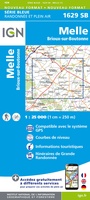 Wandelkaart - Topografische kaart 1629 Melle | IGN - Institut Géographique National
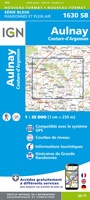 Wandelkaart - Topografische kaart 1630 SB - Serie Bleue Aulnay | IGN - Institut Géographique National
 Wandelkaart - Topografische kaart 1631 SB - Serie Bleue Matha | IGN - Institut Géographique National
 Wandelkaart - Topografische kaart 1632 SB - Serie Bleue Cognac | IGN - Institut Géographique National
 Wandelkaart - Topografische kaart 1633 SB - Serie Bleue Barbezieux-Saint-Hilaire | IGN - Institut Géographique National
 Wandelkaart - Topografische kaart 1634 SB - Serie Bleue Brossac - Montguyon | IGN - Institut Géographique National
 Wandelkaart - Topografische kaart 1635 SB - Serie Bleue Guîtres - Coutras | IGN - Institut Géographique National
 Wandelkaart - Topografische kaart 1636 SB - Serie Bleue Libourne, Saint-Emilion | IGN - Institut Géographique National★★★★★
 Wandelkaart - Topografische kaart 1637 SB - Serie Bleue Podensac | IGN - Institut Géographique National
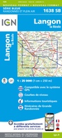 Topografische kaart - Wandelkaart 1638 La Réole - Langon | IGN - Institut Géographique National
 Wandelkaart - Topografische kaart 1639 SB - Serie Bleue Grignols - Bazas | IGN - Institut Géographique National
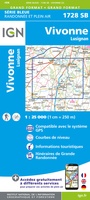 Wandelkaart - Topografische kaart 1728 SB - Serie Bleue Vivonne - Lusignan | IGN - Institut Géographique National
 Wandelkaart - Topografische kaart 1729 SB - Serie Bleue Civray - Sauze - Vaussais | IGN - Institut Géographique National
 Wandelkaart - Topografische kaart 1730 SB - Serie Bleue Ruffec - Villefagnan | IGN - Institut Géographique National
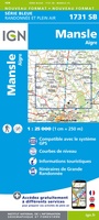 Wandelkaart - Topografische kaart 1731 SB - Serie Bleue Mansle | IGN - Institut Géographique National
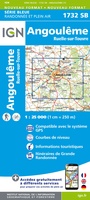 Wandelkaart - Topografische kaart 1732 SB - Serie Bleue Angoulême, Ruelle-sur-Touvre | IGN - Institut Géographique National
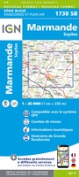 Wandelkaart - Topografische kaart 1738 SB - Serie Bleue Marmande - Seyches | IGN - Institut Géographique National
 Wandelkaart - Topografische kaart 1827 SB - Serie Bleue Poitiers - Chauvigny | IGN - Institut Géographique National
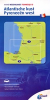 Wegenkaart - landkaart 10 Atlantische Kust - Pyreneeën West | ANWB Media
 Wandelgids 100 Les chemins de la guerre de Cent Ans GR100 - De Montluçon à Poitiers | FFRP
Laatste reviews

alleen de grote routes
prima kaart voor overzicht van een gebied maar alleen de grote routes, bijvoorbeeld naar hutten, staan er op, om zelf wandelingen te plannen minder geschikt
★★★★★ door Jasper 31 juli 2026 | Heeft dit artikel gekocht
Perfect.
Snelle levering.
★★★★★ door Anton Deutekom 31 juli 2026 | Heeft dit artikel gekocht
prima kaart en snelle service van De Zwerver
handig
★★★★★ door Barbara 31 juli 2026 | Heeft dit artikel gekocht
heel tevreden
prima kaartenaanbod
★★★★★ door yvon werniers 30 juli 2026 | Heeft dit artikel gekocht