Winkelwagen
Geen items in winkelwagen
Ga naar winkelwagen
Kaarten - Gironde
 Wandelkaart 1332ET Royan / Forêt de la Coubre | IGN - Institut Géographique National
 Wandelkaart - Topografische kaart 1336ET Lac de Lacanau & Le Porge | IGN - Institut Géographique National
 Wandelkaart - Topografische kaart 1337ET Bassin D'Arcachon | IGN - Institut Géographique National★★★★★
 Wandelkaart - Topografische kaart 1339ET Biscarrosse | IGN - Institut Géographique National
 Wandelkaart - Topografische kaart 1433 SB - Serie Bleue Lesparre-Médoc | IGN - Institut Géographique National
 Wandelkaart - Topografische kaart 1433OT Soulac-Sur-Mer & Montalivet Pointe De Grave | IGN - Institut Géographique National
 Wandelkaart 1434 SB - Serie Bleue Lesparre-Médoc | IGN - Institut Géographique National
 Topografische kaart - Wandelkaart 1434OT Hourtin, Lacs d'Hourtin Et De Carcans | IGN - Institut Géographique National
 Wandelkaart - Topografische kaart 1436 SB - Serie Bleue St-Médard-en-Jalles | IGN - Institut Géographique National
 Wandelkaart - Topografische kaart 1437 SB - Serie Bleue Saint-Jean-d'Illac | IGN - Institut Géographique National
 Wandelkaart - Topografische kaart 1438 SB - Serie Bleue Belin-Béliet | IGN - Institut Géographique National
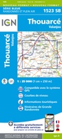 Wandelkaart - Topografische kaart 1523 SB - Serie Bleue Thouarcé | IGN - Institut Géographique National
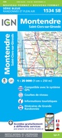 Topografische kaart - Wandelkaart 1534 SB - Serie Bleue Montendre, St-Ciers-sur-Girond | IGN - Institut Géographique National
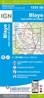 Wandelkaart - Topografische kaart 1535 SB - Serie Bleue Blaye | IGN - Institut Géographique National
 Topografische kaart - Wandelkaart 1536OT Bordeaux / Sud Médoc | IGN - Institut Géographique National
 Topografische kaart - Wandelkaart 1537 SB - Serie Bleue Pessac | IGN - Institut Géographique National
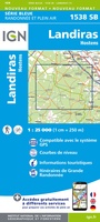 Wandelkaart - Topografische kaart 1538 SB - Serie Bleue Landiras | IGN - Institut Géographique National
 Wandelkaart - Topografische kaart 1635 SB - Serie Bleue Guîtres - Coutras | IGN - Institut Géographique National
 Wandelkaart - Topografische kaart 1636 SB - Serie Bleue Libourne, Saint-Emilion | IGN - Institut Géographique National★★★★★
 Wandelkaart - Topografische kaart 1637 SB - Serie Bleue Podensac | IGN - Institut Géographique National
Laatste reviews

Onmisbaar
Deze kaart is onmisbaar bij het wandelen in de Eifel, we lopen jaarlijks de Hermannsweg met een vergelijkbare kaart en we kunnen echt niet zonder, …
★★★★★ door R. van den Driesche 01 juli 2026 | Heeft dit artikel gekocht
Prima kaart doe vlot is geleverd.
Ideale kaart om als toerist door Jutland te trekken. Prettige schaal.
★★★★★ door Irma van Hof 01 juli 2026 | Heeft dit artikel gekocht
Prima wandelgidsen
Kompassboekjes zijn prima gidsen. Dat wordt een leuke vakantie.
★★★★★ door Anna 01 juli 2026 | Heeft dit artikel gekocht
Handig formaat en gedetailleerd
Perfecte wegenatlas en door het A4 formaat handiger dan een uitvouwbare kaart. Fijne combinatie van de wegenatlas en het navigatiesysteem van google maps
★★★★★ door Hay van Emden 30 juni 2026 | Heeft dit artikel gekocht