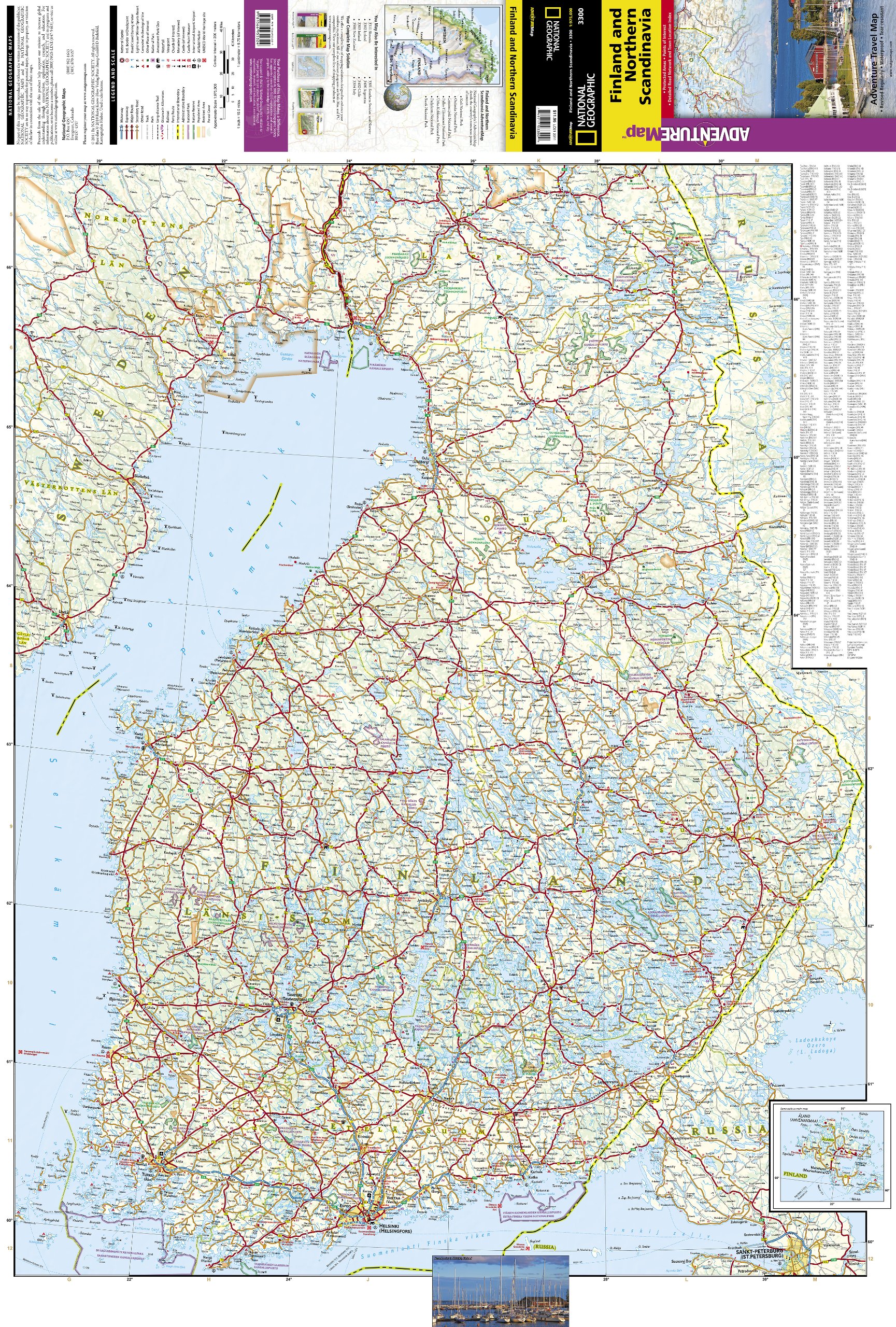
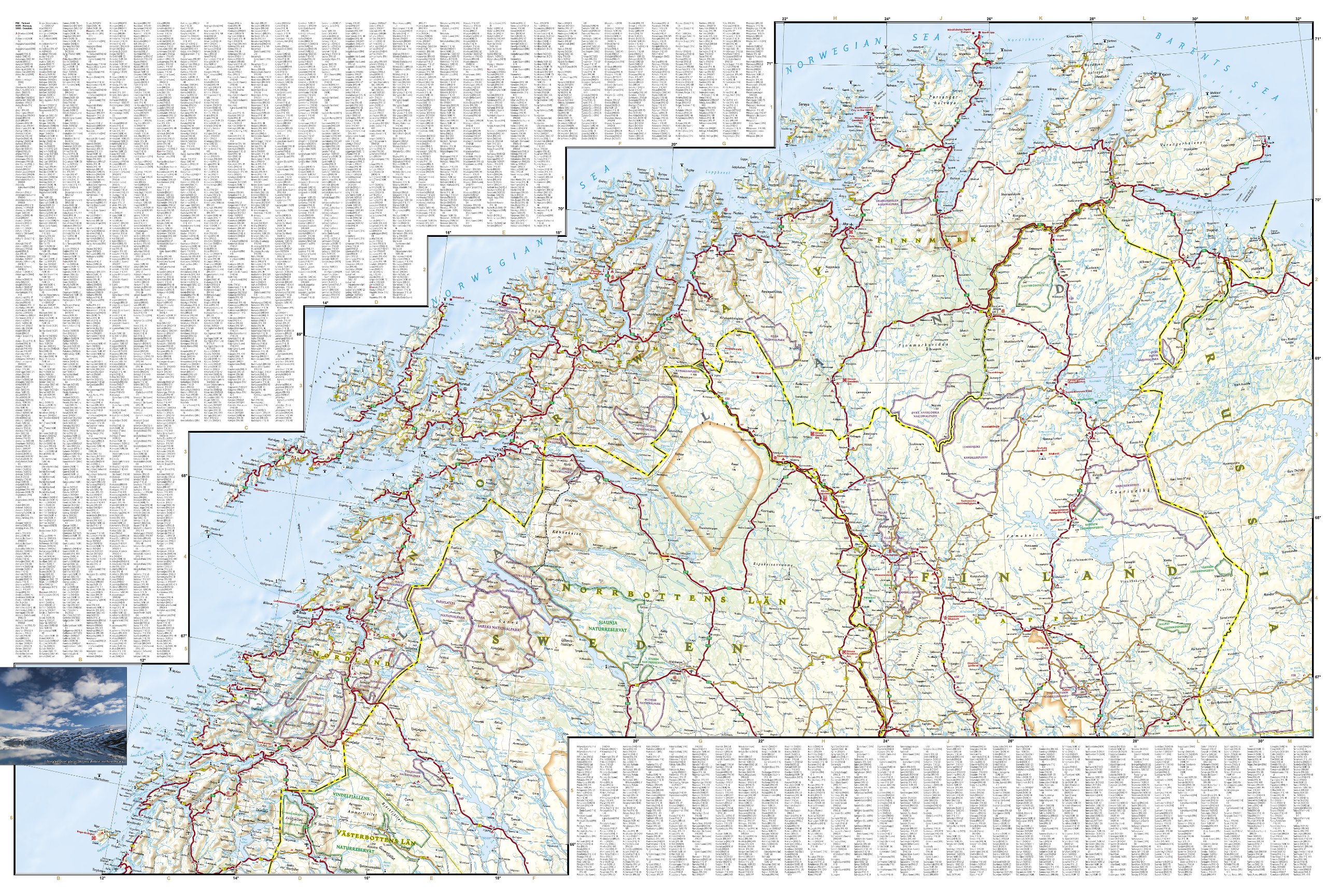
Wegenkaart - landkaart 3300 Adventure Map Finland & Northern Scandinavia - Finland en noord Scandinavië | National Geographic (9781566955324)

- ISBN / CODE: 9781566955324
- Editie: 01-12-2019
- Aantal blz.: 1
- Schaal: 1:975000
- Uitgever: National Geographic
- Soort: Wegenkaart
- Serie: Adventure Map
- Taal: Engels
- Hoogte: 24.0 cm
- Breedte: 11.0 cm
- Gewicht: 94.0 g
- Bindwijze: -
- Uitvoering: Scheur- en watervast
- Beoordeling: 3,0 ★★★★★ (1 review) Schrijf een review
-
€ 18,50
Leverbaar in 3 - 5 werkdagen in huis in Nederland Levertijd Belgie
Gratis verzending in Nederland vanaf €50,-
Beschrijving
Wegenkaart van Finland en noord Scandinavië met vermelding van veel bezienswaardigheden, nationale parken en attrakties. Watervast en scheurvast. Juist door deze vermeldingen onderscheidt de kaart zich van andere wegenkaarten.
Reviews
De NG kaart Finland and Northern Scandinavia bestrijkt inderdaad het gebied waarover ik nadere info wilde hebben. Maar de kaart is erg onduidelijk. Het is moeilijk de plaatsen te vinden en sommigen staan er niet op zoals b.v de plaats A met een rondje erop op het zuidelijkste puntje van de Lofoten. Dat bezochten we omdat we later die dag de ferry naar Bodo op het vasteland zouden pakken. Of Storslet in N, waar de 865 bij de kust komt. Wat ik wel goed vind aan de kaart is dat er hoogtelijnen op staan. Ook de "waterpartijen"zijn duidelijk. Samenvattend kan ik zeggen dat ik blij was met de kaart, maar in het vervolg niet zo gauw een NG kaart wil, dan wel niet als enige. Het (vooraf) bestuderen van kaarten is ook een deel van het reisgenoegen.
★★★★★ door Annemarijke Hofstede 23 augustus 2018Vond u dit een nuttige review? (login om te beoordelen)
Schrijf een review
Graag horen wij wat u van dit artikel vindt. Vindt u het goed, leuk, mooi, slecht, lelijk, onbruikbaar of erg handig: schrijf gerust alles op! Het is niet alleen leuk om te doen maar u informeert andere klanten er ook nog mee!
Ook interessant voor europa/finland
-

Reisverhaal Boom in een winters bos
€ 24,99Reisverhalen Scandinavië -

Fietsgids Tallinn - Sankt Petersburg
€ 20,50Fietsgidsen Estland -

Wandelkaart Fjällkartor 1:50.000 Het
€ 22,95Wandelkaarten Fins Lapland -

Reisgids ANWB Ontdek IJsland | ANWB
€ 24,50Reisgidsen Reykjavik -

Spoorwegenkaart Europe Western Railr
€ 14,95Spoorwegenkaarten Zuid Noorwegen