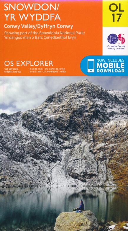
Wandelkaart - Topografische kaart OL17 OS Explorer Map Snowdon - Conwy Valley - Dyffryn Conwy | Ordnance Survey (9780319263532)
Snowdonia
- ISBN / CODE: 9780319263532
- Editie: 25-02-2019
- Schaal: 1:25000
- Uitgever: Ordnance Survey
- Soort: Topografische kaart, Wandelkaart
- Serie: OS Explorer Map
- Taal: Engels
- Hoogte: 24.0 cm
- Breedte: 13.0 cm
- Gewicht: 125.0 g
- Uitvoering: Papier
- Bindwijze: -
- Beoordeling: 4,9 ★★★★★ (8 reviews) Schrijf een review
-
€ 20,95
Levertijd 2 - 4 werkdagen in huis in Nederland Levertijd Belgie
Gratis verzending in Nederland vanaf €50,-

-
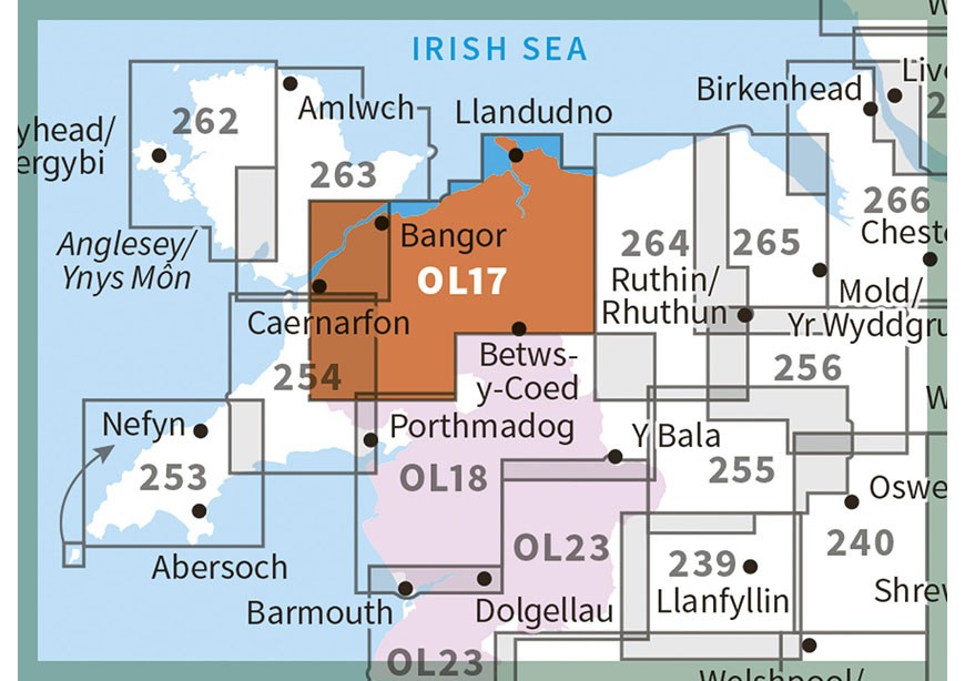
Overzichtskaart Explorer 25.000 topografische kaarten Wales


Producten op deze overzichtskaart:
Klik op een product om naar de pagina van dat product te gaan.
- Wandelkaart - Topografische kaart 151 OS Explorer Map Cardiff & Bridgend | Ordnance Survey
- Wandelkaart - Topografische kaart 152 OS Explorer Map Newport, Pontypool | Ordnance Survey
- Wandelkaart - Topografische kaart 164 OS Explorer Map Gower, Gwyr | Ordnance Survey
- Wandelkaart - Topografische kaart 165 OS Explorer Map Swansea, Abertawe | Ordnance Survey
- Wandelkaart - Topografische kaart 166 OS Explorer Map Rhondda, Merthyr Tydfil | Ordnance Survey
- Wandelkaart - Topografische kaart 177 OS Explorer Map Carmarthen, Kidwelly | Ordnance Survey
- Wandelkaart - Topografische kaart 178 OS Explorer Map Llanelli, Ammanford, Rhydaman | Ordnance Survey
- Wandelkaart - Topografische kaart 185 OS Explorer Map Newcastle Emlyn | Ordnance Survey
- Wandelkaart - Topografische kaart 186 OS Explorer Map Llandeilo, Brechfa Forest | Ordnance Survey
- Wandelkaart - Topografische kaart 187 OS Explorer Map Llandovery | Ordnance Survey
- Wandelkaart - Topografische kaart 188 OS Explorer Map Builth Wells, Llanfair-ym-Muallt | Ordnance Survey
- Wandelkaart - Topografische kaart 189 OS Explorer Map Hereford & Ross-on-Wye | Ordnance Survey
- Wandelkaart - Topografische kaart 198 OS Explorer Map Cardigan, New Quay | Ordnance Survey
- Wandelkaart - Topografische kaart 199 OS Explorer Map Lampeter | Ordnance Survey
- Wandelkaart - Topografische kaart 200 OS Explorer Map Llandrindod Wells, Elan Valley | Ordnance Survey
- Wandelkaart - Topografische kaart 201 OS Explorer Map Knighton, Presteigne | Ordnance Survey
- Wandelkaart - Topografische kaart 202 OS Explorer Map Leominster, Bromyard | Ordnance Survey
- Wandelkaart - Topografische kaart 203 OS Explorer Map Ludlow | Ordnance Survey
- Wandelkaart - Topografische kaart 213 OS Explorer Map Aberystwyth, Cwm Rheidol | Ordnance Survey
- Wandelkaart - Topografische kaart 214 OS Explorer Map Llanidloes, Newtown, Y Drenewydd | Ordnance Survey
- Wandelkaart - Topografische kaart 215 OS Explorer Map Newtown, Machynlleth | Ordnance Survey
- Wandelkaart - Topografische kaart 216 OS Explorer Map Welshpool, Montgomery | Ordnance Survey
- Wandelkaart - Topografische kaart 217 OS Explorer Map Long Mynd, Wenlock Edge | Ordnance Survey
- Wandelkaart - Topografische kaart 239 OS Explorer Map Lake Vyrnwy, Efyrnwy | Ordnance Survey
- Wandelkaart - Topografische kaart 240 OS Explorer Map Oswestry | Ordnance Survey
- Wandelkaart - Topografische kaart 241 OS Explorer Map Shrewsbury | Ordnance Survey
- Wandelkaart - Topografische kaart 253 OS Explorer Map Lleyn Peninsula West | Ordnance Survey
- Wandelkaart - Topografische kaart 254 OS Explorer Map Lleyn Peninsula East | Ordnance Survey
- Wandelkaart - Topografische kaart 255 OS Explorer Map Llangollen, Berwyn | Ordnance Survey
- Wandelkaart - Topografische kaart 256 OS Explorer Map Wrexham, Wrecsam, Llangollen | Ordnance Survey
- Wandelkaart - Topografische kaart 257 OS Explorer Map Crewe, Nantwich | Ordnance Survey
- Wandelkaart - Topografische kaart 262 OS Explorer Map Anglesey West | Ordnance Survey
- Wandelkaart - Topografische kaart 263 OS Explorer Map Anglesey East | Ordnance Survey
- Wandelkaart - Topografische kaart 264 OS Explorer Map Vale of Clwyd, Dyffryn Clwyd | Ordnance Survey
- Wandelkaart - Topografische kaart 265 OS Explorer Map Clwydian Range | Ordnance Survey
- Wandelkaart - Topografische kaart 266 OS Explorer Map Wirral & Chester | Ordnance Survey
- Wandelkaart - Topografische kaart 267 OS Explorer Map Northwich & Delamere Forest | Ordnance Survey
- Wandelkaart - Topografische kaart 275 OS Explorer Map Liverpool St Helens, Widnes & Runcorn | Ordnance Survey
- Wandelkaart - Topografische kaart OL12 OS Explorer Map Brecon Beacons NP West | Ordnance Survey
- Wandelkaart - Topografische kaart OL13 OS Explorer Map Brecon Beacons NP East | Ordnance Survey
- Wandelkaart - Topografische kaart OL14 OS Explorer Map Wye Valley - Forest of Dean - Dyfryn Gwy | Ordnance Survey
- Wandelkaart - Topografische kaart OL17 OS Explorer Map Snowdon - Conwy Valley - Dyffryn Conwy | Ordnance Survey
- Wandelkaart - Topografische kaart OL18 OS Explorer Map Harlech - Porthmadog - Y Bala | Ordnance Survey
- Wandelkaart - Topografische kaart OL23 OS Explorer Map Cadair Idris & Bala Lake | Ordnance Survey
- Wandelkaart - Topografische kaart OL35 OS Explorer Map North Pembrokeshire | Ordnance Survey
- Wandelkaart - Topografische kaart OL36 OS Explorer Map South Pembrokeshire | Ordnance Survey
-
Overzichtskaart Explorer 25.000 wandelkaarten Wales

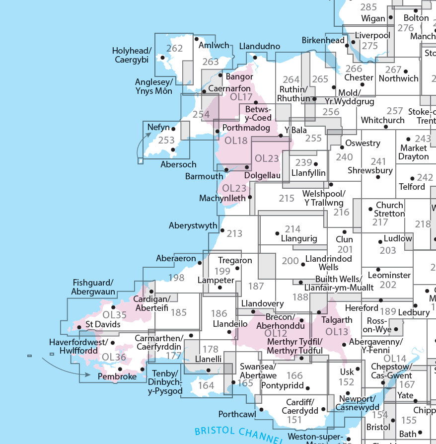
Producten op deze overzichtskaart:
Klik op een product om naar de pagina van dat product te gaan.
- Wandelkaart - Topografische kaart 151 OS Explorer Map Cardiff & Bridgend | Ordnance Survey
- Wandelkaart - Topografische kaart 152 OS Explorer Map Newport, Pontypool | Ordnance Survey
- Wandelkaart - Topografische kaart 164 OS Explorer Map Gower, Gwyr | Ordnance Survey
- Wandelkaart - Topografische kaart 165 OS Explorer Map Swansea, Abertawe | Ordnance Survey
- Wandelkaart - Topografische kaart 166 OS Explorer Map Rhondda, Merthyr Tydfil | Ordnance Survey
- Wandelkaart - Topografische kaart 177 OS Explorer Map Carmarthen, Kidwelly | Ordnance Survey
- Wandelkaart - Topografische kaart 178 OS Explorer Map Llanelli, Ammanford, Rhydaman | Ordnance Survey
- Wandelkaart - Topografische kaart 185 OS Explorer Map Newcastle Emlyn | Ordnance Survey
- Wandelkaart - Topografische kaart 186 OS Explorer Map Llandeilo, Brechfa Forest | Ordnance Survey
- Wandelkaart - Topografische kaart 187 OS Explorer Map Llandovery | Ordnance Survey
- Wandelkaart - Topografische kaart 188 OS Explorer Map Builth Wells, Llanfair-ym-Muallt | Ordnance Survey
- Wandelkaart - Topografische kaart 189 OS Explorer Map Hereford & Ross-on-Wye | Ordnance Survey
- Wandelkaart - Topografische kaart 198 OS Explorer Map Cardigan, New Quay | Ordnance Survey
- Wandelkaart - Topografische kaart 199 OS Explorer Map Lampeter | Ordnance Survey
- Wandelkaart - Topografische kaart 200 OS Explorer Map Llandrindod Wells, Elan Valley | Ordnance Survey
- Wandelkaart - Topografische kaart 201 OS Explorer Map Knighton, Presteigne | Ordnance Survey
- Wandelkaart - Topografische kaart 202 OS Explorer Map Leominster, Bromyard | Ordnance Survey
- Wandelkaart - Topografische kaart 203 OS Explorer Map Ludlow | Ordnance Survey
- Wandelkaart - Topografische kaart 213 OS Explorer Map Aberystwyth, Cwm Rheidol | Ordnance Survey
- Wandelkaart - Topografische kaart 214 OS Explorer Map Llanidloes, Newtown, Y Drenewydd | Ordnance Survey
- Wandelkaart - Topografische kaart 215 OS Explorer Map Newtown, Machynlleth | Ordnance Survey
- Wandelkaart - Topografische kaart 216 OS Explorer Map Welshpool, Montgomery | Ordnance Survey
- Wandelkaart - Topografische kaart 217 OS Explorer Map Long Mynd, Wenlock Edge | Ordnance Survey
- Wandelkaart - Topografische kaart 239 OS Explorer Map Lake Vyrnwy, Efyrnwy | Ordnance Survey
- Wandelkaart - Topografische kaart 240 OS Explorer Map Oswestry | Ordnance Survey
- Wandelkaart - Topografische kaart 241 OS Explorer Map Shrewsbury | Ordnance Survey
- Wandelkaart - Topografische kaart 253 OS Explorer Map Lleyn Peninsula West | Ordnance Survey
- Wandelkaart - Topografische kaart 254 OS Explorer Map Lleyn Peninsula East | Ordnance Survey
- Wandelkaart - Topografische kaart 255 OS Explorer Map Llangollen, Berwyn | Ordnance Survey
- Wandelkaart - Topografische kaart 256 OS Explorer Map Wrexham, Wrecsam, Llangollen | Ordnance Survey
- Wandelkaart - Topografische kaart 257 OS Explorer Map Crewe, Nantwich | Ordnance Survey
- Wandelkaart - Topografische kaart 262 OS Explorer Map Anglesey West | Ordnance Survey
- Wandelkaart - Topografische kaart 263 OS Explorer Map Anglesey East | Ordnance Survey
- Wandelkaart - Topografische kaart 264 OS Explorer Map Vale of Clwyd, Dyffryn Clwyd | Ordnance Survey
- Wandelkaart - Topografische kaart 265 OS Explorer Map Clwydian Range | Ordnance Survey
- Wandelkaart - Topografische kaart 266 OS Explorer Map Wirral & Chester | Ordnance Survey
- Wandelkaart - Topografische kaart 267 OS Explorer Map Northwich & Delamere Forest | Ordnance Survey
- Wandelkaart - Topografische kaart 275 OS Explorer Map Liverpool St Helens, Widnes & Runcorn | Ordnance Survey
- Wandelkaart - Topografische kaart OL12 OS Explorer Map Brecon Beacons NP West | Ordnance Survey
- Wandelkaart - Topografische kaart OL13 OS Explorer Map Brecon Beacons NP East | Ordnance Survey
- Wandelkaart - Topografische kaart OL14 OS Explorer Map Wye Valley - Forest of Dean - Dyfryn Gwy | Ordnance Survey
- Wandelkaart - Topografische kaart OL17 OS Explorer Map Snowdon - Conwy Valley - Dyffryn Conwy | Ordnance Survey
- Wandelkaart - Topografische kaart OL18 OS Explorer Map Harlech - Porthmadog - Y Bala | Ordnance Survey
- Wandelkaart - Topografische kaart OL23 OS Explorer Map Cadair Idris & Bala Lake | Ordnance Survey
- Wandelkaart - Topografische kaart OL35 OS Explorer Map North Pembrokeshire | Ordnance Survey
- Wandelkaart - Topografische kaart OL36 OS Explorer Map South Pembrokeshire | Ordnance Survey
Overzichtskaarten
Beschrijving
Een van de beste detailkaarten die er op de wereld gemaakt worden: zeer gedetailleerd, prachtig helder kleurgebruik, veel topografische aspecten en - zeer belangrijk - allerlei toeristische en recreatieve aspecten zijn ingetekend. De perfecte kaart voor vakantie en vrije tijd: wandelen, fietsen of gewoon de omgeving verkennen. Door de grootte van de kaart, voor- en achterzijde,
bestrijkt het een behoorlijk groot gebied!
These highly detailed maps show all the administrative boundaries, settlements as small as isolated farms, road network down to unfenced roads and country tracks, and field boundaries (hedges and drystone walls) which make navigation across the countryside much easier. Steep gradients on roads are indicated. Various landmarks, eg. powerlines, archaeological sites, windmills, churches and lighthouses are shown, and additional graphics indicate natural terrain features such as cliffs, scree, mud and vegetation variations. Contour interval is 5 metres in the lower parts of the country and 10 metres in the uplands, and spot heights are marked. Each map covers an area of 30 x 20km (i.e. approx. 19 x 12 miles), with some double-sided maps covering more, as indicated in the individual descriptions. The maps are fully GPS compatible, with the National Grid shown at 1km intervals and latitude and longitude indicated by margin ticks at 1'.
Explorer maps show a large amount of information for ramblers and tourists. Public rights of way are shown (except in Scotland), together with other routes with public access: National Trails and Recreational Paths, permitted paths and bridleways, and selected cycle routes. Open access land created under the Countryside and Rights of Way Act 2000 is marked. Tourist information includes caravan and camp sites, Park & Ride locations, recreation/leisure/sport centres, museums, historic buildings, English Heritage and National Trust sites, rural pubs, etc. The map legend is in English only, except for the tourist information content which is also in French and German.
Dit product heeft meerdere varianten:

Reviews
Fijne wandelkaart voor Snowdonia. Kleine kanttekening, paden zijn soms moeilijk te vinden. Ligt niet aan de kaart, meer aan de kwaliteit van de paden daar.
★★★★★ door Esther 11 mei 2026 | Heeft dit artikel gekochtVond u dit een nuttige review? (login om te beoordelen)
Handige kaart voor het voorbereiden van wandelingen. De digitale versie die je na aankoop van de kaart gratis met een code kunt binnenhalen op je smartphone is een geweldige hulp tijdens het wandelen, omdat de wandelomgeving en je positie steeds uitstekend in beeld zijn (veel beter dan bij Google Maps).
★★★★★ door Tini van Gruijthuijsen 27 september 2019 | Heeft dit artikel gekochtVond u dit een nuttige review? (login om te beoordelen)
Fijne, goed leesbare wandelkaart van Wales, de kaarten die wij hadden zijn betrouwbaar gebleken, veel correcte informatie over paden en herkenningspunten, bestrijkt ook een flink gebied dus veel topografie voor je geld.
★★★★★ door Jasper 23 augustus 2018Vond u dit een nuttige review? (login om te beoordelen)
Schrijf een review
Graag horen wij wat u van dit artikel vindt. Vindt u het goed, leuk, mooi, slecht, lelijk, onbruikbaar of erg handig: schrijf gerust alles op! Het is niet alleen leuk om te doen maar u informeert andere klanten er ook nog mee!
Ook interessant voor europa/engeland/wales
-

Wandelkaart - Topografische kaart 26
€ 26,95Topografische kaarten Wales -

Wandelgids 078 Pathfinder Guides Ang
€ 18,95Wandelgidsen Wales -

Wandelkaart - Topografische kaart 25
€ 26,95Topografische kaarten Wales -

Wandelkaart 263 OS Explorer Map | Ac
€ 26,95Wandelkaarten Wales -

Wandkaart 20664 Engeland en Wales, 7
€ 25,95Wandkaarten van landen Wales
Contactgegevens
T: +31 (0)50 - 3 12 69 50
E: info@dezwerver.nl
![]()
![]()
![]()
![]()
![]()
Bankgegevens
IBAN: NL11 RABO 0140 1961 88
BIC: RABONL2U
Kamer van Koophandel
Kvk: 75240440
BTW-nummer
NL 860203633 B01
BE 0541 545 456
Openingstijden klantenservice
- Maandag10.00 - 12.30 en 13.30 - 17.00
- Dinsdag10.00 - 12.30 en 13.30 - 17.00
- Woensdag10.00 - 12.30 en 13.30 - 17.00
- Donderdag10.00 - 12.30 en 13.30 - 17.00
- Vrijdag10.00 - 12.30 en 13.30 - 17.00
- Zaterdaggesloten
- Zondaggesloten
Nieuwsbrief
Op de hoogte blijven van nieuwe reisgidsen, travelgadgets en kaarten? Geef u op voor onze nieuwsbrief. U ontvangt de nieuwsbrief 1x per maand.
Bekijk hier onze laatste nieuwsbrief:
Onze laatste Nieuwsbrief