
Winkelwagen
Geen items in winkelwagen
Ga naar winkelwagen
Wandelgids Pembrokeshire | Northern Eye Books (9781908632623)
Cardigan to Amroth
- ISBN / CODE: 9781908632623
- Editie: 2023
- Aantal blz.: 48
- Schaal: 1:25000
- Uitgever: Northern Eye Books
- Soort: Wandelgids
- Taal: Engels
- Hoogte: 21.5 cm
- Breedte: 11.0 cm
- Dikte: 1.0 cm
- Gewicht: 112.0 g
- Bindwijze: -
- Uitvoering: Papier
- Schrijf als eerste een review
-
€ 17,50
Dit artikel is (tijdelijk) niet leverbaar
Beschrijving
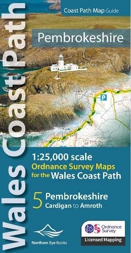
OS Map Books: Wales Coast Path: Pembrokeshire Coast Path Map Atlas | Ordnance Survey ‘Explorer’ Large-scale 1:25,000 maps for the Pembrokeshire Coast in compact book format | Pocket Atlas | Walking Wales | UK Long-Distance Trails | Hiking | Adventure
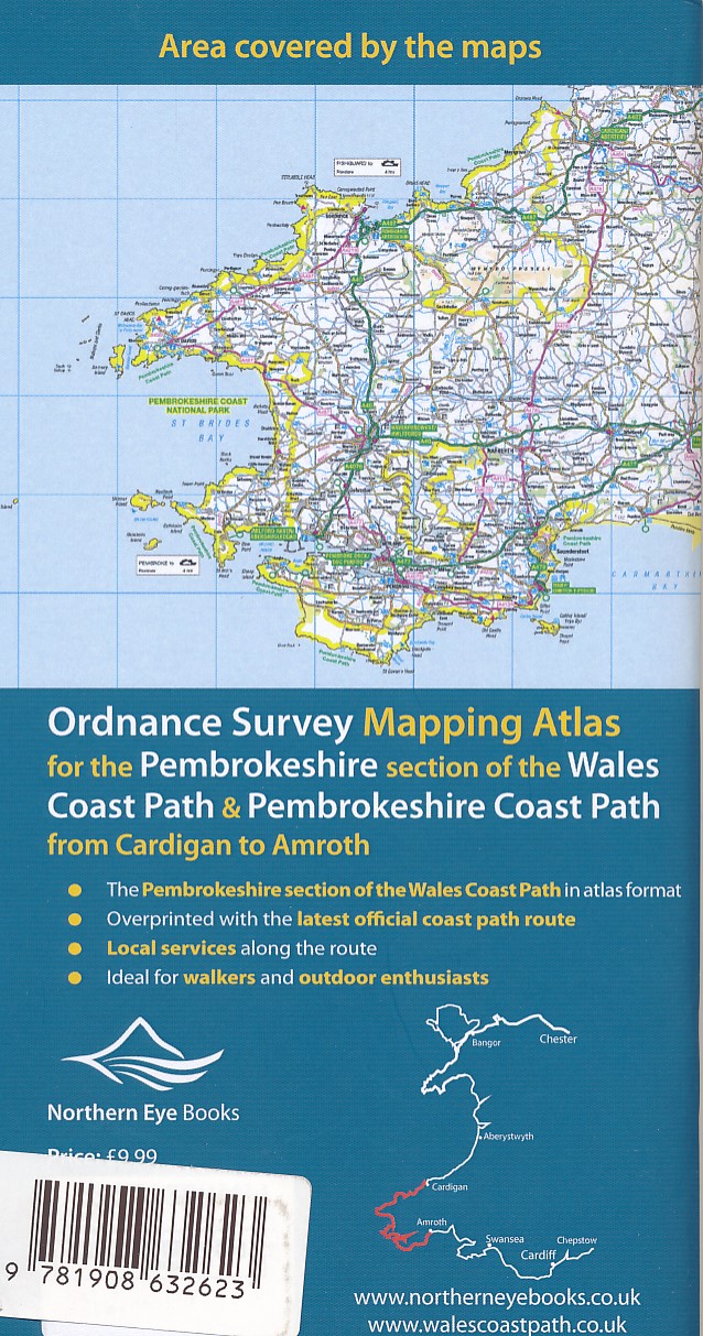
One of seven handy Ordnance Survey Map Books covering the entire 870 mile/1400 kilometre-long, world-class Wales Coast Path — from Chester in the north to Chepstow in the south.
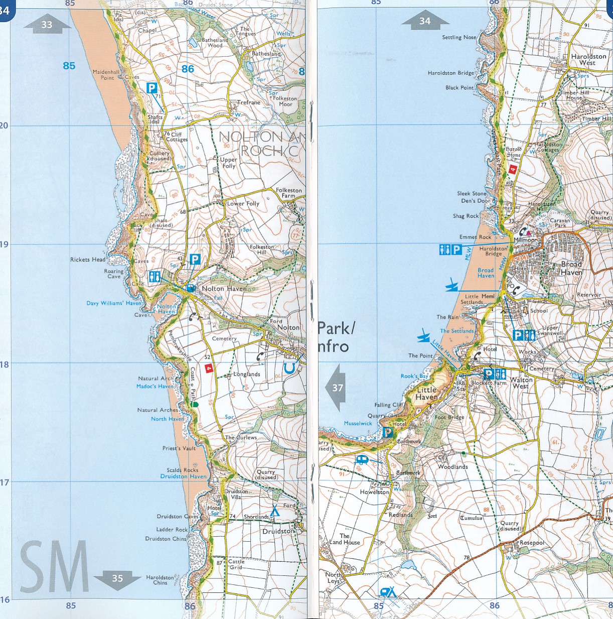
Enjoy enhanced, large scale (1:25,000) Ordnance Survey Explorer mapping in compact atlas format with all the detailed mapping you need to walk the Pembrokeshire Coast section of the Wales Coast Path.
Continuous, full colour OS mapping covering the Wales Coast Path between Cardigan and Amroth. Contains extracts from large scale Explorer maps OL 35 and OL 36. The enhanced OS 1:25,000 maps are accurate, up-to-date and reliable. Additional map symbols show tea shops, cafes, extra parking, and public toilets.
A brief introduction to Pembrokeshire Coast includes a fascinating photo mosaic highlighting notable views, places of interest and wildlife you’ll meet along the way. There is also a section of detailed Useful Information at the back of the atlas. Laminated flapped covers showing Wales Coast Path signs and waymarkers, route details and map symbols make these atlases simple and easy to use. The map books’ dimensions are 215mm x 107mm and they fit easily into a standard map pocket.
Key features:
• Large scale OS mapping for the complete coast of the Pembrokeshire Coast in a handy atlas format • Highlighted, up-to-date official route of the Wales Coast Path • On-map symbols showing amenities at main towns and villages • Introduction with attractive photo mosaic of places along the way • Additional useful information on accommodation, food, drink, toilets and more …
Pembrokeshire is Britain’s only Coastal National Park. A delightful and popular section of the Wales Coast Path with high cliffs, rocky headlands, hidden coves and sandy beaches. Perfect for puffins and seal-watching too.
Highlights include:
• Strumble Head and its iconic lighthouse • St Davids town, St Davids Cathedral and bishops’ palace • Offshore islands for boat trips, puffins and wildlife • Bosherton Lily Ponds • Barafundle Bay – ‘Wales’ most beautiful beach’ • Pastel-painted Tenby, Old Town and harbour
This easy-to-use, versatile map book is light and fits easily in a bag or pocket.
Each map book matches one of the seven sections covered by the Official Guidebooks. Sec-tions include: 1: North Wales Coast, 2: Isle of Anglesey, 3: Llyn Peninsula, 4: Snowdo¬nia & Ceredigion Coast, 5: Pembrokeshire, 6: Carmarthen Bay & Gower, and 7: South Wales Coast.
These pocket map atlases are the ideal gift for walkers and other outdoors activities.
Reviews
Geen reviews gevonden voor dit product.
Schrijf een review
Graag horen wij wat u van dit artikel vindt. Vindt u het goed, leuk, mooi, slecht, lelijk, onbruikbaar of erg handig: schrijf gerust alles op! Het is niet alleen leuk om te doen maar u informeert andere klanten er ook nog mee!
Alle gerelateerde rubrieken >
Ook interessant voor europa/engeland/wales
-
Wandelkaart - Topografische kaart 26
€ 26,95Topografische kaarten Wales -

Fietsgids Bikepacking – Mountain Bik
€ 26,50Fietsgidsen Wales -

Wandelkaart - Topografische kaart 26
€ 20,95Topografische kaarten Wales -

Reisgids Wild Ruins | Wild Things Pu
€ 25,95Reisgidsen Wales -

Wandkaart 20664 Engeland en Wales, 7
€ 25,95Wandkaarten van landen Wales



