Engeland
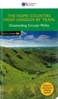 Wandelgids 072 Pathfinder Guides The Home Counties from London by Train | Ordnance Survey
The all-revised edition contains 27 carefully selected walks, all chosen to be easily accessible from London's main railway stations. The routes lie across Essex, Bedfordshire, Oxfordshire, Surrey, West Sussex, East …
 Wandelgids 074 Pathfinder Guides The Malverns to Warwickshire | Ordnance Survey
Discover 28 beautiful walks across The Malverns to Warwickshire with the OS Pathfinder Guidebooks, graded by length and ranging from 3 to 9 miles - ideal for both holidaymakers and …
 Fietskaart 1 Tour Map Cornwall | Ordnance Survey
Overzichtelijke, gedetailleerde kaart met veel toeristische informatie, waaronder campings en jeugdherbergen. Groot voordeel, naast de prima schaal, is dat de routes van het National Cycle Network duidelijk staan ingetekend. De …
★★★★★ Wandkaart 20664 Engeland en Wales, 76 x 92 cm | National Geographic
This classic-style map of England and Wales shows political boundaries, major highways and roads, cities and towns, airports, and other geographic details. Thousands of place-names and exact borders are carefully …
 Wandkaart 20667 Engeland en Wales, antiek, 76 x 91 cm | National Geographic
This earth-toned, executive-style map of England and Wales shows political boundaries, major highways and roads, cities and towns, airports, and other geographic details. Thousands of place-names and exact borders are …
 Fietsgids Bikepacking – Mountain Bike Camping Adventures on the Wild Trails of Britain | Wild Things Publishing
Cycling journalist Laurence McJannet embarks on an off-road adventure to bike and wild camp his way along 30 of Britain’s most beautiful off-road trails and ancient trackways. Lightweight ‘bikepacking’ is …
 Reisverhaal Magisch en mystiek Engeland | Cois Geysen
Engeland, het land van mysteries. Jaarlijks trekken duizenden mensen naar Glastonbury in het land van Avalon, gaan op zoek naar de onverklaarbare graancirkels of bezoeken de gigantische steenkringen van Stonehenge …
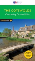 Wandelgids 006 Pathfinder Guides Cotswolds | Ordnance Survey
180 miles of wonderful walking in idyllic, limestone countryside . . . Take a journey on 28 beautiful walks across the Cotswolds with the OS Pathfinder Guidebooks, graded by …
★★★★★ Wandelgids 011 Pathfinder Guides Dorset | Ordnance Survey
Wandelgids van een deel van Engeland. Deze gids bevat 28 dagwandelingen, variërend van korte tochten tot pittige dagtochten. De bijbehorende kaarten zijn uitstekend: men heeft de topografische kaarten van Ordnance …
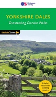 Wandelgids 015 Pathfinder Guides Yorkshire Dales | Ordnance Survey
Wandelgids van een deel van Engeland. Deze gids bevat 28 dagwandelingen, variërend van korte tochten tot pittige dagtochten. De bijbehorende kaarten zijn uitstekend: men heeft de topografische kaarten van Ordnance …
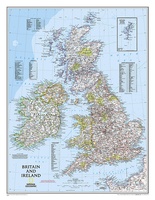 Wandkaart 02022 Britain and Ireland - Groot Brittannië en Ierland, 60 x 76 cm | National Geographic
This classic-style map of England and Wales shows political boundaries, major highways and roads, cities and towns, airports, and other geographic details. Thousands of place-names and exact borders are carefully …
 Reisgids Wild Ruins | Wild Things Publishing
Discover and explore Britain’s extraordinary history through its most beautiful lost ruins. From crag-top castles to crumbling houses in ancient forests, and ivy-encrusted relics of industry to sacred places long …
 Fietsgids Cols and Passes of the British Isles
A col is the lowest point on the saddle between two mountains. Graham Robb has spent years uncovering and cataloguing the 2,002 cols and 105 passes scattered across the British …
 Wandelgids Wildlife Walks | Wildlife Trust
This guide offers both nature lovers and families everything they need to know when looking for a day out in the fresh air and being part of the UK's conservation …
 Wandelgids 026 Pathfinder Guides Dartmoor | Ordnance Survey
Wandelgids van een deel van Engeland. Deze gids bevat 28 dagwandelingen, variërend van korte tochten tot pittige dagtochten. De bijbehorende kaarten zijn uitstekend: men heeft de topografische kaarten van Ordnance …
★★★★★★★★★★ Wandelgids 029 Pathfinder Guides Wye Valley and Forest of Dean | Ordnance Survey
Wandelgids Wye Valley en Forest of Dean. Deze gids bevat 28 dagwandelingen, variërend van korte tochten tot pittige dagtochten. De bijbehorende kaarten zijn uitstekend: men heeft de topografische kaarten van …
★★★★★ Wandelgids 031 Pathfinder Guides Oban, Mull & Kintyre | Ordnance Survey
Wandelgids van een deel van Schotland. Deze gids bevat 28 dagwandelingen, variërend van korte tochten tot pittige dagtochten. De bijbehorende kaarten zijn uitstekend: men heeft de topografische kaarten van Ordnance …
 Wandelgids 048 Pathfinder Guides Suffolk | Ordnance Survey
Fraaie, goed verzorgde wandelgidsjes met 28 wandelingen van max. een dag, (beginnend bij korte, eindigend bij langere wandelingen). Weergegeven op duidelijke topografische kaartjes (1:25.000). Bevat verder wetenswaardigheden en praktische informatie …
 Wandelgids 049 Pathfinder Guides Vale of York and the Yorkshire Wolds | Ordnance Survey
Wandelgids van een deel van Engeland. Deze gids bevat 28 dagwandelingen, variërend van korte tochten tot pittige dagtochten. De bijbehorende kaarten zijn uitstekend: men heeft de topografische kaarten van Ordnance …
 Wegenkaart - landkaart 10 Road Map Britain Groot-Brittannië | AA Publishing★★★★★★★★★★
- 1
- 2
- 3
- Volgende >>
- 12
Laatste reviews

Kort voor vakantie naar de Galapagos eilanden toch nog behoefte aan extra reisgids. Simpel kunnen bestellen en snelle levering. Zou niet weten wat er beter …
★★★★★ door Piet Grootenboer 25 juni 2026 | Heeft dit artikel gekocht
Enorm mooie wereldkaart met details en snelle fijne levering.
★★★★★ door Steven Goyvaerts 25 juni 2026 | Heeft dit artikel gekocht
Deze Cicerone gids over de via Francigena is uitermate geschikt om je route en etappes te plannen als je de Via Francigena vanuit Zwitserland gaat …
★★★★★ door Vic 24 juni 2026 | Heeft dit artikel gekocht
Heerlijk om al te kunnen voorbereiden op een fantastische vakantie met dit uiterst fijne boek.
★★★★★ door Harry 24 juni 2026 | Heeft dit artikel gekocht