Winkelwagen
Geen items in winkelwagen
Ga naar winkelwagen
Topografische kaarten - Europa
 Wandelkaart - Topografische kaart 1734 SB - Serie Bleue Ribérac - Chalais | IGN - Institut Géographique National
 Wandelkaart - Topografische kaart 1735 SB - Serie Bleue Montpon-Ménestérol ,Saint-Médard-de-Mussidan | IGN - Institut Géographique National
 Wandelkaart - Topografische kaart 1736 SB - Serie Bleue Ste-Foy-la-Grande, Vélines | IGN - Institut Géographique National
 Wandelkaart - Topografische kaart 1737 SB - Serie Bleue Monségur | IGN - Institut Géographique National★★★★★
 Wandelkaart - Topografische kaart 1738 SB - Serie Bleue Marmande - Seyches | IGN - Institut Géographique National
 Topografische kaart - Wandelkaart 1739 SB - Serie Bleue Tonneins - Casteljaloux | IGN - Institut Géographique National
 Wandelkaart - Topografische kaart 174 Landranger Newbury & Wantage, Hungerford & Didcot | Ordnance Survey
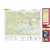 Topografische kaart 174 MT50 Sangüesa | CNIG - Instituto Geográfico Nacional1
 Wandelkaart - Topografische kaart 174 OS Explorer Map Epping Forest, Lee Valley | Ordnance Survey
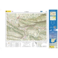 Topografische kaart 174-II Lumbier | CNIG - Instituto Geográfico Nacional1
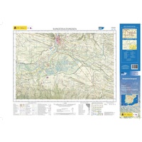 Topografische kaart 174-IV Sangüesa / Zangoza | CNIG - Instituto Geográfico Nacional1
 Wandelkaart - Topografische kaart 1740 SB - Serie Bleue Nérac | IGN - Institut Géographique National
 Wandelkaart - Topografische kaart 1741 SB - Serie Bleue Mézin | IGN - Institut Géographique National
 Topografische kaart - Wandelkaart 1742 SB - Serie Bleue Eauze | IGN - Institut Géographique National★★★★★
 Wandelkaart - Topografische kaart 1743 SB - Serie Bleue Plaisance - Montesquiou | IGN - Institut Géographique National
 Wandelkaart - Topografische kaart 1744 SB - Serie Bleue Miélan - Vic en Bigorre | IGN - Institut Géographique National
 Wandelkaart - Topografische kaart 1745 SB - Serie Bleue Tarbes | IGN - Institut Géographique National
 Wandelkaart - Topografische kaart 1746 SB - Serie Bleue Bagnères-de-Bigorre | IGN - Institut Géographique National
 Wandelkaart - Topografische kaart 1747ET Bagnères-de-Bigorre | IGN - Institut Géographique National
 Wandelkaart - Topografische kaart 1748ET Neouvielle | IGN - Institut Géographique National★★★★★
Laatste reviews

Goede kaart!
Fijne kaart, goed leesbaar. Niet waterafstotend maar in Spanje is dat vaak niet nodig
★★★★★ door Marlieke 18 mei 2026 | Heeft dit artikel gekocht
Credencial Camino de Santiago
Voor en goede prijs snel thuis ontvangen na bestellen.
★★★★★ door Veronica 18 mei 2026 | Heeft dit artikel gekocht
Prima kaart voor tochtplanning en backup
Duuraam resistent papier. Voor navigatie zou een meer gedetailleerde schaal beter zijn, maar de eigenlijke wandelroutes zijn ook in het veld vindbaar door markering. In …
★★★★★ door Jan Willem Genuit 14 mei 2026 | Heeft dit artikel gekocht
Duidelijke kaart
Prima kaart met veel informatie.
★★★★★ door Hans 13 mei 2026 | Heeft dit artikel gekocht