Winkelwagen
Geen items in winkelwagen
Ga naar winkelwagen
Topografische kaarten - Europa
 Wandelkaart - Topografische kaart 1443 SB - Serie Bleue Dax | IGN - Institut Géographique National
 Wandelkaart - Topografische kaart 1444 SB - Serie Bleue Orthez | IGN - Institut Géographique National
 Wandelkaart - Topografische kaart 1445 SB - Serie Bleue Mauléon-Licharre – St-Palais | IGN - Institut Géographique National
 Wandelkaart - Topografische kaart 1446ET Tardets-Sorholus, Arette | IGN - Institut Géographique National★★★★★
 Wandelkaart - Topografische kaart 145 OS Explorer Map Guildford, Farnham | Ordnance Survey
 Wandelkaart - Topografische kaart 145 Landranger Cardigan & Mynydd Preseli - Wales | Ordnance Survey
 Topografische kaart 145 MT50 Sallent de Gállego | CNIG - Instituto Geográfico Nacional1
 Topografische kaart 146 MT50 Monte Perdido | CNIG - Instituto Geográfico Nacional1
 Wandelkaart - Topografische kaart 146 Landranger Lampeter & Llandovery - Wales | Ordnance Survey
 Wandelkaart - Topografische kaart 146 OS Explorer Map Dorking, Box Hill, Reigate | Ordnance Survey
 Topografische kaart 146-I Macizo de Viñamala | CNIG - Instituto Geográfico Nacional1
 Topografische kaart 146-III Valle de Bujaruelo | CNIG - Instituto Geográfico Nacional1
 Topografische kaart 146-IV Monte Perdido | CNIG - Instituto Geográfico Nacional1
 Wandelkaart - Topografische kaart 147 OS Explorer Map Sevenoaks and Tonbridge | Ordnance Survey
 Wandelkaart - Topografische kaart 147 Landranger Elan Valley & Builth Wells - Wales | Ordnance Survey★★★★★
 Wandelkaart - Topografische kaart 147 OS Explorer Map | Active Sevenoaks / Tonbridge | Ordnance Survey
 Topografische kaart 147-IV Bachimala | CNIG - Instituto Geográfico Nacional1
 Wandelkaart - Topografische kaart 148 Landranger Presteigne & Hay-on-Wye, Llanandras a'r Gelli Gandryll - Wales | Ordnance Survey
 Wandelkaart - Topografische kaart 148 OS Explorer Map Maidstone, Medway Towns | Ordnance Survey
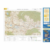 Topografische kaart 148-III Hospital de Benasque | CNIG - Instituto Geográfico Nacional1
Laatste reviews

Goede kaart, maar weinig meerwaarde boven de 1:200.000-kaart
Op zich een goede kaart, maar het is eigenlijk gewoon een uitvergroting van de bekende 1:200.000-kaarten, dus weinig tot geen extra informatie. Wel wat duidelijker …
★★★★★ door FGM Ballhaus 13 mei 2026 | Heeft dit artikel gekocht
Iets te grote schaal voor wandelen, maar verder een goede kaart voor wandelen en fietsen
Duidelijke kaart, goed voor fietsen, iets minder voor wandelen door de schaal, maar er is heel weinig kaartmateriaal voor dit gebied dus daarom toch dik …
★★★★★ door FGM Ballhaus 13 mei 2026 | Heeft dit artikel gekocht
Goede fietskaart voor nét over de grens
Fietskaart is een goede aanvulling op de Nederlandse fietskaarten, laat de Achterhoek zien maar ook een heel stuk Duitsland in (naar het oosten). Kwalitatief ook …
★★★★★ door FGM Ballhaus 13 mei 2026 | Heeft dit artikel gekocht
Leuk informatief boek, precieze route goed weergegeven.
Keurig verpakt, snel verzonden. Boek voldoet aan mijn verwachtingen!
★★★★★ door Beatrice 12 mei 2026 | Heeft dit artikel gekocht