Winkelwagen
Geen items in winkelwagen
Ga naar winkelwagen
Topografische kaarten - Europa
 Wandelkaart - Topografische kaart 293 Valpelline | Swisstopo★★★★★
 Topografische kaart 293 MT50 Berga | CNIG - Instituto Geográfico Nacional1
 Wandelkaart - Topografische kaart 293 OS Explorer Map Kingston upon Hull, Beverley | Ordnance Survey
 Wandelkaart - Topografische kaart 222 OS Explorer Map Rugby, Daventry | Ordnance Survey
 Wandelkaart - Topografische kaart 222 Clos du Doubs | Swisstopo
 Wandelkaart - Topografische kaart 2220 SB - Serie Bleue Jargeau, Olivet, La Ferté-St-Aubin | IGN - Institut Géographique National
 Wandelkaart - Topografische kaart 2221 SB - Serie Bleue Lamotte-Beuvron | IGN - Institut Géographique National
 Topografische kaart - Wandelkaart 2222 SB - Serie Bleue Salbris | IGN - Institut Géographique National
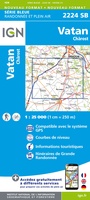 Wandelkaart - Topografische kaart 2224 SB - Serie Bleue Vatan, Charost | IGN - Institut Géographique National
 Wandelkaart - Topografische kaart 2225 SB - Serie Bleue Issoudun, Neuvy-Paillouxt | IGN - Institut Géographique National
 Wandelkaart - Topografische kaart 2226 SB - Serie Bleue Ardentes - La Berthenoux | IGN - Institut Géographique National
 Wandelkaart - Topografische kaart 2227 SB - Serie Bleue La Châtre, Neuvy-St-Sépulchre | IGN - Institut Géographique National★★★★★
 Wandelkaart - Topografische kaart 2228 SB - Serie Bleue Châtelus-Malvaleix, Aigurande | IGN - Institut Géographique National
 Wandelkaart - Topografische kaart 2229 SB - Serie Bleue Ahun - Gueret | IGN - Institut Géographique National
 Wandelkaart - Topografische kaart 223 OS Explorer Map | Active Northampton / Market Harborough | Ordnance Survey
 Wandelkaart - Topografische kaart 223 Delémont | Swisstopo
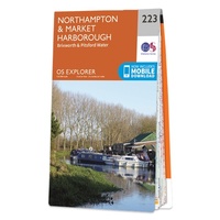 Wandelkaart - Topografische kaart 223 OS Explorer Map Northampton, Market Harborough | Ordnance Survey
 Topografische kaart 223-III/222-IV Vigo | CNIG - Instituto Geográfico Nacional1
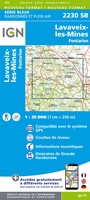 Wandelkaart - Topografische kaart 2230 SB - Serie Bleue Lavaveix-les-Mines, Pontarion | IGN - Institut Géographique National
 Wandelkaart - Topografische kaart 2231 SB - Serie Bleue Gentioux-Pigerolles, Royère-de-Vassivière | IGN - Institut Géographique National
Laatste reviews

Prima kaart voor tochtplanning en backup
Duuraam resistent papier. Voor navigatie zou een meer gedetailleerde schaal beter zijn, maar de eigenlijke wandelroutes zijn ook in het veld vindbaar door markering. In …
★★★★★ door Jan Willem Genuit 14 mei 2026 | Heeft dit artikel gekocht
Duidelijke kaart
Prima kaart met veel informatie.
★★★★★ door Hans 13 mei 2026 | Heeft dit artikel gekocht
Goede kaart, maar weinig meerwaarde boven de 1:200.000-kaart
Op zich een goede kaart, maar het is eigenlijk gewoon een uitvergroting van de bekende 1:200.000-kaarten, dus weinig tot geen extra informatie. Wel wat duidelijker …
★★★★★ door FGM Ballhaus 13 mei 2026 | Heeft dit artikel gekocht
Iets te grote schaal voor wandelen, maar verder een goede kaart voor wandelen en fietsen
Duidelijke kaart, goed voor fietsen, iets minder voor wandelen door de schaal, maar er is heel weinig kaartmateriaal voor dit gebied dus daarom toch dik …
★★★★★ door FGM Ballhaus 13 mei 2026 | Heeft dit artikel gekocht