Winkelwagen
Geen items in winkelwagen
Ga naar winkelwagen
Topografische kaarten - Europa
 Wandelkaart - Topografische kaart 320 OS Explorer Map Castle Douglas, Loch Ken, New Galloway | Ordnance Survey
 Wandelkaart - Topografische kaart 321 OS Explorer Map Nithsdale, Dumfries | Ordnance Survey
 Wandelkaart - Topografische kaart 3210 SB - Serie Bleue Longuyon | IGN - Institut Géographique National
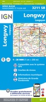 Wandelkaart - Topografische kaart 3211 SB - Serie Bleue Longuyon - Longwy | IGN - Institut Géographique National
 Wandelkaart - Topografische kaart 3212 SB - Serie Bleue Étain | IGN - Institut Géographique National
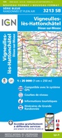 Wandelkaart - Topografische kaart 3213 SB - Serie Bleue Vigneulles-lès-Hattonchâtel | IGN - Institut Géographique National★★★★★
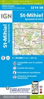 Wandelkaart - Topografische kaart 3214 SB - Serie Bleue St-Mihiel | IGN - Institut Géographique National★★★★★
 Wandelkaart - Topografische kaart 3215 SB - Serie Bleue Commercy | IGN - Institut Géographique National
 Wandelkaart - Topografische kaart 3216 SB - Serie Bleue Gondrecourt-le-Château | IGN - Institut Géographique National
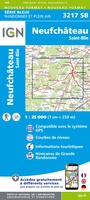 Wandelkaart - Topografische kaart 3217 SB - Serie Bleue Neufchateau, St-Blin | IGN - Institut Géographique National
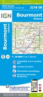 Wandelkaart - Topografische kaart 3218 SB - Serie Bleue Bourmont - Clefmont | IGN - Institut Géographique National
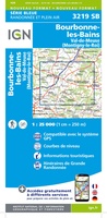 Wandelkaart - Topografische kaart 3219 SB - Serie Bleue Bourbonne-les-Bains - Val-de-Meuse (Montigny-le-Roi) | IGN - Institut Géographique National
 Wandelkaart - Topografische kaart 322 OS Explorer Map Annandale | Ordnance Survey
 Topografische kaart - Wandelkaart 3220 SB - Serie Bleue Fayl-Billot | IGN - Institut Géographique National★★★★★
 Topografische kaart - Wandelkaart 3221 SB - Serie Bleue Champlitte | IGN - Institut Géographique National
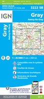 Wandelkaart - Topografische kaart 3222 SB - Serie Bleue Gray - Autrey-lès-Gray | IGN - Institut Géographique National
 Wandelkaart - Topografische kaart 3223 SB - Serie Bleue Pesmes - Gendrey | IGN - Institut Géographique National
 Wandelkaart - Topografische kaart 3224 Dole | IGN - Institut Géographique National
 Wandelkaart - Topografische kaart 3225 SB - Serie Bleue Poligny, Chaussin | IGN - Institut Géographique National
 Topografische kaart - Wandelkaart 3226ET Lons-le-Saunier / Poligny / Reculée de Baume | IGN - Institut Géographique National
Laatste reviews

Super
Rother wandelgidsen stellen nooit teleur. Mooie routes, goede opgave kilometers, hoogtemeters en horeca. Een aanrader!
★★★★★ door Anita Geel 13 januari 2026 | Heeft dit artikel gekocht
Prachtig boek!
Mooi boek met prachtige foto’s! Voldoet helemaal aan mijn verwachtingen.
★★★★★ door Hans Eldering 13 januari 2026 | Heeft dit artikel gekocht
zeer vlotte levering
het product voldeed aan mijn verwachtingen en was geplastificeerd wat natuurlijk perfect is voor kaart die veel wordt geraadpleegd!
★★★★★ door Peter Lantinga 13 januari 2026 | Heeft dit artikel gekocht
Gedetailleerde wegenkaart
Ik heb de wegenkaart Maleisië aangeschaft om zelf een rondreis per huurauto te kunnen plannen. Deze kaart heeft daar heel goed bij geholpen doordat er …
★★★★★ door M. Rizvi 13 januari 2026 | Heeft dit artikel gekocht