Winkelwagen
Geen items in winkelwagen
Ga naar winkelwagen
Topografische kaarten - Europa
 Wandelkaart - Topografische kaart 1724 SB - Serie Bleue Loudun – Richelieu | IGN - Institut Géographique National★★★★★
 Wandelkaart - Topografische kaart 1725 SB - Serie Bleue Lencloitre, St-Jean-de-Sauves | IGN - Institut Géographique National
 Wandelkaart - Topografische kaart 1728 SB - Serie Bleue Vivonne - Lusignan | IGN - Institut Géographique National
 Wandelkaart - Topografische kaart 1729 SB - Serie Bleue Civray - Sauze - Vaussais | IGN - Institut Géographique National
 Wandelkaart - Topografische kaart 173 OS Explorer Map London North | Ordnance Survey
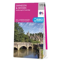 Wandelkaart - Topografische kaart 173 Landranger Swindon & Devizes, Marlborough & Trowbridge | Ordnance Survey
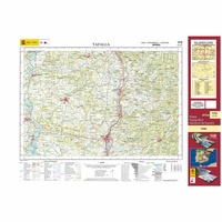 Topografische kaart 173 MT50 Tafalla | CNIG - Instituto Geográfico Nacional1
 Wandelkaart - Topografische kaart 1730 SB - Serie Bleue Ruffec - Villefagnan | IGN - Institut Géographique National
 Wandelkaart - Topografische kaart 1731 SB - Serie Bleue Mansle | IGN - Institut Géographique National
 Wandelkaart - Topografische kaart 1732 SB - Serie Bleue Angoulême, Ruelle-sur-Touvre | IGN - Institut Géographique National
 Wandelkaart - Topografische kaart 1733 SB - Serie Bleue Montmoreau-Saint-Cybard | IGN - Institut Géographique National
 Wandelkaart - Topografische kaart 1734 SB - Serie Bleue Ribérac - Chalais | IGN - Institut Géographique National
 Wandelkaart - Topografische kaart 1735 SB - Serie Bleue Montpon-Ménestérol ,Saint-Médard-de-Mussidan | IGN - Institut Géographique National
 Wandelkaart - Topografische kaart 1736 SB - Serie Bleue Ste-Foy-la-Grande, Vélines | IGN - Institut Géographique National
 Wandelkaart - Topografische kaart 1737 SB - Serie Bleue Monségur | IGN - Institut Géographique National★★★★★
 Wandelkaart - Topografische kaart 1738 SB - Serie Bleue Marmande - Seyches | IGN - Institut Géographique National
 Topografische kaart - Wandelkaart 1739 SB - Serie Bleue Tonneins - Casteljaloux | IGN - Institut Géographique National
 Wandelkaart - Topografische kaart 174 OS Explorer Map Epping Forest, Lee Valley | Ordnance Survey
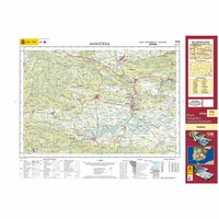 Topografische kaart 174 MT50 Sangüesa | CNIG - Instituto Geográfico Nacional1
 Wandelkaart - Topografische kaart 174 Landranger Newbury & Wantage, Hungerford & Didcot | Ordnance Survey
Laatste reviews

Prima kaart voor tochtplanning en backup
Duuraam resistent papier. Voor navigatie zou een meer gedetailleerde schaal beter zijn, maar de eigenlijke wandelroutes zijn ook in het veld vindbaar door markering. In …
★★★★★ door Jan Willem Genuit 14 mei 2026 | Heeft dit artikel gekocht
Duidelijke kaart
Prima kaart met veel informatie.
★★★★★ door Hans 13 mei 2026 | Heeft dit artikel gekocht
Goede kaart, maar weinig meerwaarde boven de 1:200.000-kaart
Op zich een goede kaart, maar het is eigenlijk gewoon een uitvergroting van de bekende 1:200.000-kaarten, dus weinig tot geen extra informatie. Wel wat duidelijker …
★★★★★ door FGM Ballhaus 13 mei 2026 | Heeft dit artikel gekocht
Iets te grote schaal voor wandelen, maar verder een goede kaart voor wandelen en fietsen
Duidelijke kaart, goed voor fietsen, iets minder voor wandelen door de schaal, maar er is heel weinig kaartmateriaal voor dit gebied dus daarom toch dik …
★★★★★ door FGM Ballhaus 13 mei 2026 | Heeft dit artikel gekocht